Whitewash Trail

Because the Sandia Mountains are practically in the backyard of Albuquerque, we have done numerous hikes there in the years we have been here. Since it isn’t a big mountain range, you would think that we would know most of the trails by now. But yesterday our friends, Ken and Sue, introduced us to an interesting trail, labeled on some maps as the Whitewash Trail, but not appearing at all on other maps.

The hike required a shuttle, parking one car at the Embudido Trailhead in the foothills on the east side of Albuquerque. Then driving east of town through Tijeras Canyon we started the hike on the Three Gun Springs (Tres Pistoles) Trail. We have done that trail a number of times in various combinations, as it connects with a couple of other trails.

Map of hike on Three Gun Springs and Whitewash Trails.

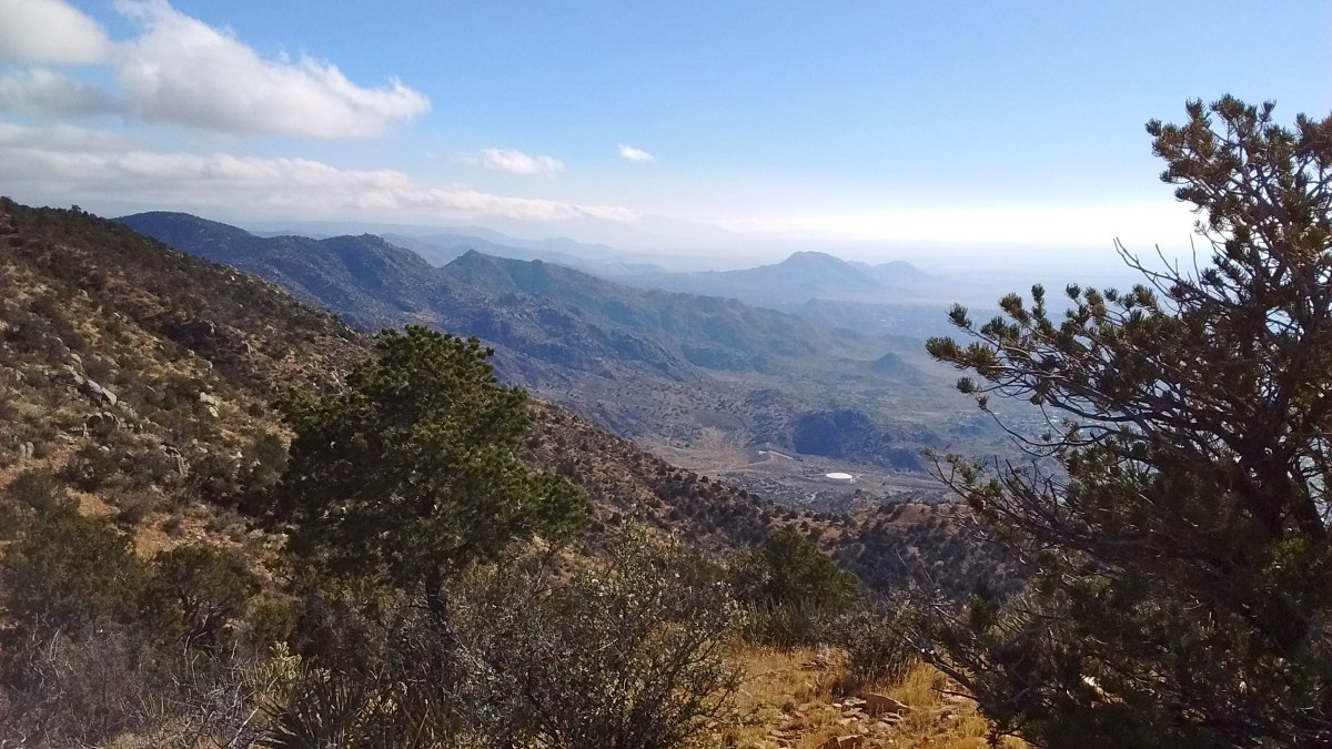
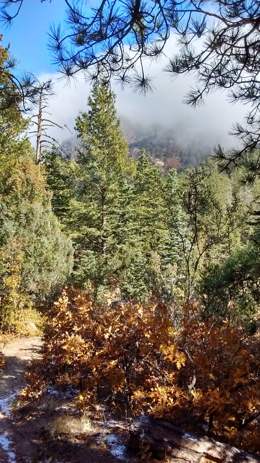
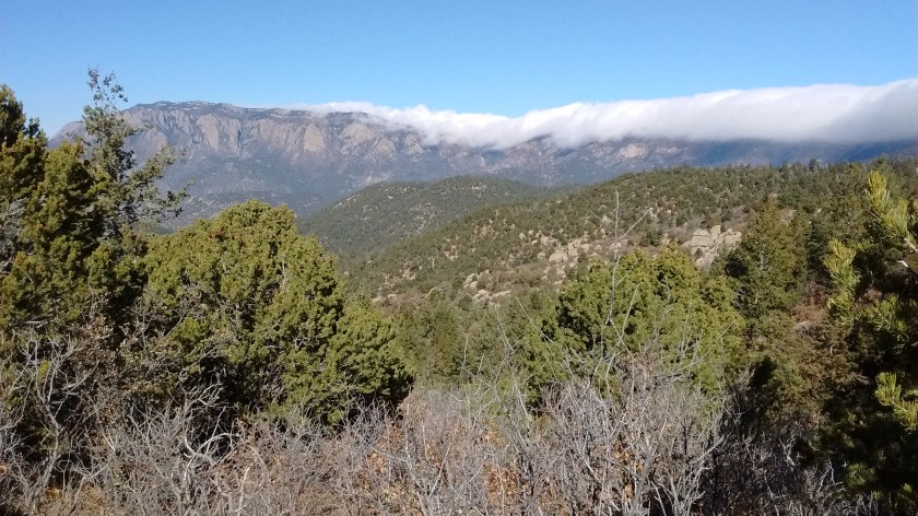
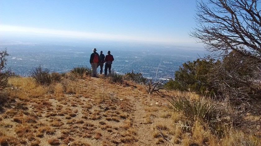
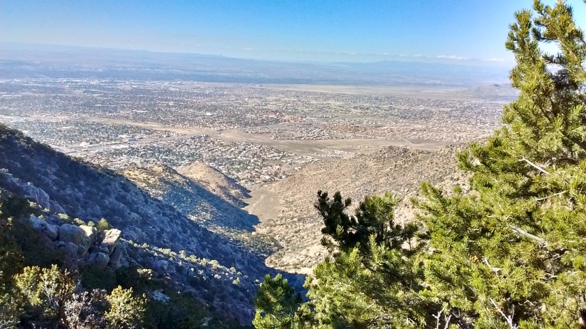
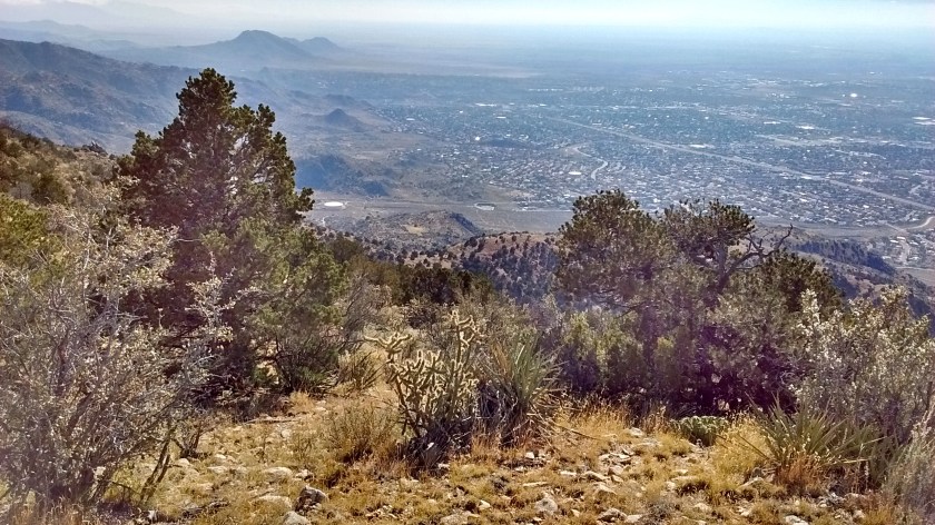
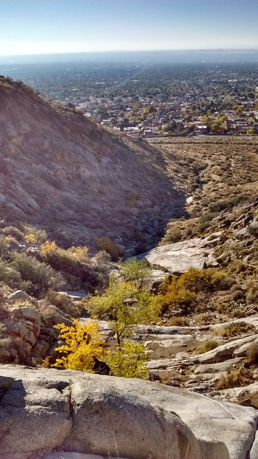
It’s a steep ascent for 3 miles up to Oso Pass, which is about a mile below South Sandia Peak on the Crest Trail. This is where we left familiar trails and took an unmarked trail heading west along a ridge that would eventually descend the mountain and get us back to the foothills. We could now see the advantage of hiking this Whitewash Trail in the Sandias that we hadn’t been on before. It had very distinctive views of the city, as well as views of the Crest towards the north and the south from different perspectives.

At Oso Pass, looking up at the Crest under the clouds somewhere.

South Sandia Peak shrouded in clouds behind us viewed from Whitewash Trail.

Looking at north end of Sandias from Whitewash Trail.

At lower elevations on the ridge when the trail was still obvious.

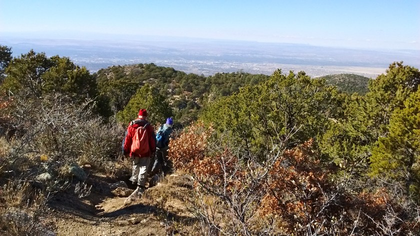
The fact that there are no trail signs for this trail wasn’t a problem in the beginning. It was easy to follow the trail along the ridge at the higher elevations. But once we got out to the more open areas and could actually see where our car was parked in the foothills below, that’s where the problems began. Somewhere along the way we got off trail and found ourselves scrambling over steep, rocky terrain, trying to make our way downhill without slipping and falling into a cactus or other obstacle.
A view down into the city which couldn't be reached before scrambling over a lot of rough terrain.
A view down into the city which couldn’t be reached before scrambling over a lot of rough terrain.

It looks like an easy way down into the city but it was in the wrong direction.

Looking to the south before ascending into the foothills.

The parking lot is to the right of the water tank but no direct route to get there.

It was a relief to finally reach level terrain in the foothills, but, unfortunately, we had gotten so far off course that we were not in the section of the foothills where our car was parked. It was another mile or so trudging through the desert before we rounded a hill and could see once again the parking lot that was our goal. I was quite exhausted after trekking 9 miles, a third of it a very steep ascent and a third of it trying to scramble back down the mountain. But, as is always the case, it was an enjoyable day spent doing our favorite outdoor activity.

An interesting canyon, but a final obstacle to scramble around before reaching the bottom--and then another mile across the desert.
An interesting canyon, but a final obstacle to scramble around before reaching the bottom–and then another mile across the desert.

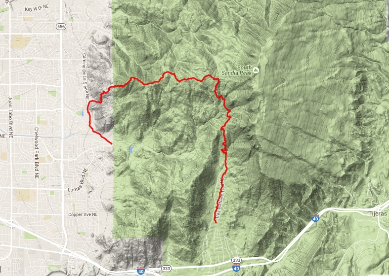
I created an interactive map from the GPS track of our hike. If you click on the link for the map it allows you to zoom in and out and move around to get a better idea of where we were.
A map of the hike

Giving Back to our Beloved Bosque

We have spent many enjoyable hours wandering through Albuquerque’s bosque, the riverside wooded area along both sides of the Rio Grande. Some areas of it we can walk to from our apartment, other areas that are further away we access by first driving to a parking area, and still others we enjoy as part of a bike ride. This morning we had an opportunity to put in some time working on improvements to the bosque, as part of the city’s 21st annual Dia del Rio (Day of the River) event.

The area of the bosque chosen for this year’s event is one that we pass by every time that we ride our bikes across the Rio Grande on the bike trail that parallels Paseo del Norte. We glance at it on the south side of the trail as we ride by, but we had never taken the time to walk through it. After spending the morning working there and realizing how extensive it is, I think we will walk there more often in the future.

Bike trail parallel to Paseo del Norte that we use when crossing the Rio Grande.
View of bisque from the bike trail.
View of bosque from the bike trail.
View of the Rio Grande we see when we cross at Paseo del Norte on the bike trail.

Dia del Rio event participants had half a dozen projects to choose from, including trail maintenance, trash pickup and revegetation. I thought trash pickup would be about my speed, but with Lee’s encouragement, we joined one of the groups doing a revegetation project. The project was in an area that had been a temporary road through the bosque, but was now being replanted with native shrubs to restore it (hopefully) to its original, natural state.

Gathering at the registration booth.
Setting out the pots of shrubs.
Demo by city employee.
Lee hard at work.
Lee hard at work.
Water truck made sure to give each newly-planted shrub a good first soaking.
A new 1/4-mile section of this trail was built as one of the projects.

Closing ceremony included a raffle.  We both had winning tickets--free entree at local restaurants.
Closing ceremony included a raffle. We each had a winning ticket–free entree at local restaurants.

The physical effort expended in this morning’s work was more than paid back to us by all that we enjoyed. And even if only one of the dozen or so shrubs that I put in the ground survives, it will have been worth it because that one shrub can grow up and reproduce many more.