We’ve spent over 6 fun-filled weeks in Iowa, but all good things must come to an end. Today it was time to get back on the road and continue our travels.
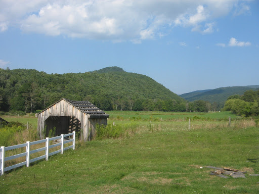
Our departure point for leaving Iowa was a bridge crossing of the Mississippi River from Muscatine, Iowa, into Illinois. Just after crossing the river we took a short sightseeing detour upriver to investigate the US Army Corps of Engineers Lock and Dam No. 16.

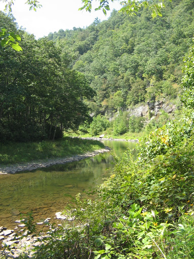
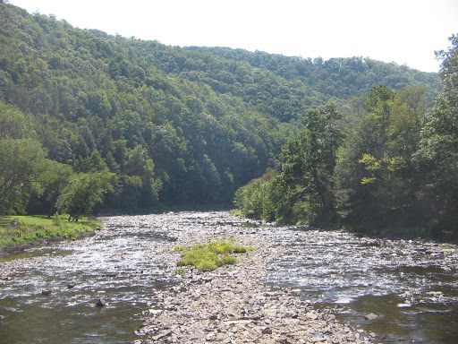
There we learned some of the history of the Upper Mississippi River Nine-Foot Channel Navigation Project. In order to spur commerce on the Mississippi River in 1930, Congress passed the Rivers and Harbors Act that included the 9-foot channel project. The Upper Mississippi River channel is often too shallow for a barge or boat. The type of barge used here needs a minimum of 9 feet of water. To achieve a 9-foot channel the Corps of Engineers built a series of 29 locks and dams on the stretch of river from St. Paul, MN, to the Southern Tip of Illinois at Cairo. The dams form pools that make the river navigable in the shallow areas. The locks are passageways through the dam allowing the boats to travel from one pool to the next.
Here across from Muscatine, Iowa, we were at lock 16 of the 29. Looking downriver from the viewing platform we were able to see firsthand how the lock works as a large 15 barge tow was making its way towards the lock.

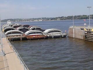


If we would have stayed to watch the whole process we would have been there over an hour. A 15 barge tow is too long to fit into the lock. When a tow of 15 barges locks through, it is required to separate and make two lockages. The first 9 barges are locked through, pulled out and tied off to the guide wall. Then the second half of the tow can be locked through.
And just another set of facts and figures that we learned: If all the material (in this case, it was coal) that is being transported on a 15 barge tow were carried by train or truck it would take 240 rail cars or 1050 semi trailers to transport that much coal. So I guess it’s worth a bit of time and patience to work these barges downriver through the dams and locks.
After leaving our history lesson on the Mississippi River the rest of the day was spent grinding out the miles on a long stretch of interstate. We are spending the night about 50 miles west of Indianapolis, Indiana, and tomorrow will continue our drive to Ohio.

Our year of travel and being “homeless” has been a great adventure, but it has also been a wonderful opportunity to stop at various locations in the country and spend time with family and friends we wouldn’t otherwise see because they don’t live nearby. The plaque above in the guest bedroom here at the Regan’s house in Bowling Green, Ohio, is a reminder that home is much more than a street address where we receive our mail and place our belongings.
Before we arrived in Bowling Green we spent a couple of days in rural western Ohio visiting our friend, Jerry, at his home in Maria Stein. When we met Jerry last winter in Florida he told us about Maria Stein but neither of us had heard of it before and were not familiar with that part of Ohio. Jerry has lived there all of his life. His knowledge of the area and its people and his eagerness to share that knowledge with us was a delightful learning experience.
Mercer County, where Maria Stein is located, has a nickname “Land of the Cross-Tipped Churches.” It’s an appropriate name as you look around from nearly any location in the area and see one or more of the church steeples in the surrounding communities. The area was settled in the early 19th century by German immigrants who were almost all devout Catholics. Under the leadership of the missionary priest, Francis de Sales Brunner, the Society of the Most Precious Blood founded many churches and schools in the region, as well as several seminaries. The name Maria Stein, in German means “Mary of the Rock”. Besides St. John’s Church, one of the “cross-tipped” churches that is here, Maria Stein is also home to the Shrine of the Holy Relics, which has beautiful park-like grounds where Jerry gave us a walking and biking tour.


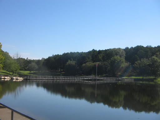
Jerry also led us on a bike ride to nearby Grand Lake St. Mary’s. This lake is Ohio’s largest inland lake and has the distinction of being the largest hand dug lake in the world. When it was completed in 1845 it was the largest man made lake in the world, but since the advent of power equipment to accomplish such tasks there are obviously now man made lakes larger than this one. Looking at the size of this lake (13,500 acres) it was hard to imagine that it was all dug by hand–one sign said it took about 1,700 laborers working for 8 years at a rate of 30 cents a day (and a jigger of whiskey for malaria prevention) to accomplish the task.

After an enjoyable visit in Maria Stein, we made the relatively short drive further north and east in Ohio and arrived in Bowling Green, Ohio, in time to spend our birthdays with Lee’s brother and sister-in-law. After a much-needed rainstorm Saturday evening and Sunday morning, we are enjoying pleasantly cool temperatures and will be doing some bike riding on roads and trails around Bowling Green.

The 2 birthday kids. Lee is holding one of his gifts, which is a snapshot of him and his brother at a much younger age.
Wow, did we finally find a place where the weather is perfect and the sparkling, sandy beaches await our eternal relaxation? Unfortunately, even if such a place exists, it is not where we were yesterday when this picture was taken.
Friday we left Bowling Green, Ohio, and drove north towards Standish, Michigan. After weeks of hot, dry weather throughout the Midwest the weather pattern took an extreme shift in the opposite direction. It was overcast and drizzly in Ohio and we knew that there would also be rain in Michigan. But we weren’t prepared for the amount of rain and for the drop in temperatures.
Our destination was Saginaw Bay Resort where a family reunion was planned for Saturday. We were going to camp there Friday night. But as the rain increased and the temperatures decreased we realized that we would have to change plans. Cousin Terri has a summer home on the bay less than 2 miles from the resort and when she offered us accommodations there for the night we were more than happy to accept.
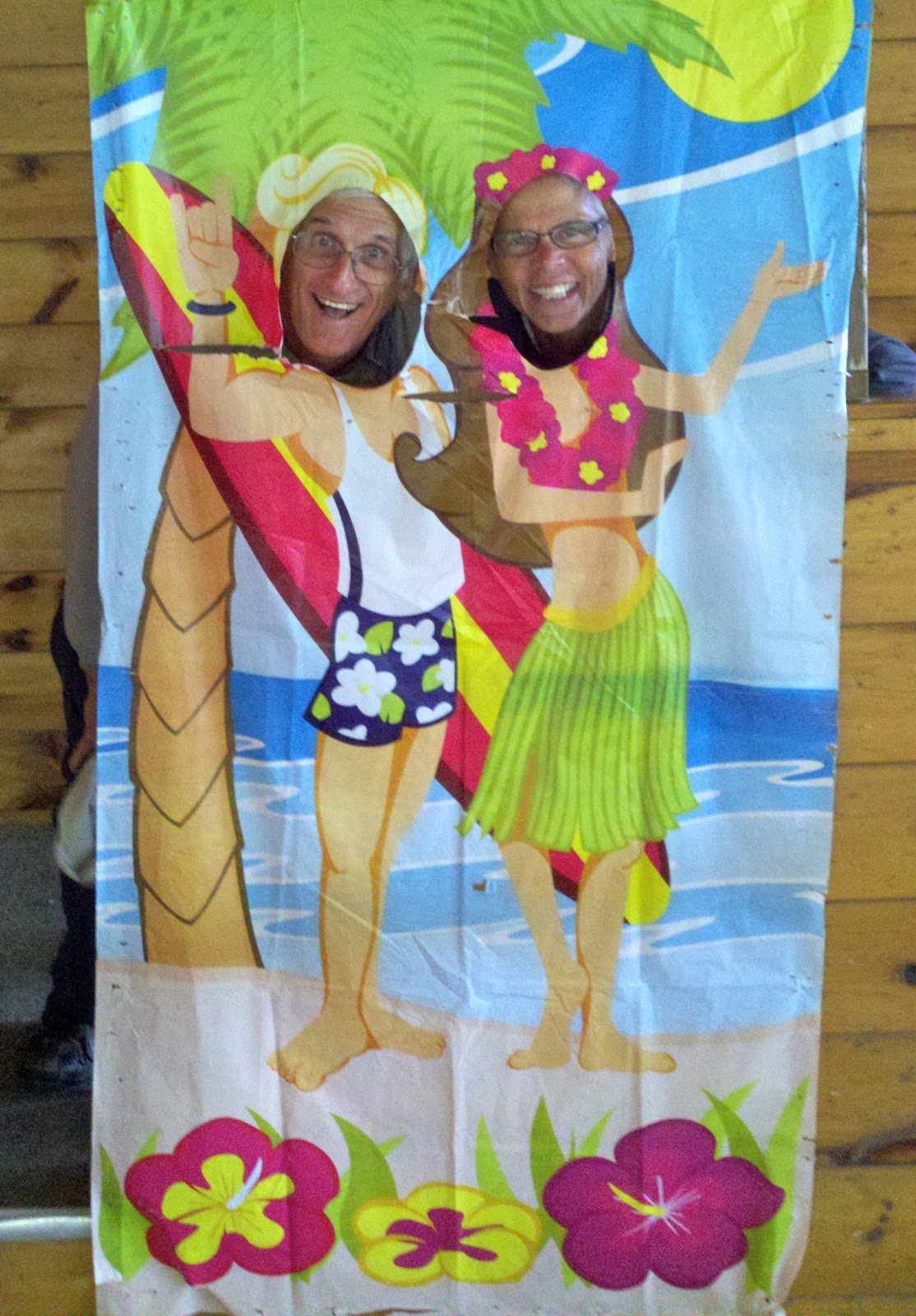
After a restful, dry sleep at Terri’s house we awakened to another chilly, gray day. But at least the heavy rains had given way to only scattered showers. Terri and other family members who planned the reunion did a marvelous job of working around the uncooperative weather to find a place to set up the noon meal where the family would gather. Tables were set up in one end of the resort’s pavilion and there was plenty of space for our group to grill and enjoy the dishes everyone had brought. The theme of the week at the resort was Hawaiian and the pavilion was set up for a special dinner later that afternoon for all the resort guests. That explains why we found the photo op in the pavilion of 2 happy Hawaiian travelers.
It wasn’t Hawaiian weather by any means, but it isn’t the weather that counts when a family comes together. What counts is that you are with people that you care about and who care about you. It was wonderful to see everyone and spend the afternoon catching up with each other. This side of the family doesn’t gather together as often as we should. Special thanks to Terri and Kathy and their families for providing the time and place and doing all the hard work to bring this together.
Lee and I are now setting out to cross over into Ontario from Port Huron, Michigan. We will spend a couple of days camping in Ontario, making our way to Niagara Falls, a place that I have not yet seen, but am sure will be beautiful. From there, our destination will be upstate New York where we will visit Lee’s mother and reconnect again with Lee’s brother and sister-in-law at their annual stay at Sacandaga Lake in the Adirondacks. Let’s hope the weather warms back up and that summer isn’t over yet.

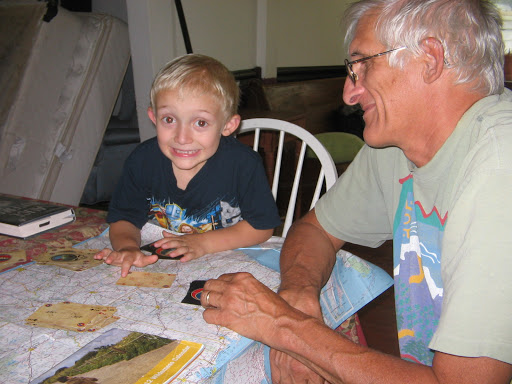
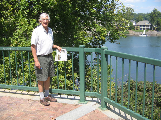
Our travels have brought us to Saratoga Springs, New York, where we are spending several days visiting Lee’s mother. Betty is not part of the digital world and has not been able to follow our adventures through the blog. Over the months, Lee was faithful to keep in touch with phone calls and frequent packages containing photos and travel descriptions. It is a treat now for both of them that they can share in person, as they are doing in this photo with the atlas between them.
To get to Saratoga Springs from Michigan we drove on Sunday across the St. Clair River from Port Huron, Michigan, to Sarnia, Ontario. This was my first visit to Canada, although Lee has traveled there a number of times. Once across the bridge (not a speedy process) we stopped at the Visitor Information for maps and brochures. By this time it was mid-afternoon and we hoped to find a campground before dark. All of the provincial parks in this part of Ontario are on Lake Ontario and would have been somewhat out of the way. But we discovered that there were many private campgrounds along our route.
About 10 miles east of London, Ontario, we stopped for the night at a quiet, very clean place called Casey’s Campground. It was a first for me to camp in Canada. And there was another first for both of us the next morning shortly after breakfast when the electricity went out. As tent campers we don’t require an electric hookup but it did mean no water, restrooms or showers until power was restored. The campground owner assured us that he was doing his best to monitor the situation. And it wasn’t too long before the power came back on and we were able to finish getting ready for our day.
This was the day that we made our visit to Niagara Falls. Now I have another breathtaking wonder of nature that I can add to the list of sights seen on our travels.


After filling up on the awesome beauty of Niagara we drove the length of the 30-mile Niagara Parkway that follows the Niagara River from the falls down to the bridge crossing at Fort Erie. We enjoyed the drive with views of the river on one side and beautiful estates and mansions on the other side. At Fort Erie we crossed the Peace Bridge, coming back into the US at Buffalo, New York.
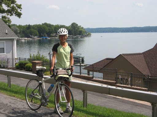
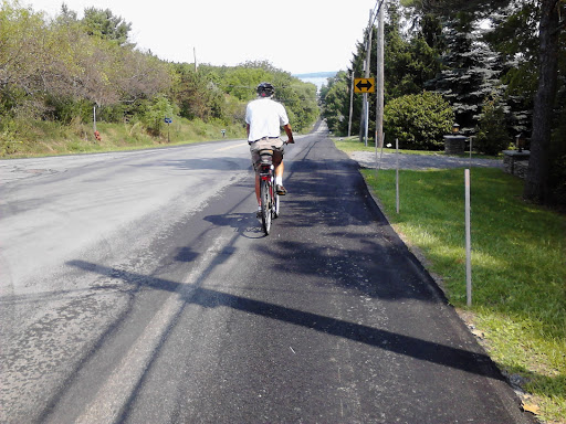
Our stop for the night Monday was a motel in Canandaigua, a small town on the northern end of the lake with the same name (a name that I had a very hard time pronouncing)! This lake is, practically speaking, the westernmost of the series of lakes in New York called the Finger Lakes. A look at a map of New York state shows why this is a fitting name.
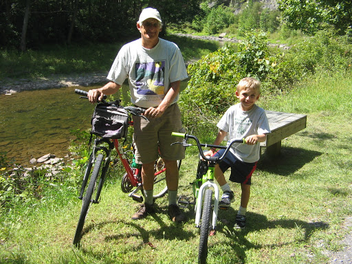
Tuesday before leaving Canandaigua we rode our bikes partway around the lake on a road along the western side of the lake. The Finger Lakes are in a part of the state that is quite hilly and we did get to stretch our leg muscles on several good-sized hills.
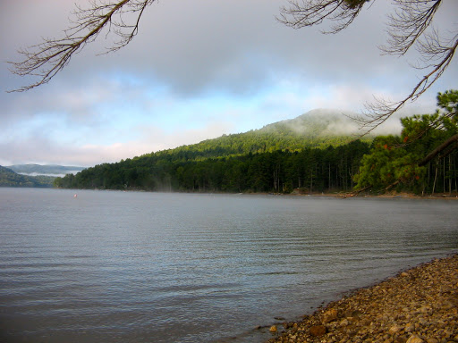
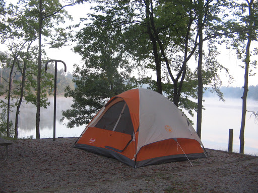
Tuesday night was another camping opportunity, this time at a New York state park next to Caroga Lake at the southern edge of Adirondack Park. Our tent kept us warm and dry during the night as some heavy rainstorms moved through the area.
We are adjusting now to the northeast, which has not suffered from the heat and drought we experienced for months on our travels in the west and midwest. It is nice to see green again and flowers gardens that have not wilted or dried up. We look forward to this weekend where we will be visiting the Regans again, this time at the cottage they have rented on Sacandaga Lake.
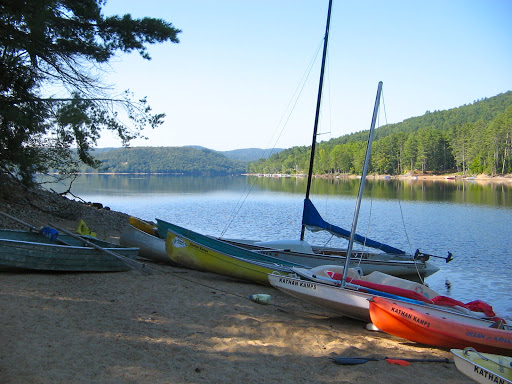
We enjoyed our weekend with the Regans at the cabin they rent every summer on New York’s Great Sacandaga Lake. The cabin is one of 12 located on the north shore of the lake at a family-owned property, Kathan Kamps. The Kathan family owned farmland that was flooded in 1930 when Sacandaga Lake came into being at the completion of the Conklingville Dam. Dr. Dudley Kathan moved the farmhouse and several buildings to higher ground and those buildings became the start of Kathan Kamps.
The Regan family history has deep roots at Kathan Kamps. Brothers and sisters, aunts and uncles, cousins and grandparents, all have great memories of fun times at the gatherings here over the years. Time passes and children grow up and buildings age and in 2012 we no longer saw games being played or children digging in the sand at the lake shore. But it is a beautiful, peaceful location and we appreciated the hospitality of our host and hostess.


When we left New York yesterday our plan was to camp last night at a state park in Pennsylvania. The weather, however, had other plans. We encountered some very heavy rains driving from Binghamton to Scranton. By the time we got to Scranton the worst of the rainstorm was over, but it was in the 60’s and gray and drizzly. We opted for a motel stay and spent a comfortable night. Today we make the drive to Virginia where we will spend several days at our old home territory visiting friends and taking care of a few items of business.

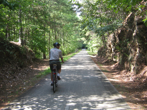
Hello again to our storage container and goodbye (for now) to the faithful bicycle that carried me for so many miles this summer in Iowa.
One of the tasks we accomplished in our 5-day day stopover in Virginia was to gain access to our storage container so that we could offload one of 3 bicycles we have been carrying on the back of the car ever since we left Iowa. It was a strange feeling to look inside the container and see the household goods we had put there way back in December. One file cabinet drawer had come loose, but, other than that, everything was just as we had left it. And when we resettle somewhere and call for the container to be delivered I expect that we will find everything just as we left it. Closing the door and saying goodbye to “stuff” is not a big deal.
It was much more difficult to say hello and goodbye to the many friends that we reconnected with this week. When you are wandering around the country it’s easy to get distracted and not pay as much attention as you should to keeping in touch with friends. With a limited number of days here we didn’t see everyone, but we were blessed tremendously by each and every one of the friends we did see.
We are especially grateful to Brian and Darlene for having us over for a cookout, to Greg and Wayne for keeping our mail for us, to Eva for letting us crash at her place and to Matt and Veronica for putting us up at their beautiful country home in Culpeper. And then our friends at church and Liz and Alex and the group at their home were so welcoming and made us feel that we hadn’t left here at all.
But now there are other places yet to visit and it’s time to say goodbye once again to Virginia. Tomorrow’s travels will take us to West Virginia where we will see our 2 grandsons and check out the family’s new digs in Marlinton.
Our welcome to Frost, WV, was by no means frosty. It’s not an easy drive to get there, especially if you’re like me and tend to get car sick on winding mountain roads. And if you are looking for any stores, gas stations or rest stops in Frost you won’t find them. We were looking, however, for Mort and Kelly’s house and found a very warm greeting when we got there.
The driveway to the house is immediately after the “Frost Unincorporated” sign. The edge of the property is apparently the eastern boundary of Frost. The western boundary of Frost is probably less than a mile further down the road. The only buildings in between are the volunteer fire department, a Methodist church and a couple of other houses. It’s really small town living in Frost.


Not only were we warmly welcomed by family in Frost, but the weather was also warm and sunny the days that we were there. The northern terminus of the Greenbriar River Trail is very close to Frost, as is Seneca State Forest. We enjoyed biking a few miles on the trail and driving through some back mountain roads in the state forest.
Also very close to Frost, in fact, so close that we walked to it one morning, is the interesting facility called Mountain Quest. It is an inn and conference center, which didn’t happen to have any guests the day that we were there. The innkeeper allowed us look around the inn, library (very extensive) and guest rooms.
The closest town of any size to Frost is the county seat, Marlinton. We took the opportunity one morning to drive into Marlinton and enjoyed a delicious sandwich at the Dirtbean, a combination cafe, bike shop and wellness facility. In spite of being the county seat, Marlinton is also a small town, less than 2,000 population.
After biding farewell this morning to our hosts in Frost we wound our way through the West Virginia mountains again, this time heading towards the Tennessee border. Before stopping for the night we made it as far as Knoxville, TN, where we are relaxing in a motel. Tomorrow brings new adventures in eastern Tennessee.

We have been enjoying our weeklong stay in Knoxville, Tennessee, as we explore the sights of eastern Tennessee. When we arrived here on Labor Day weekend we didn’t know that Knoxville is famous for the annual Labor Day fireworks display called Boomsday. Crowds began gathering downtown early in the day on Sunday to visit vendor booths, listen to live bands and find the best places to set up chairs in preparation for the start of the fireworks at dark. We made sure to get there early enough to find parking and then had plenty of time to walk around and enjoy the festivities.
We could see that the fireworks were going to be set off from an unused railroad bridge that spans the Tennessee River in the downtown area. Our chairs were set up for prime viewing. We had our umbrellas with us and had to use them before the fireworks started as a couple of thundershowers passed overhead.
Promptly at 9:30 the display began and I have to say that it was the most impressive fireworks display I have ever seen. For 30 minutes the sky was filled with multiple bursts, there was an accompanying soundtrack over the loudspeakers and twice there was also this awesome effect where a waterfall of cascading lighted fireworks flowed down from the railroad bridge to the river below. The last 5 minutes of the grand finale came just as the heavens opened up with a huge downpour of rain that sent people running in every direction. Even with our umbrellas we got wet but it all added to the excitement and fun of the event. A Labor Day weekend I won’t forget, that’s for sure.
Besides being famous for the annual Boomsday event, Knoxville also has the distinction that in 1982 it hosted the World’s Fair. There is a World’s Fair Park downtown that commemorates the event. The Sunsphere is a steel truss tower topped with a gold-colored glass sphere that was set up as the symbol of the fair. From the observation deck of the Sunsphere we were able to get a bird’s eye view of the city.


There is also a lot of Civil War history that one can learn by visiting Knoxville. Tennessee was on the side of the Confederacy but the majority of Eastern Tennessee favored the Union side. Earthen forts built by Union armies on the bluffs of the Tennessee River overlooking Knoxville were important in defending the city in several battles that took place as the Confederacy tried to take the city. We visited one of those forts, Fort Dickerson.


Today we wandered further afield and drove to Cookesville, Tennessee. We had heard that it was a good place for relocating retirees and wanted to check it out. I can’t say much about Cookesville, but I was awestruck by the waterfalls we saw at nearby Burgess Falls State Park Natural Area. The sign at the trailhead explained that there were a series of 3 falls, the largest being the third one. The first 2 were worth seeing, but the 3rd one really was something special. The 3rd one had a trail that you could hike down to get to the base. It warned hikers that it would be a strenuous climb and Lee wasn’t sure he wanted to do it. But we made our way down there and were more than glad that we had done it.


Tomorrow our plan is to do a hike in the Great Smoky Mountains National Park, which is not too far from Knoxville. Several years ago we visited a different part of the park but tomorrow we will see what other trails we can find there to explore.

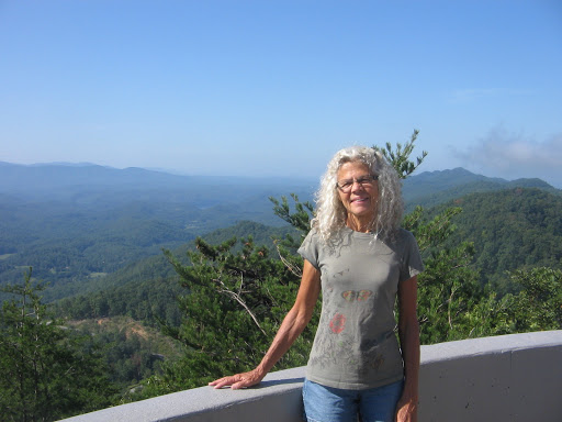
After our weeklong stay in Knoxville we spent several days camping and sightseeing in Georgia. We then circled back northward yesterday to end up in Greenville, South Carolina, where we have again rented a weeklong extended stay. We have been in the Greenville area before but would like to spend more time this visit so that we can take advantage of the nice weather and the proximity to the Blue Ridge Mountains.
The last 2 days of our week in Knoxville were spent visiting Great Smoky Mountains National Park. Our first visit was to the area called Cades Cove. Besides the historic farms and cabins that are a popular attraction, this valley also offers some of the best opportunities in the park for viewing wildlife. An 11-mile loop road winds through the valley and we decided to ride our bikes, instead of driving the car. We were surprised at how many cars were on the road, considering it was after Labor Day and not a weekend. At one point, as were pedaling along, up ahead of us we saw a large group of cars that were stopped and people were getting out to look along the roadside. As we approached, we realized the attraction stopping the traffic was a small black bear ambling across the road and through the adjacent meadow. I’ve seen black bears in the wild before but the unique behavior we observed from this guy was that he proceeded to climb up into a nearby tree and skillfully balanced himself on a couple of shaky limbs that didn’t look nearly strong enough to support his weight. But, apparently, he knew what he was doing and seemed to be enjoying his perch oblivious to us gawking tourists below.
Near the halfway point of the Cades Cove loop road we made a diversion down a side road that led to the trailhead of a hike to a waterfall on Abrams Creek. It was a five-mile round trip hike to get to the falls and back, but well worth it for the views at the falls and along the trail. There was a bit more climbing up and down of ridges on the trail than what we had expected. Not to mention that the Cades Cove loop road presented some uphill challenges on the bike ride portion of our tour. Needless to say, we were pretty tired after our first day in the Smokies.
Our second day in the Smokies was no less exhausting and exhilarating, but for different reasons. We mapped out a circuit hike using a park map and combining portions of trails that looked interesting to us. Once again we had no way to judge how much elevation climb to expect. As we hiked this day it wasn’t just the elevation that was a challenge but there were several stretches of trail that were filled with fallen trees requiring ups, overs, unders, roundabouts, and whatever other means we could devise to negotiate the piles of brushy tangles. It was only at the end of the day when we finally made it back to the car that we stopped to read a notice on a kiosk warning hikers of trail closures due to spring storm damages that had not yet been cleared out. Wouldn’t you know it, several of the trails mentioned were ones that we had been hiking on. But, difficult as it was, it was all part of the fun and adventure.


Georgia does not have the mountains like the Smokies and the Blue Ridge that we love to explore, but we were pleasantly surprised at the many opportunities we did find there for enjoying the great outdoors. One day we rode our bikes on a portion of the Silver Comet Trail, a 60-mile rail trail that starts in Smyrna, Georgia, passes close to Atlanta and ends in the northwestern part of the state at the Georgia-Alabama border. We did a short out-and-back ride near the center of the trail, starting at the Rockmart trailhead. We were told by a fellow bicyclist at the end of our ride that we had selected the best portion of the trail because it passes through less-populated areas and is more scenic. We agreed that it was a scenic ride and even had some elevation that is usually not part of a rail trail ride.

Other things that we enjoyed in Georgia were 2 nights at a couple of different state parks. The first was Sloppy Floyd State Park, near Summerville, Georgia. What kind of name is that, you might well ask? This park was named for James H. (Sloppy) Floyd, who served in the Georgia House of Representatives from 1953 to 1974 and was from the area. We loved the quiet, beauty of this small park, surrounded by rural countryside and the Chattahoochee National Forest.
Another night of camping in Georgia was again at a small rural park, Hamburg State Park, along the edge of quiet Hamburg Lake fed by the Little Ogeechee River.
A trip through central Georgia wouldn’t be complete without a stop at Ocmulgee National Monument, a place of interest to students of American Indian history; hence, something on Lee’s bucket list. I enjoyed it, too, because, to see the Indian Mounds that are there, it requires walking outdoors on a circuit path and it was a beautiful day to be outside.

And last, but not least, before leaving Georgia to cross over into South Carolina, we stopped in Augusta, Georgia, visited the downtown area and walked for a bit along the Riverwalk path that parallels the Savannah River.
After last week’s hiking, driving, and bike riding we look forward to being planted in one place again for a full week. The weather promises to be gorgeous September days so we won’t be sitting around indoors for very long here in Greenville. As we study maps and brochures of the area, I’m sure we will find the right balance between rest, relaxation and recreation during our time here.
We had saved our hike in North Carolina’s Blue Ridge Mountains for today, our last day in Greenville before leaving the Carolinas. Unfortunately, the weather made other plans for us. We could see the rain in the forecast this morning when we left Greenville for the drive to the Blue Ridge. But we had hoped that it would be like yesterday’s rain that cleared out before lunchtime. Brevard, North Carolina, was the first stop and we dashed out in the soaking rain to go into the Visitor’s Center for a map. The Visitor’s Center had an overhead TV displaying Doppler radar and it was evident that the rain was not going to let up anytime soon. The comment that the lady at the desk made in the discussion of our failed hopes for hiking today summarized this visit to North Carolina: “With all of this rain, the waterfalls will be beautiful tomorrow!”
For us, the beautiful waterfalls in North Carolina are going to have to wait for another time. There didn’t seem to be any point in sticking around so we drove back to Greenville. At times, the rain was so heavy that we could barely see the road. Although it stopped raining once we got down from the mountains, I think it’s probably still raining up there.
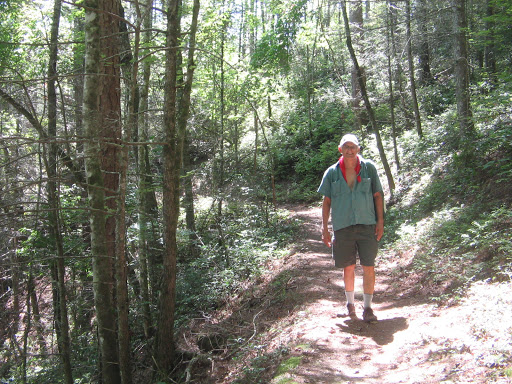
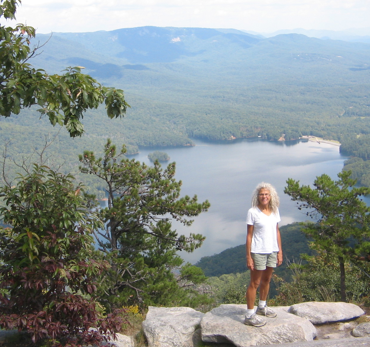
We missed our day of hiking today but we enjoyed other activities this week in the Greenville area. This part of South Carolina is known as the “Upcountry”, a land of forested mountains, scenic lakes, rocky outcroppings and rushing whitewater rapids. A hike we took one day climbed steeply for 3.5 miles to the top of the rock formation at Table Rock State Park. 3.5 miles doesn’t sound like a lot, but with 2000-foot elevation gain and a very rocky trail, we got a good workout. The views were well worth it.


The one day of bike riding that we did during our time in Greenville was on the Swamp Rabbit Trail, a 17-mile rail-to-trail path that runs along the Reedy River and connects Greenville with the town of Travelers Rest. About 7 miles north of Greenville the trail passes next to Furman University and we took some time to ride around the Furman campus.


A day’s excursion that took us further afield from Greenville was a visit to Columbia, the capital of South Carolina. After some time spent walking in the downtown area, we took a 15-mile drive southeast of the city to see Congaree National Park. Here we battled the humidity and mosquito swarms to gape at the towering trees surrounding us in the forest as we strolled along a 2.5-mile boardwalk trail. The Congaree National Park is a 22,000 acre tract of old-growth bottomland hardwood forest, the largest of its kind in the US. One of the park signs states: “No place in North America has a larger contiguous area of 130-foot to over 160-foot tall trees”. Despite the mosquitos, we absorbed the awe-inspiring beauty and peacefulness of these giant trees.


Tomorrow we bid farewell to the southern states and turn northward, our goal being northern Virginia on Friday to take care of some personal business. It doesn’t seem the right time of year to be heading north. But all good things must come to an end and we have many wonderful memories to take with us into whatever next state we find ourselves.
The posts that I have been writing on this blog since last December served as a means of keeping friends and family informed of our location and adventures as we traveled the US. As we now begin preparations for relocating ourselves and our belongings to a new home (one more permanent than the Subaru Forester that has served us so well these past months) a new chapter begins.
We have a lot of work ahead of us and a whole new focus for planning our activities in the coming days. For us it continues to be an adventure, but one of a different sort. It will not be the type of adventure where we visit exciting new places, ride our bikes, hike up mountains and/or take “tourist” photos. For those of you who have been faithful followers of this blog, these new trials and tribulations of our upcoming relocation adventures will not be very interesting.
For this reason, as we start our new chapter, I am officially bringing this one to a close. I will not be posting any new entries to this blog. We will do our best to individually keep each of you posted on our progress of relocating. Phone calls and emails are always welcome if you haven’t heard from us.
May our Lord Jesus richly bless each of you who know Him as your Lord and Savior. For those who don’t yet know Him we pray that you will soon reach that blessed truth.
