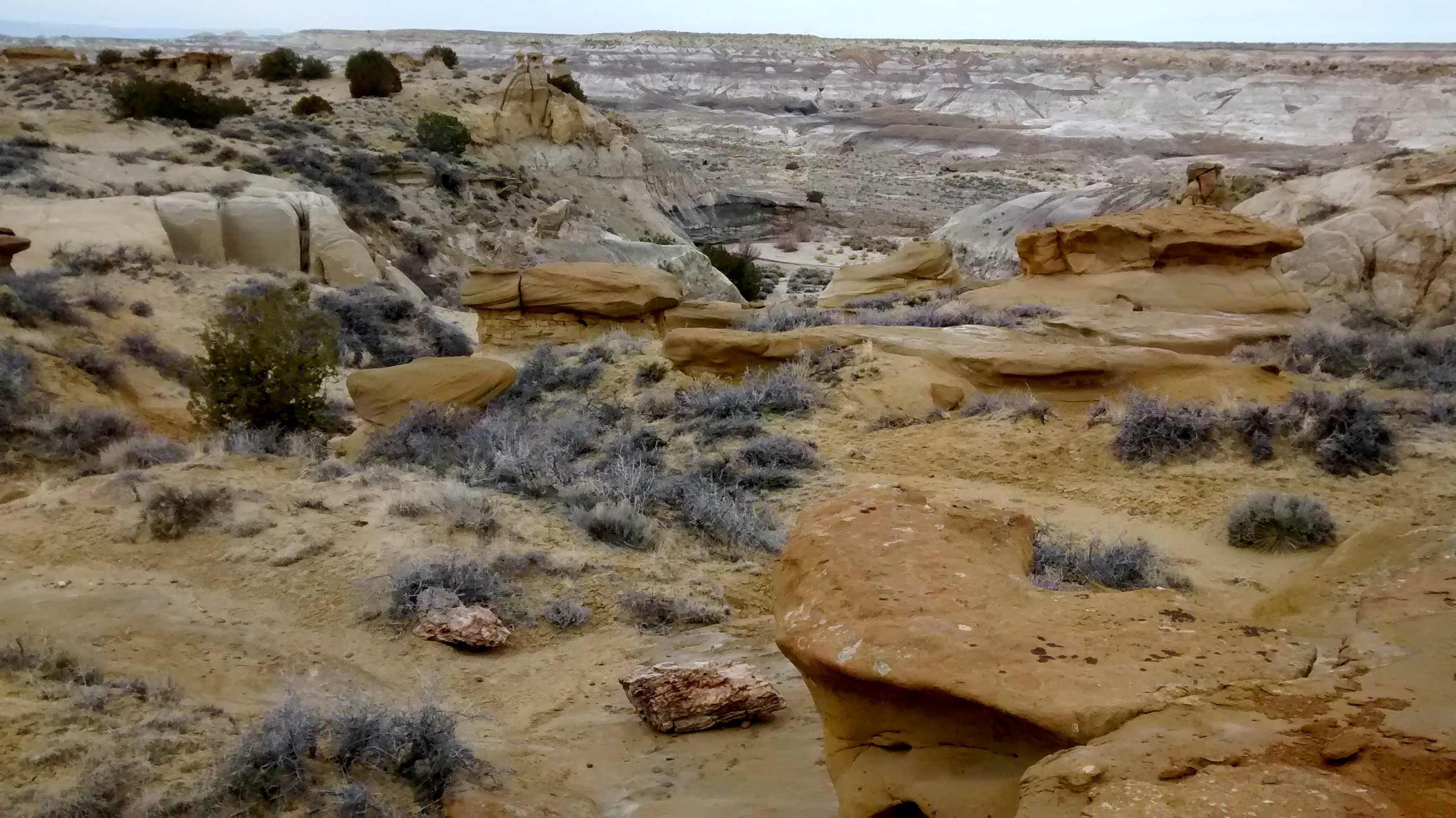
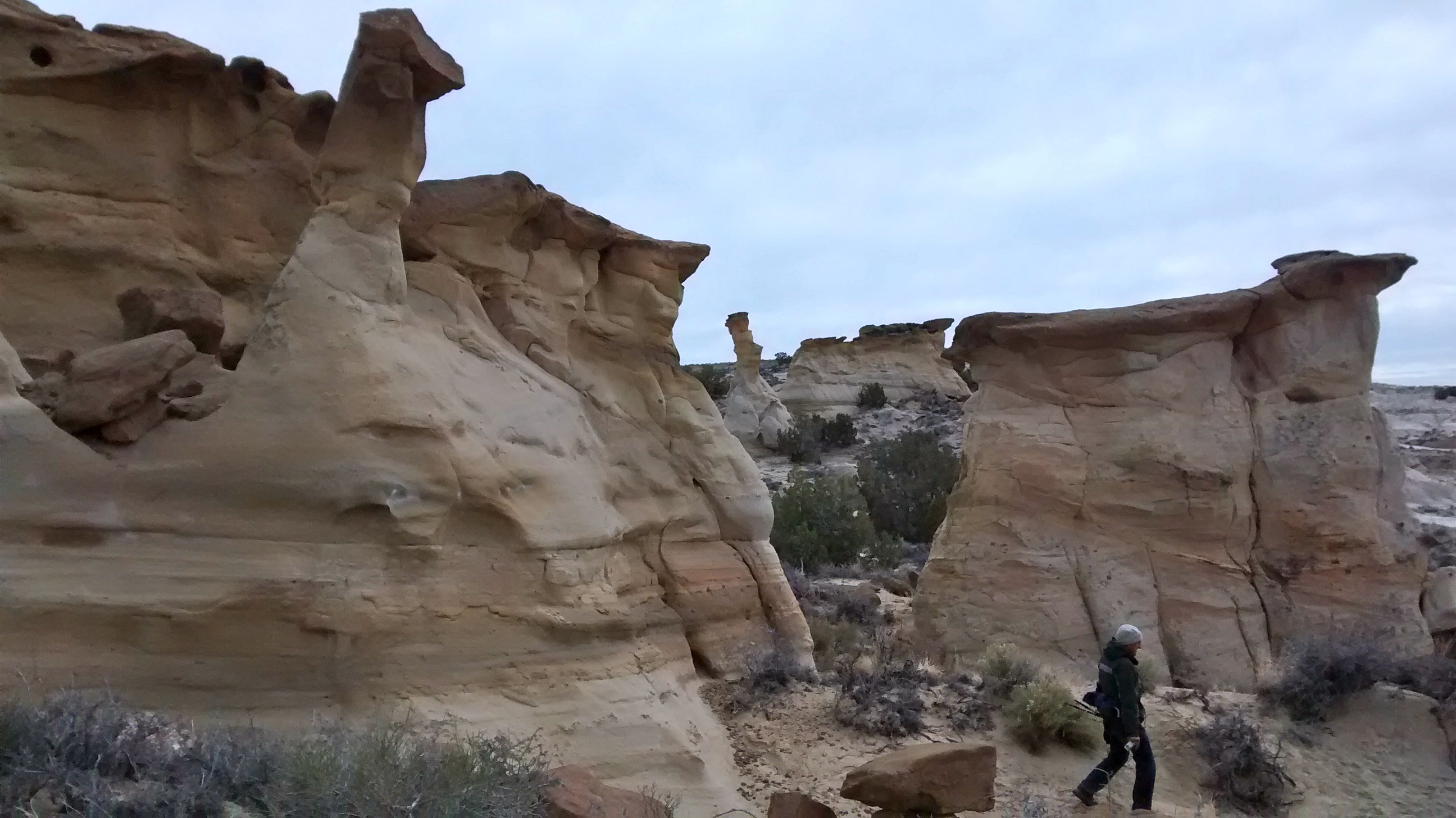
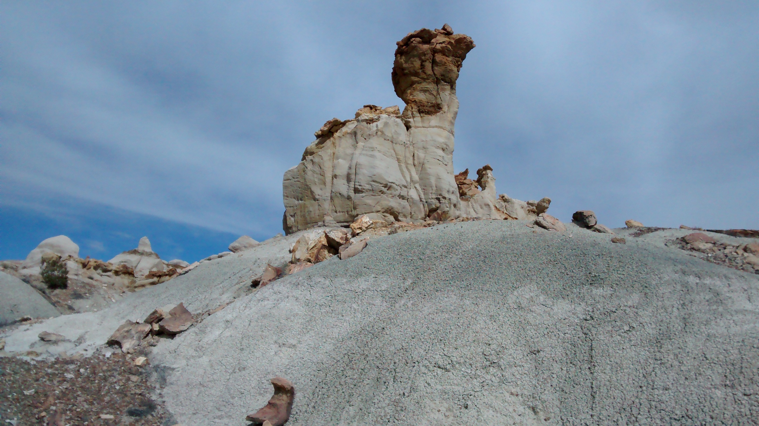
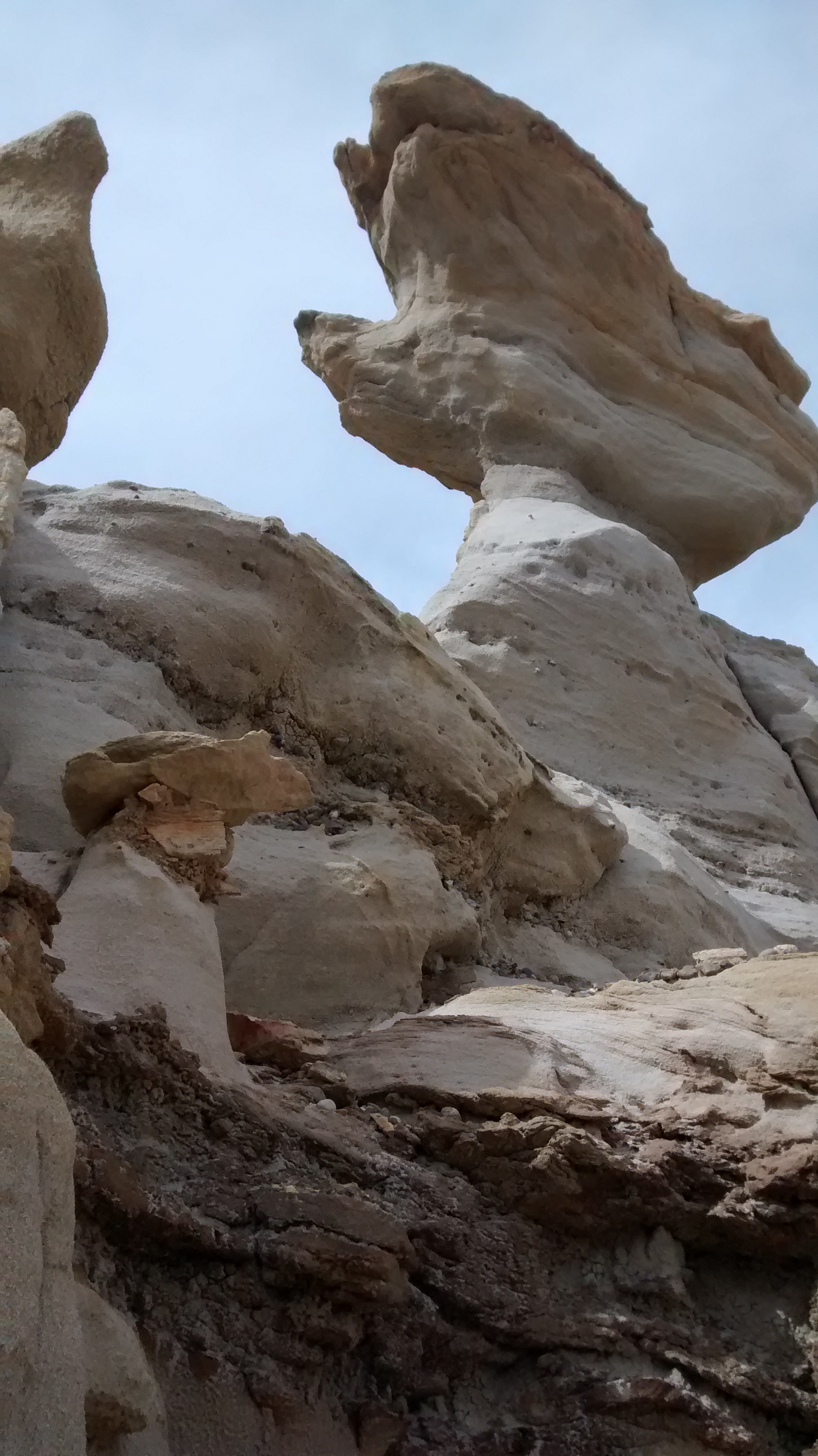
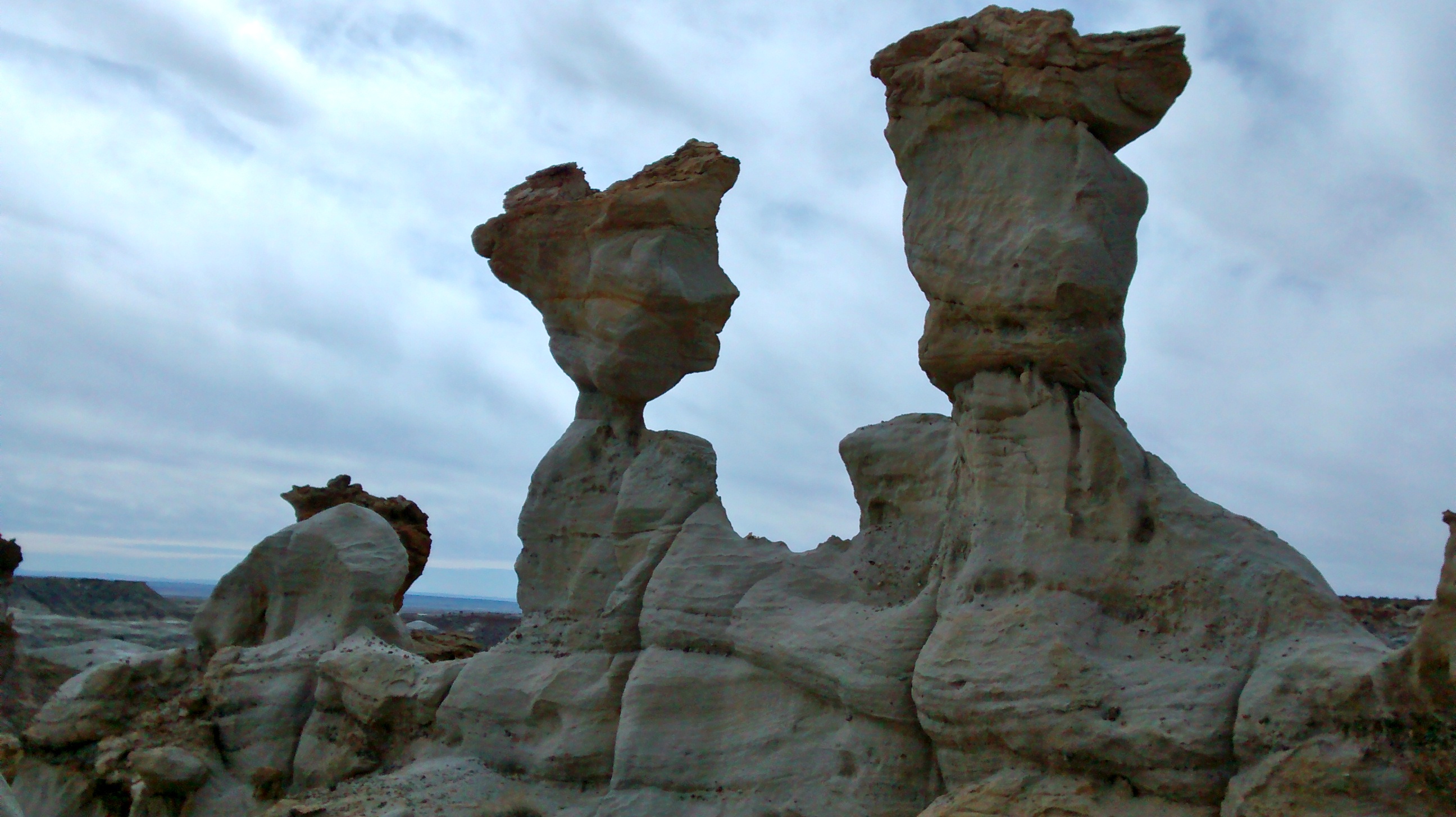
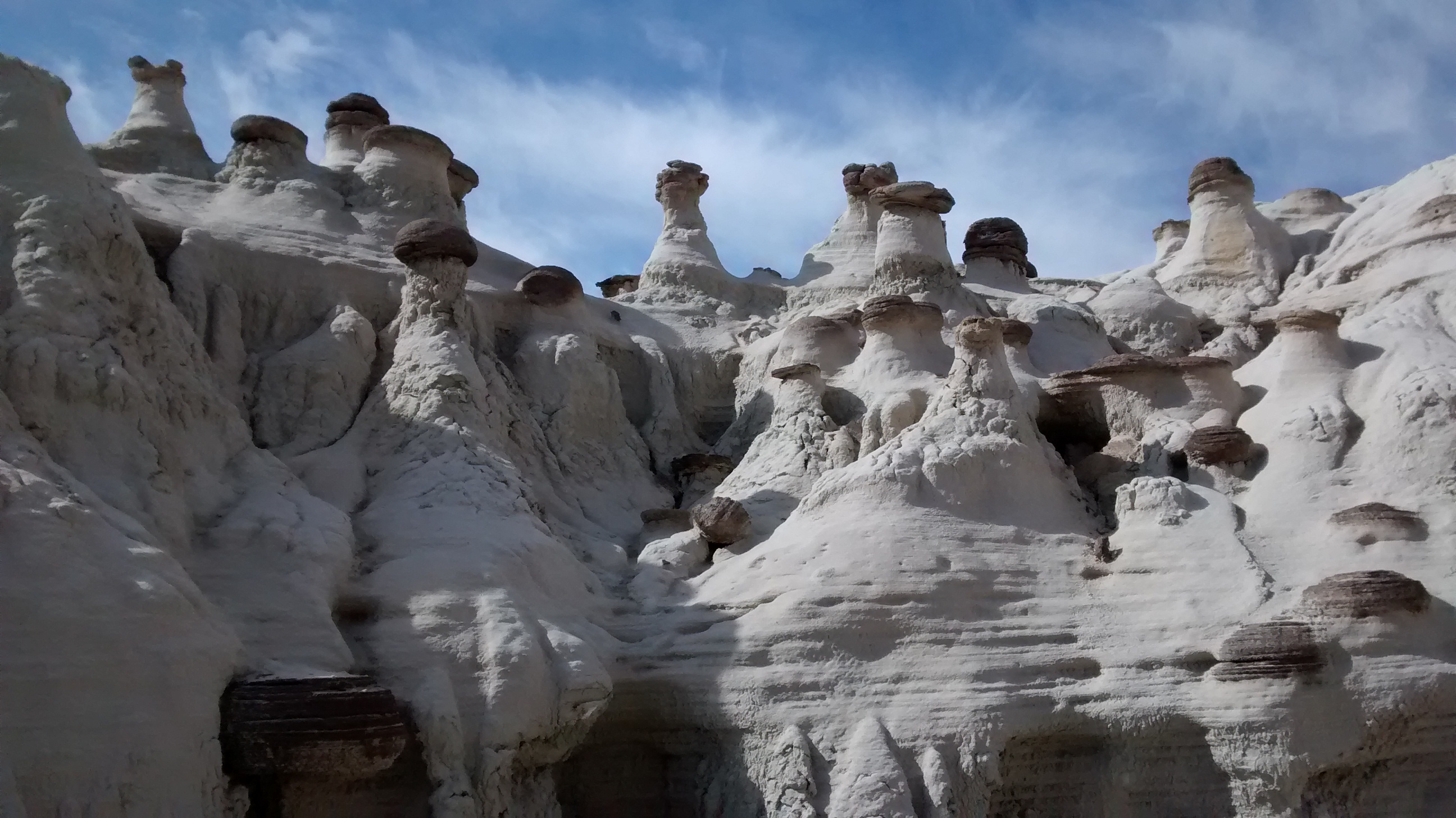
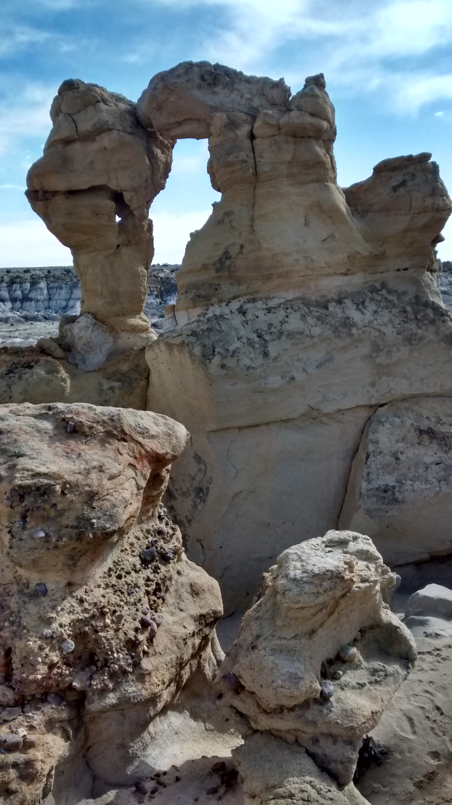
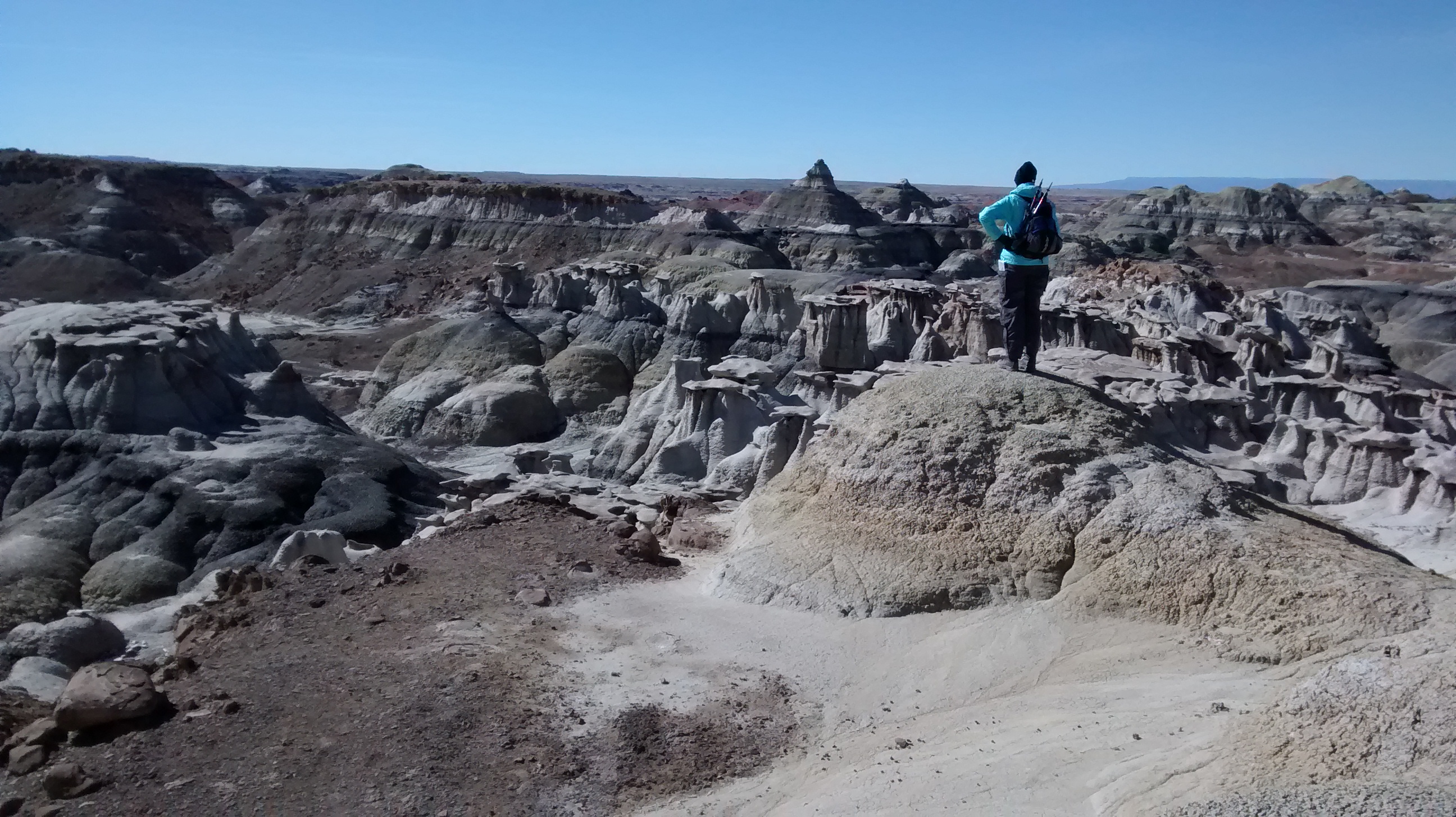
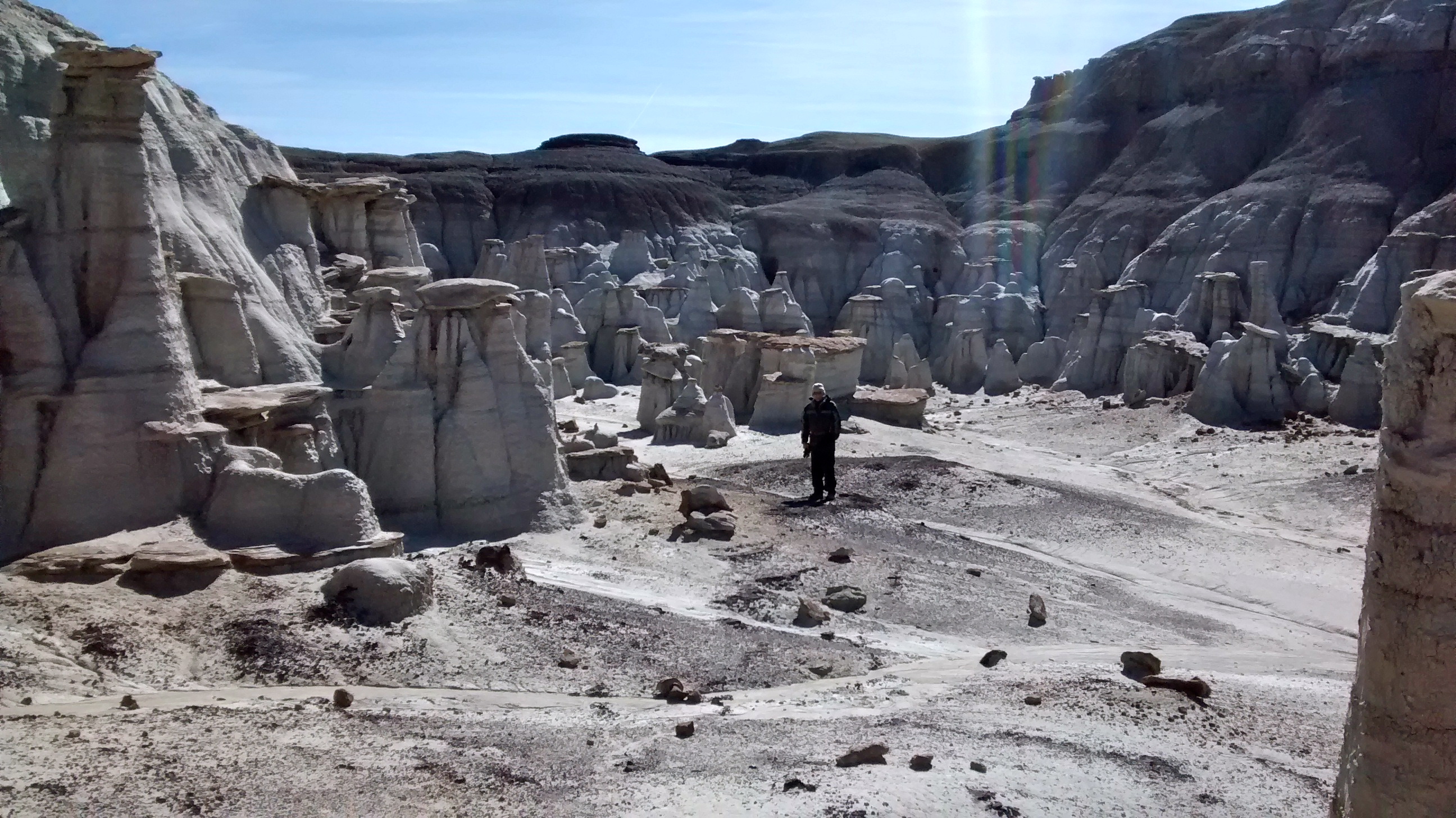
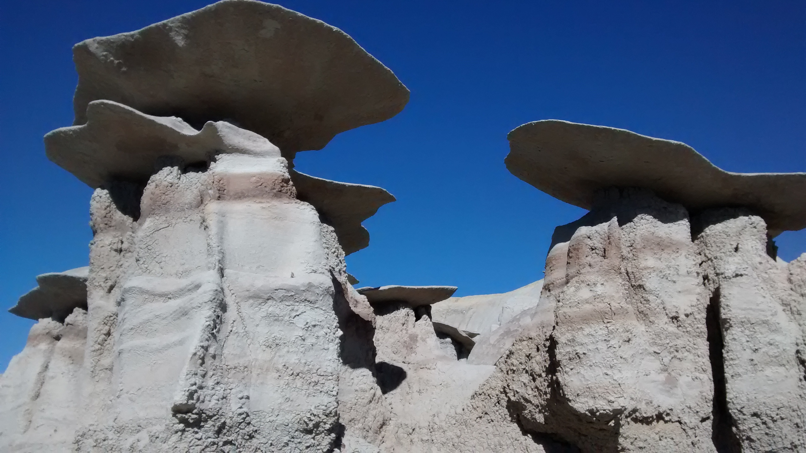
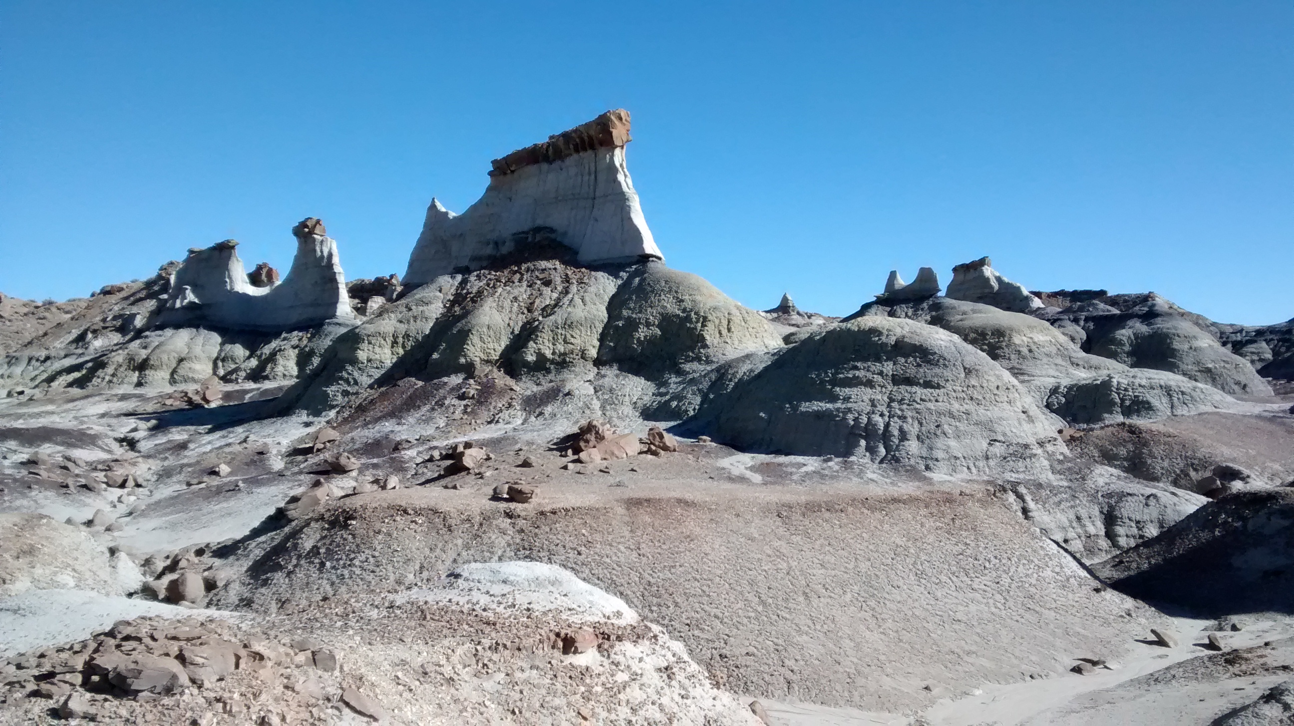
We finally made a trip to northwestern New Mexico to explore the De-Na-Zin and Bisti Wilderness Areas. It’s an area of badlands that I’d been wanting to see, but it’s a bit too far from Albuquerque for a day hike. By spending the night in Farmington, we had plenty of time to hike through De-Na-Zin the first day and then Bisti the second day.
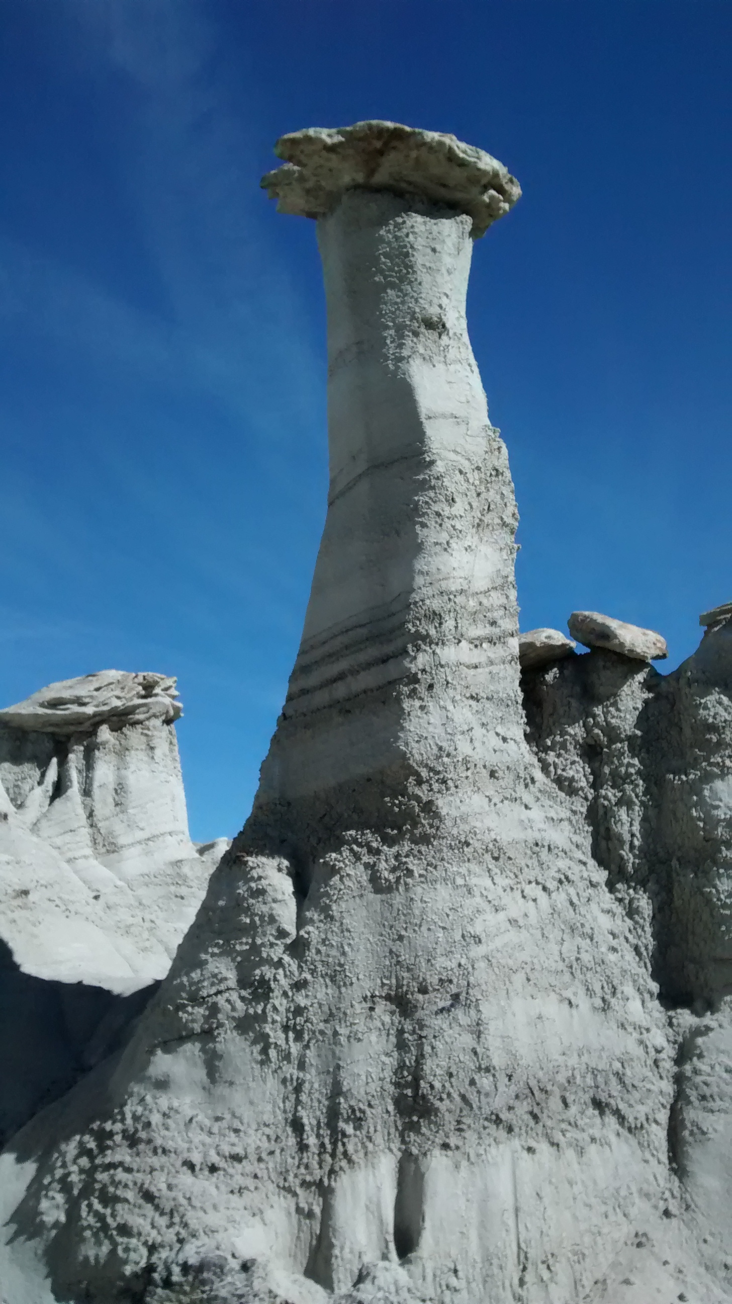
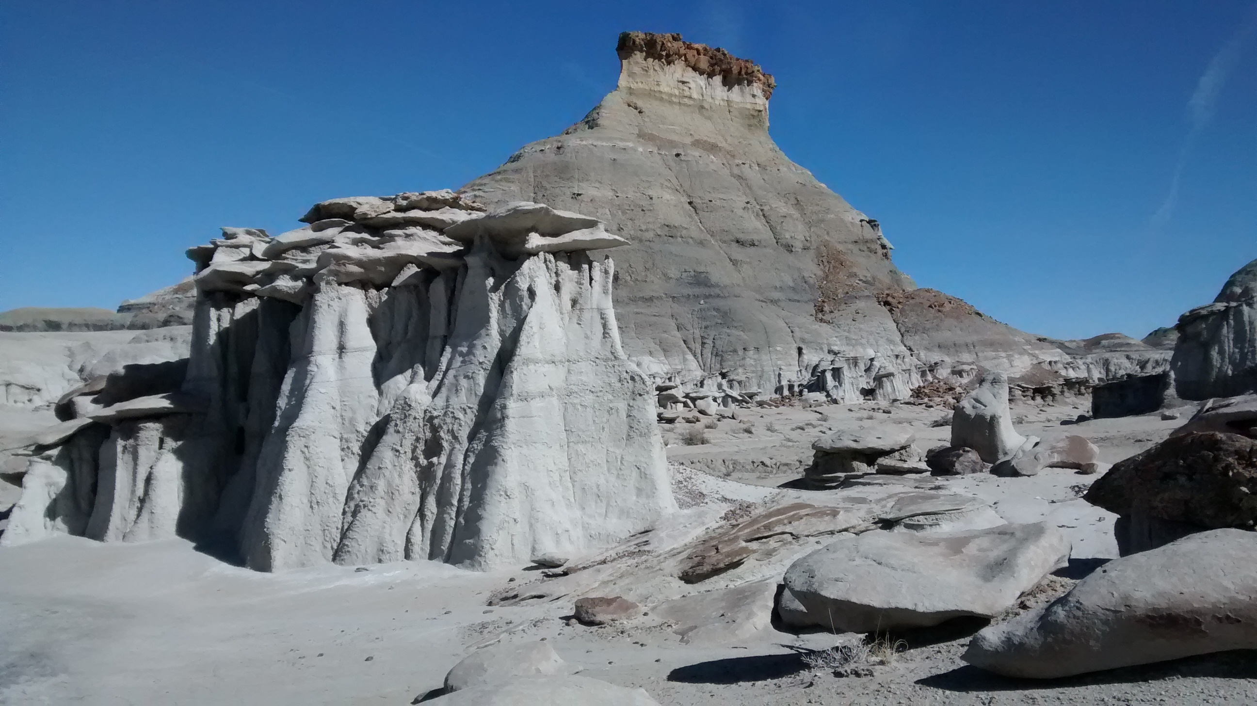
Saying that we hiked through the 2 areas is probably not the most accurate description. There are more than 40,000 acres of remote badlands with no marked trails and no way to see all of it in one visit. We were fortunate to have Ken and Sue, our hike leader friends, join us on the trip. Sue had GPS tracks along for both days to keep us from getting lost and to guide us to some of the most interesting formations. Of course, if you get excited about eroded rock hoodoos and exposed geologic formations like we do then it would be hard to find formations that weren’t interesting.
Here are a few of the photos we took:
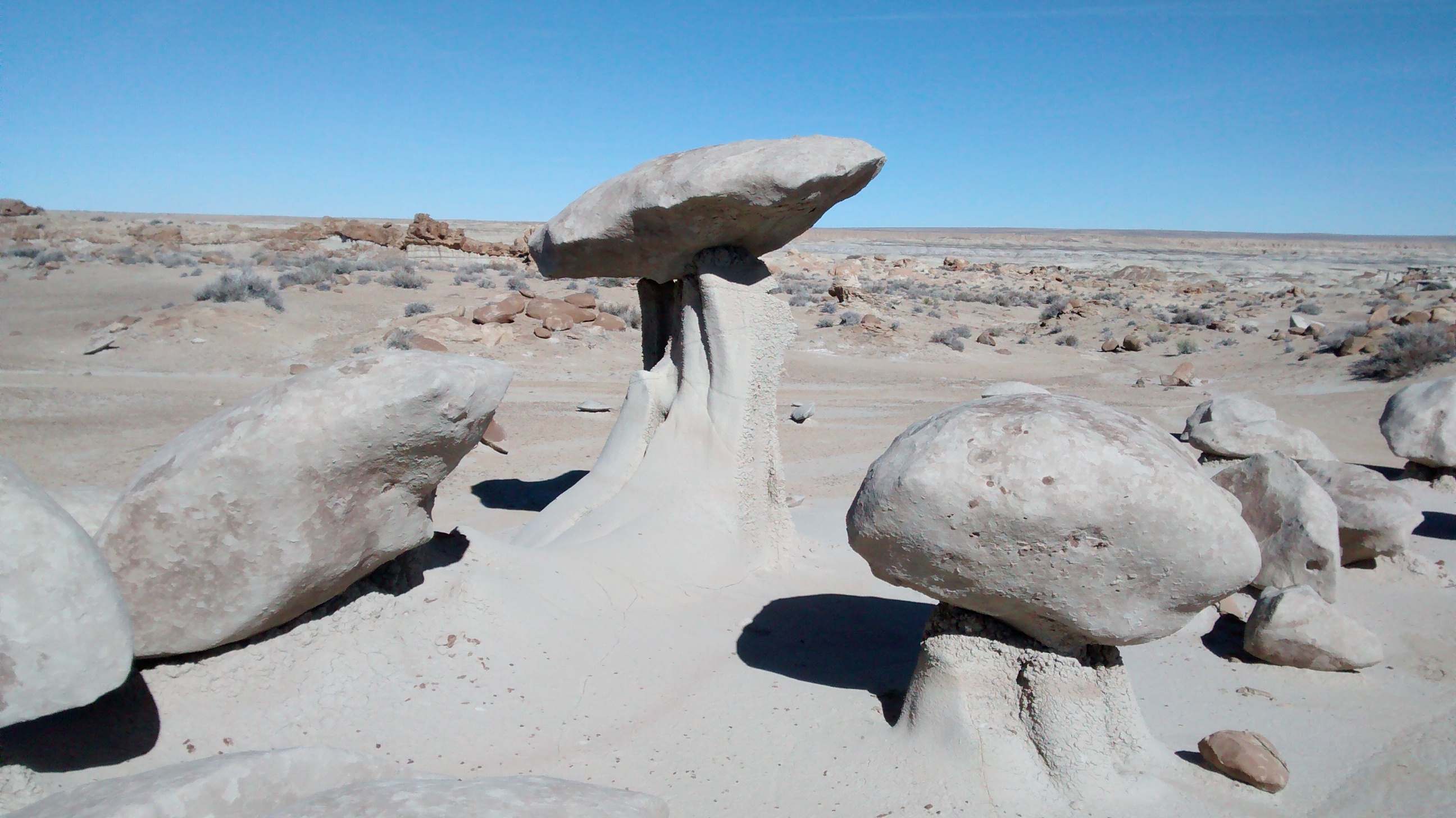
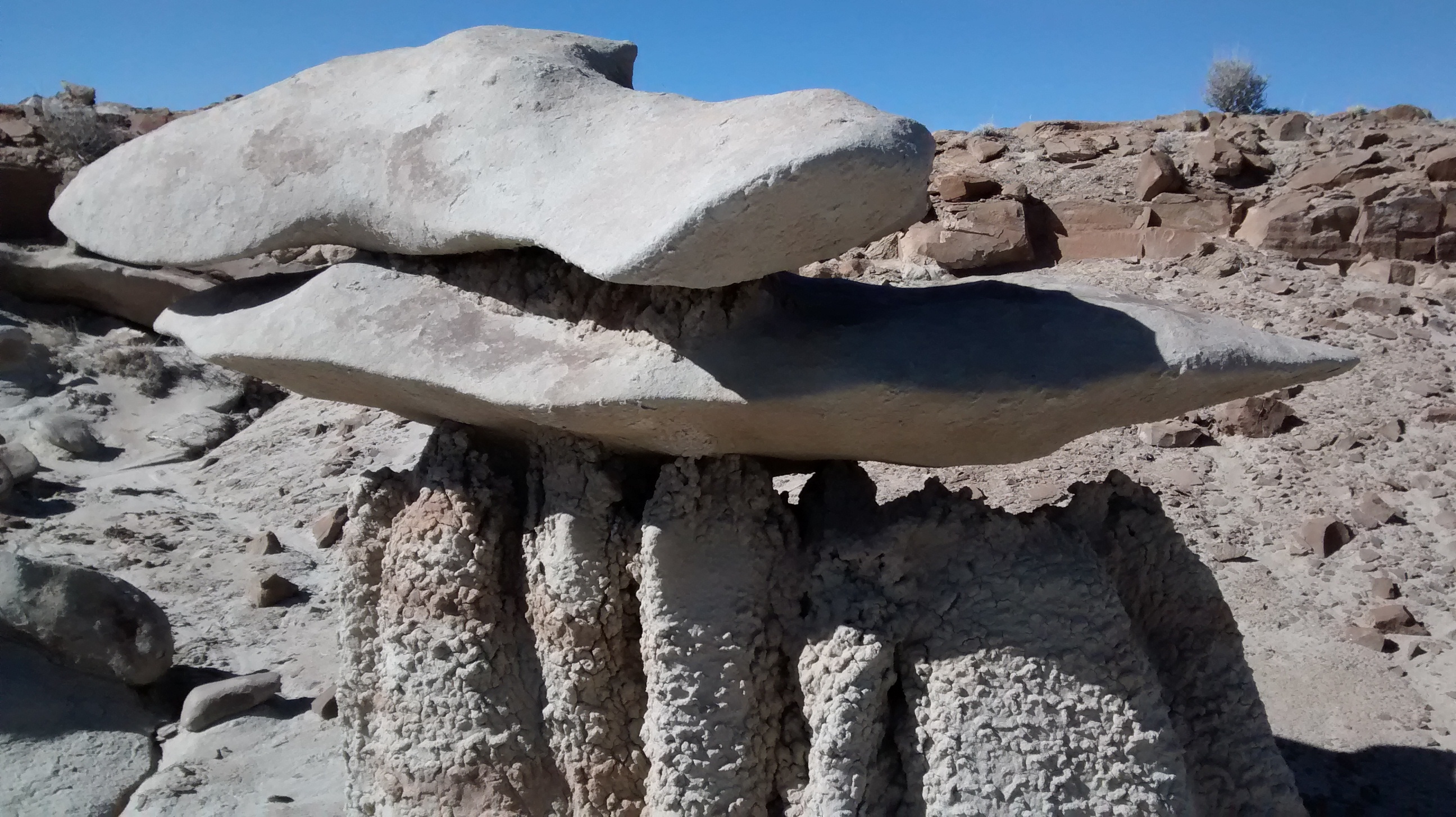
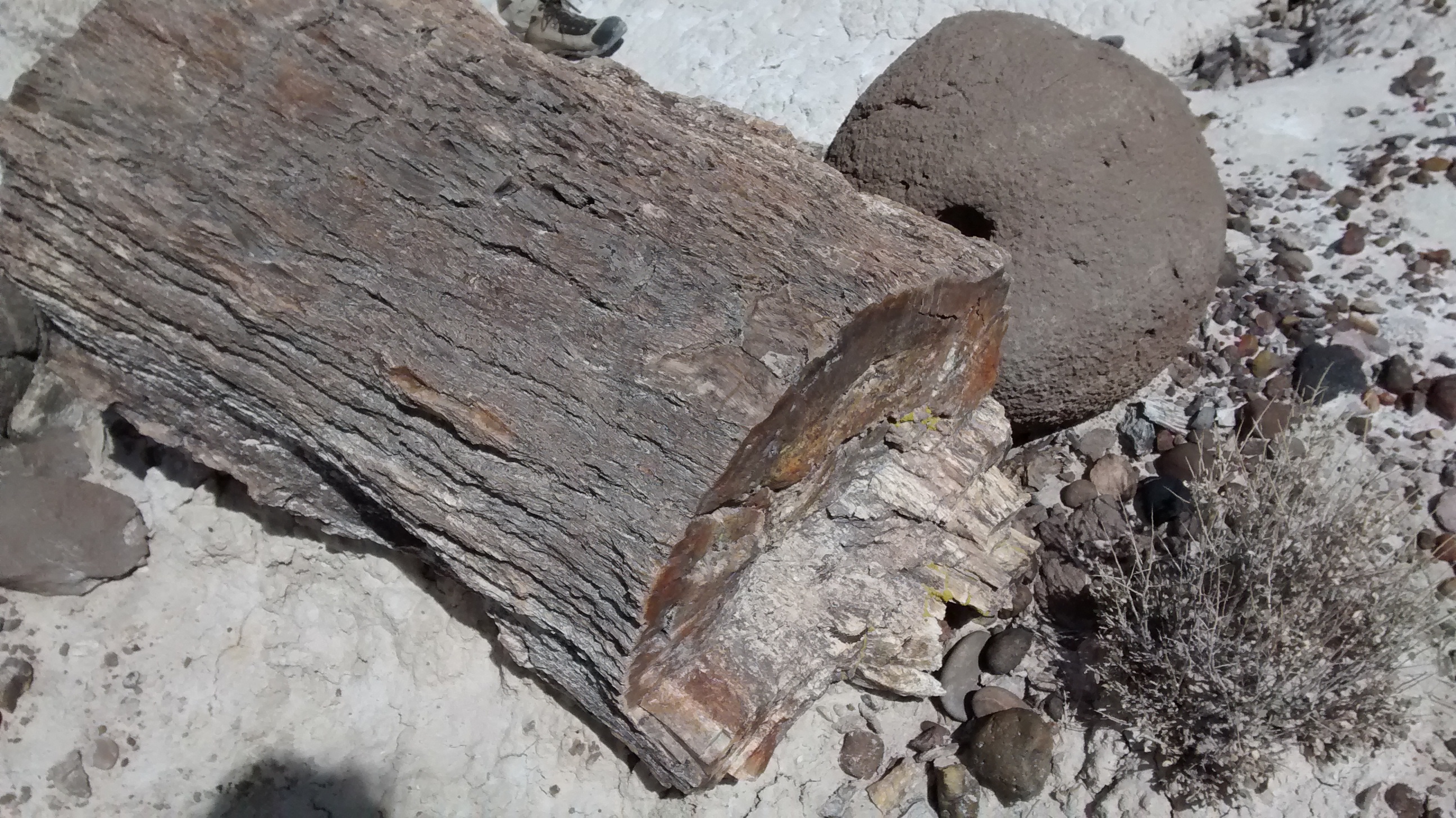
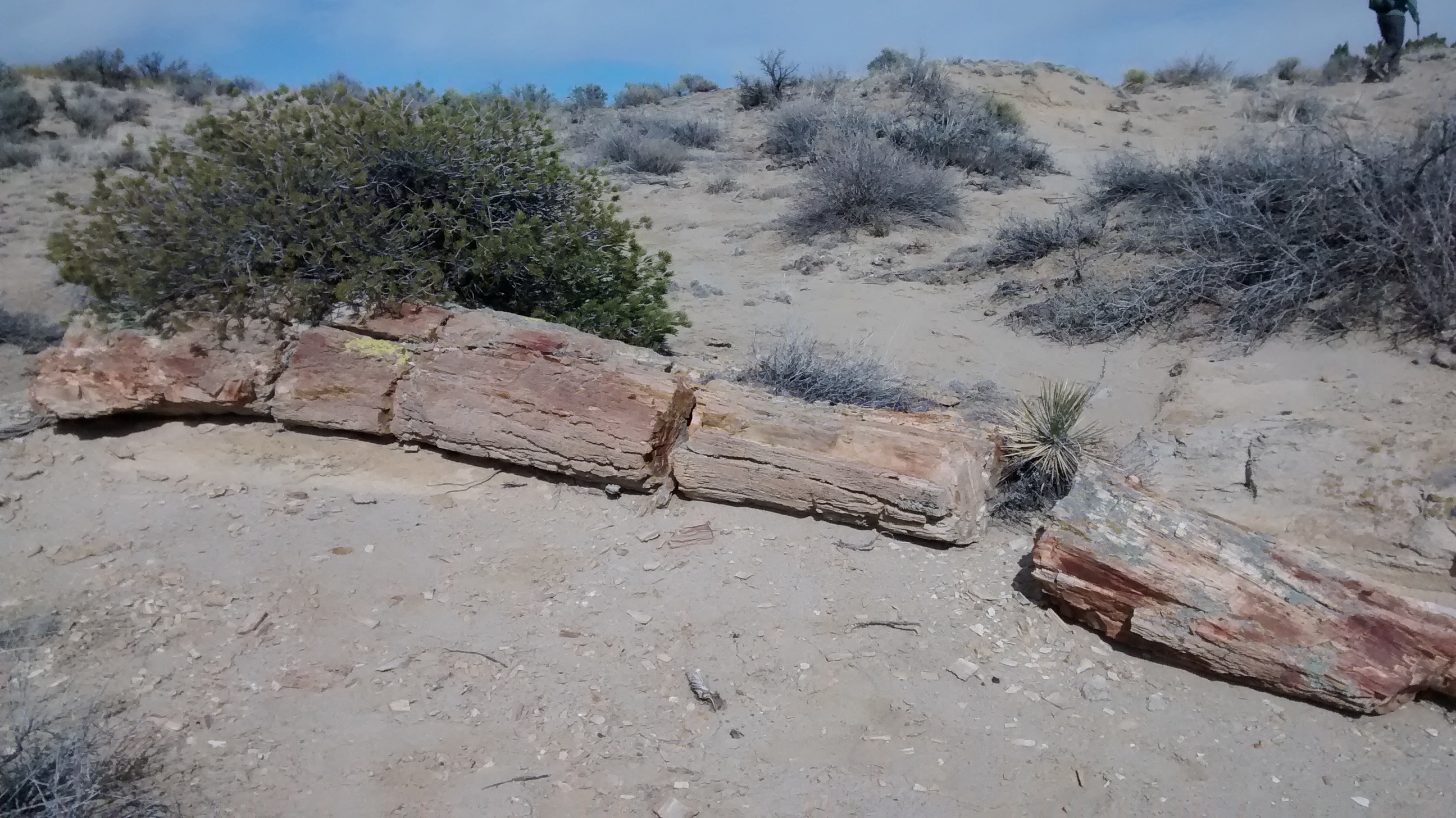
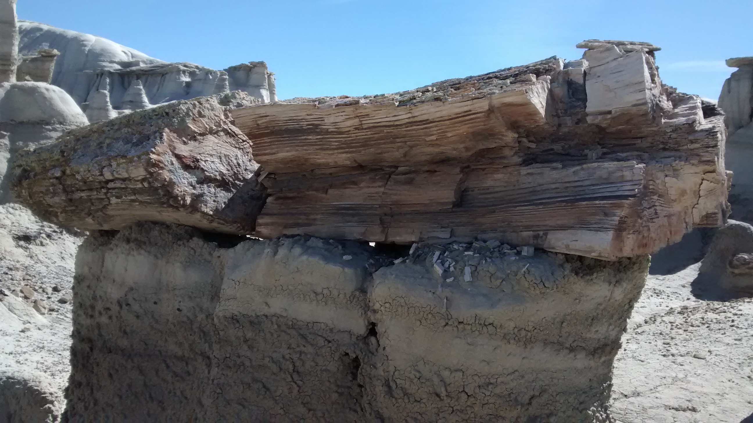
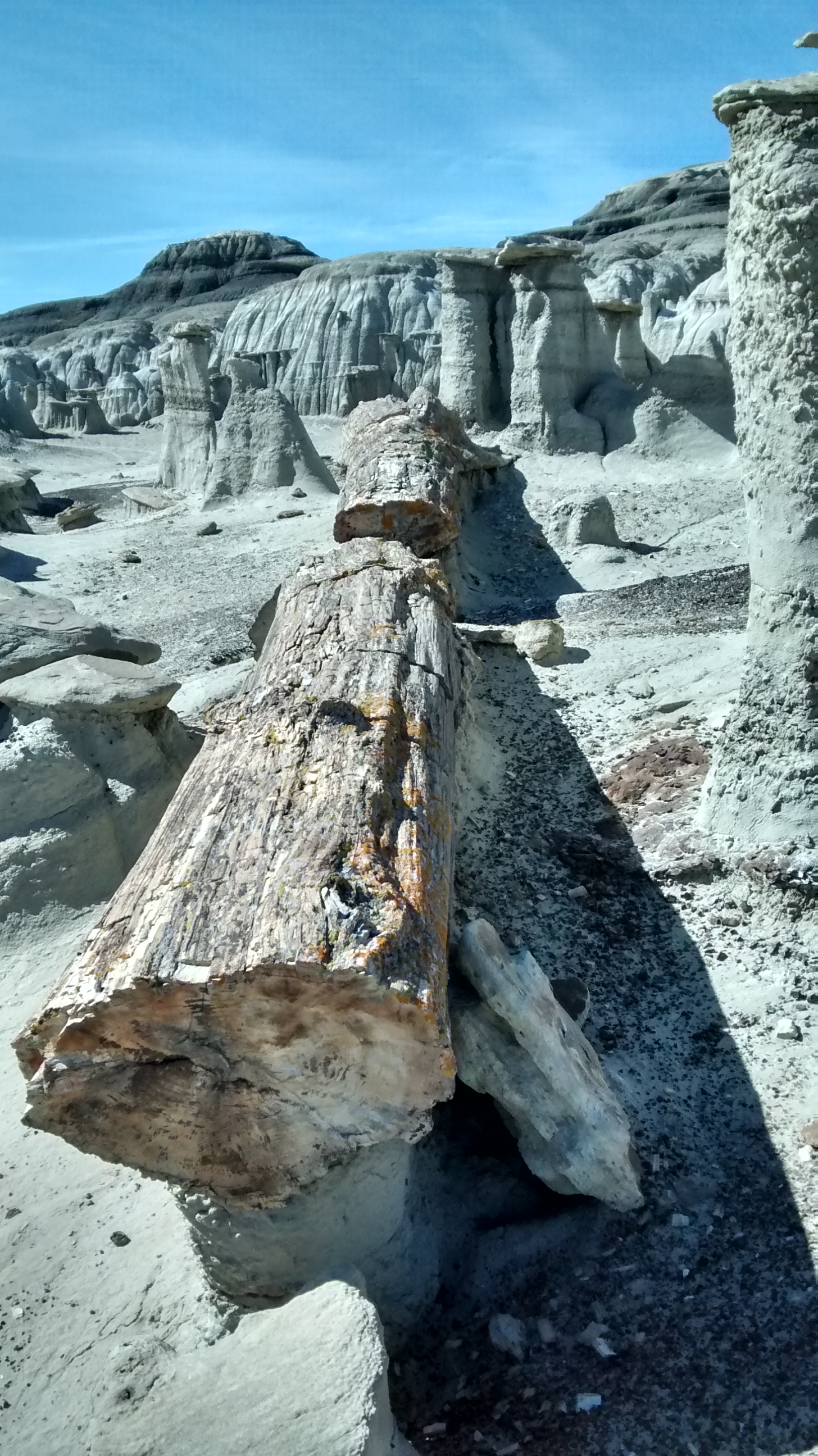
Besides rocks eroded into weird shapes, both areas have amazing examples of petrified wood logs and splinters scattered everywhere. Here are photos of some of the petrified logs. Trying to photograph the piles of petrified wood chips and splinters didn’t give a sense of the detail, but the logs are quite impressive, some of them over 50 feet long.
I’ve often thought that geocaching might be an interesting activity, since I like being outdoors and enjoy studying maps and mapping data. But since it’s a popular activity with a plethora of websites urging you to get involved, I’ve been overwhelmed by information overload whenever I’ve started researching it. The experience that I had on today’s hike would more likely be the type of inspiration that would motivate me to get involved.
At one of the hilltop viewpoints on the trail we paused briefly to catch a breath. I happened to glance down at my feet and next to the trail, nestled in a pile of rocks, I noticed a strange looking object. I hesitated at first to pick it up because it was a small, cylindrical plastic container wrapped in camouflage tape and all my mind could think of was “explosive device!” On other hikes in this area, I had seen teams of rescue workers doing practice maneuvers on these trails and thought it might be something left behind during one of their exercises.
When Sue looked over my shoulder to see what I had spotted, she laughed at my hesitancy, so I felt brave enough to reach over and pick it up. I was surprised to find that a piece of fishing line was attached to it, holding it in place on a nearby branch. That’s when Sue clued me in that what I had found was probably a geocache.
Closer inspection revealed that it was a pill bottle. We opened it and there was a wrapped up piece of paper and miniature pencil to be used by the geocachers to log their find. It was interesting to note that the last time that it had been found was April of 2014. In the geocaching world this probably means it’s not that popular. It wasn’t one that had any other “treasures” to be exchanged but I went ahead and added a penny to it for the next person. I know, that’s not really much of a treasure, but when you’ve just brought your water and lunch for a short day hike you’re not carrying much interesting stuff that you can use to add to a geocache.
I was curious enough about the whole thing that after I got home I looked up the geocaching.com website that was referenced on the log paper. I thought I might add my “find” to the website, but got discouraged when it said I had to log in by creating an account or using my Facebook account. Not wanting to create a new account on the site, I went for the Facebook option. But then after I logged in with my Facebook account it stopped me with a message that said “account email domain is banned.” It wasn’t worth pursuing after that point.
But I did manage to find the place on the site where this particular cache is described and logged. For some unknown reason it has the name ‘Cooper’ and has 21 visits logged. It was interesting to read the comments left by others who found it.
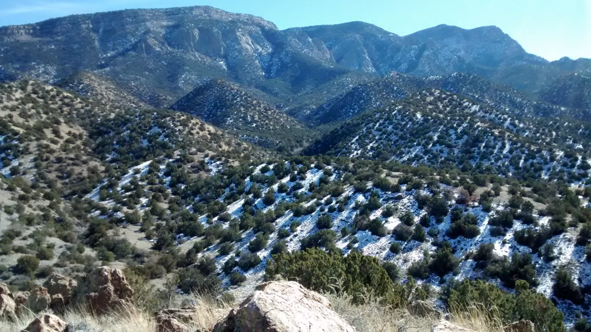
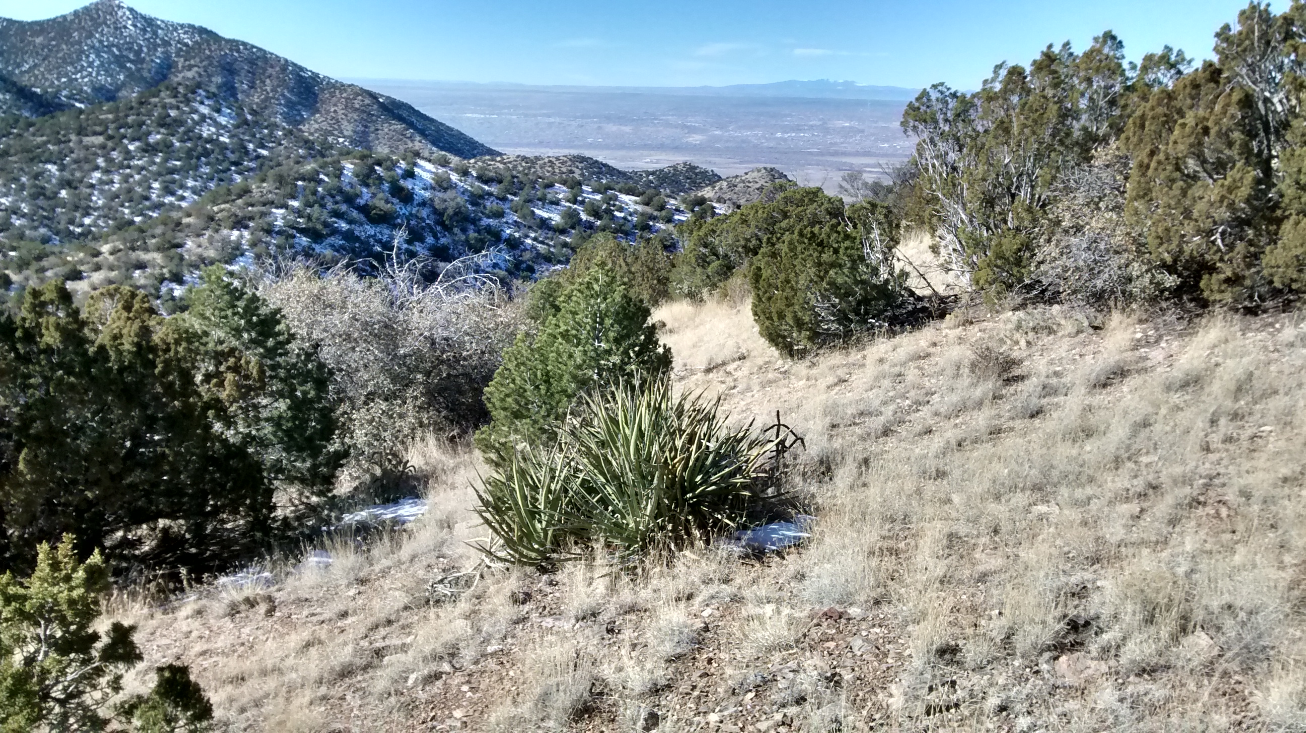
For now, I don’t think geocaching will be a new hobby for me. It would be too distracting on a hike to purposely be looking for a geocache instead of what we were doing today–enjoying the beautiful weather and scenic views in the Sandia foothills near Placitas. View west towards Rio Rancho and Mt Taylor on far horizon.
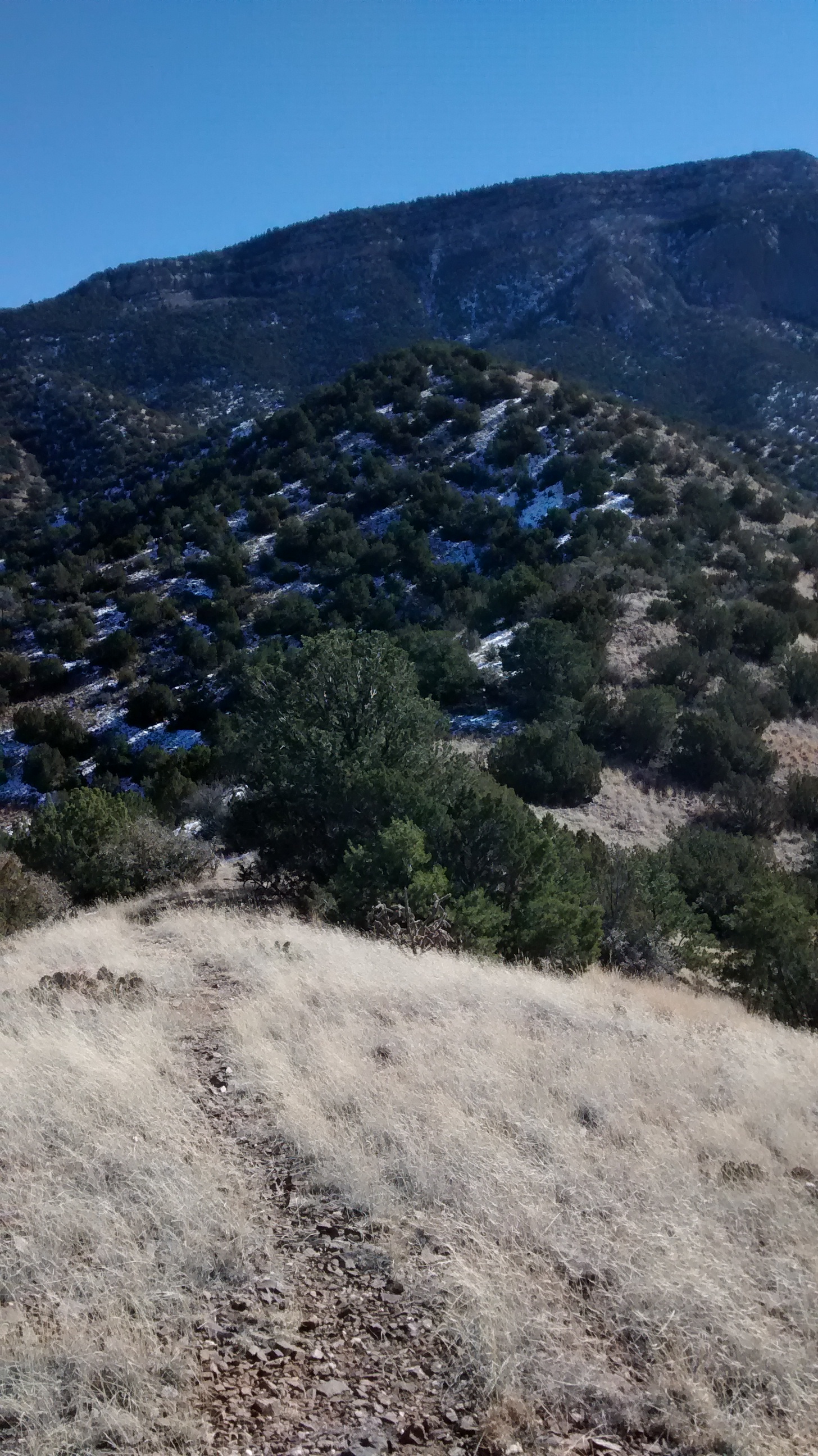
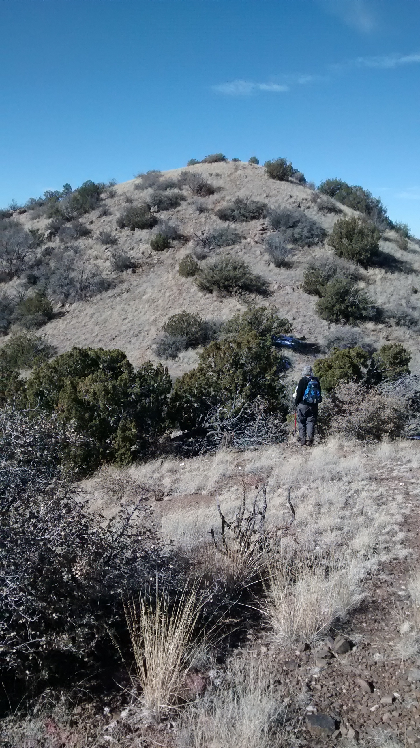
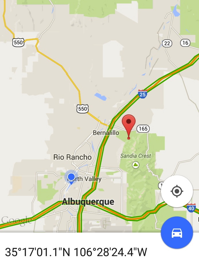
View north towards Santa Fe and Sangre de Cristo Mts on far horizon.Steep hill climb behind us.Steep hill climb in front of us.View of north crest of Sandias.Sue and Ken looking towards Placitas on the way down.The “pill bottle” geocache.The red icon on the map shows the location of the geocache.