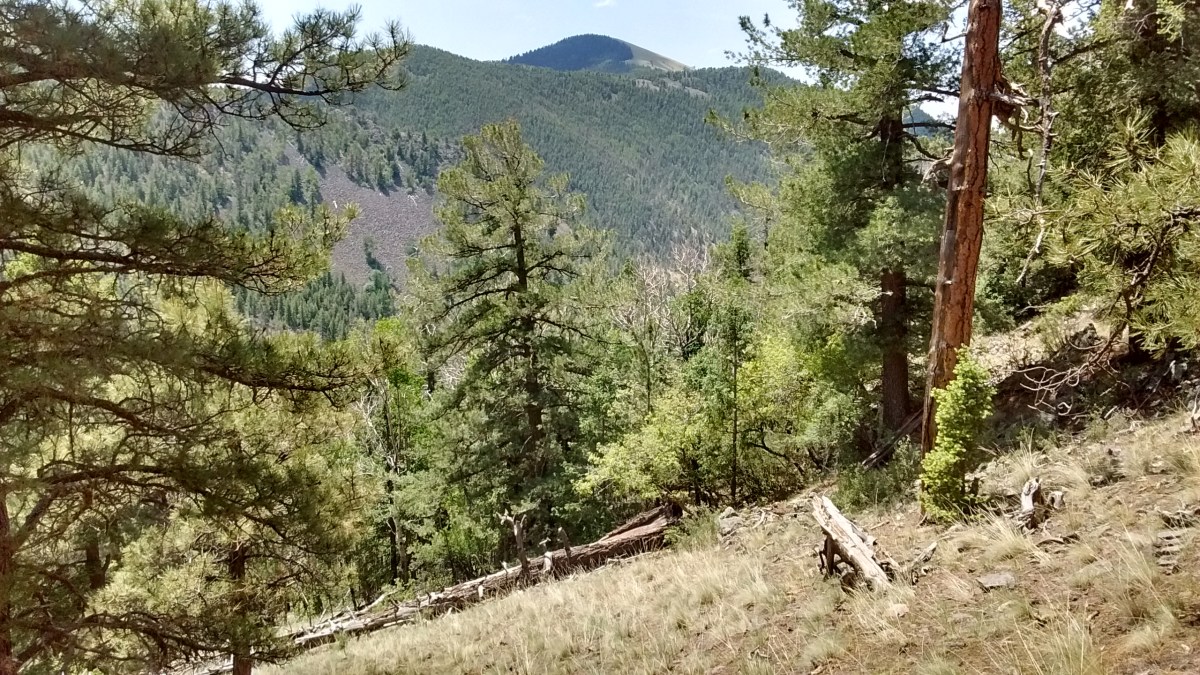
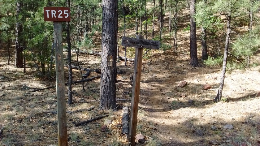
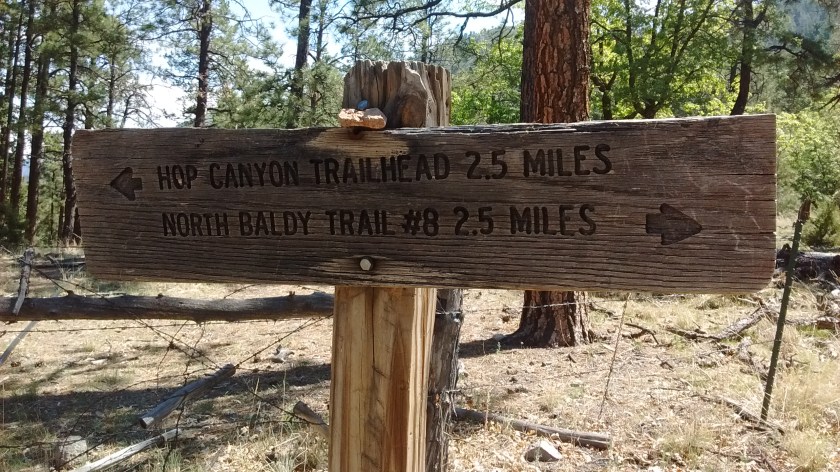
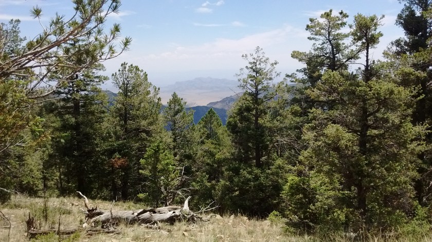
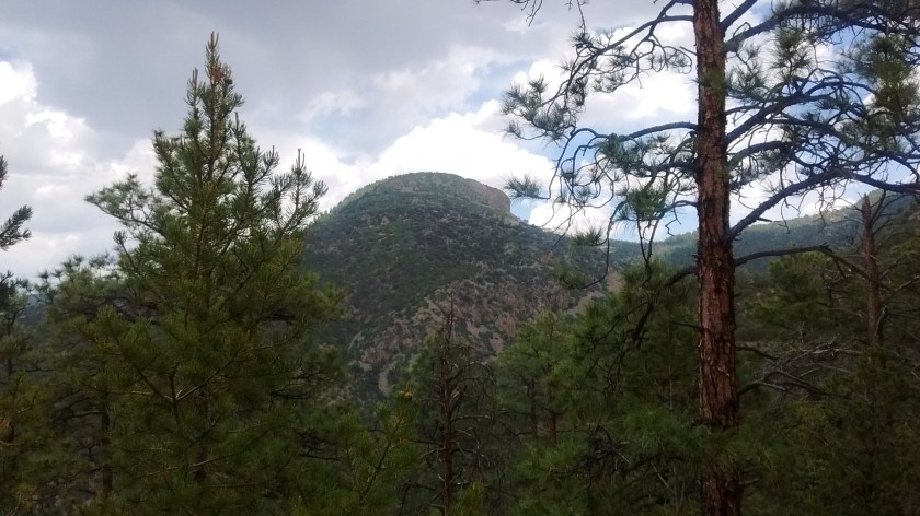
We aren’t sure what to call the trail that we hiked recently in the Magdalena Mountains, but we both agreed that we never would have made it to our desired destination at the top of the ridge if we hadn’t had each other to provide encouragement. There isn’t a lot of documentation for hikes in the Magdalena’s but we had stopped at the ranger station and had a vague idea that it would be all uphill from the Hop Canyon trailhead to the point that our map showed Trail 25, aka Hop Canyon Trail, intersecting Trail 8. What we weren’t expecting was 5 miles of climbing from a start of 7700 feet to a high point of 9800 feet.
To get to the trailhead it’s a one-hour drive south of Albuquerque to Socorro, NM, then 25 miles west on Highway 60 to the town of Magdalena, which is at the base of the northern end of the Magdalena Mountains. Then you drive about 10 miles up into the mountains on Hop Canyon Road to reach the trailhead.
We like the Magdalena Mountains because not many people hike there and they are surprisingly beautiful considering they are surrounded by so much flat, uninhabited desert. We had made a trip there in March and hiked up a canyon on the eastern side, approaching the ridge between South Baldy and North Baldy. But we gave up before we actually reached the ridge. That was part of the challenge for completing Trail 25 because it would take us to the ridge that we hadn’t conquered in March.
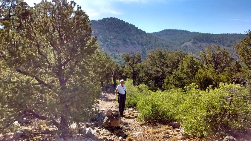
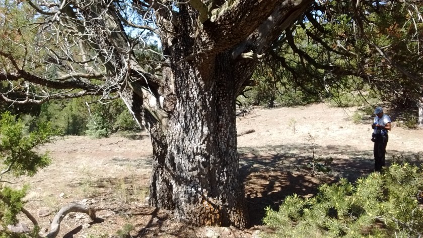
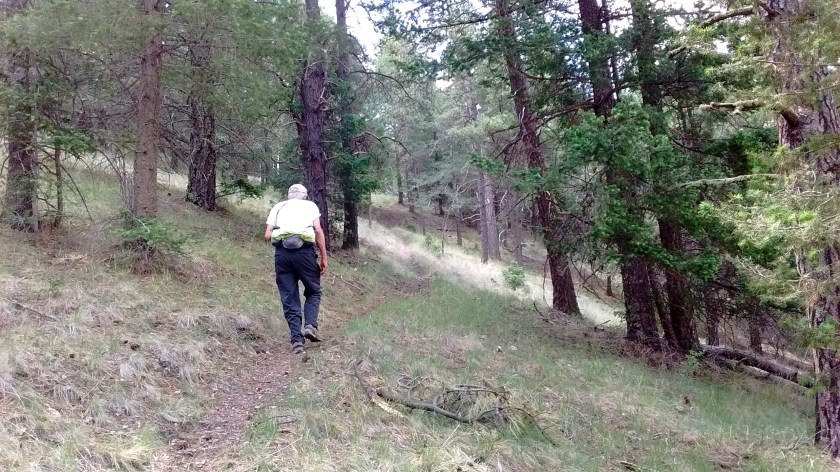
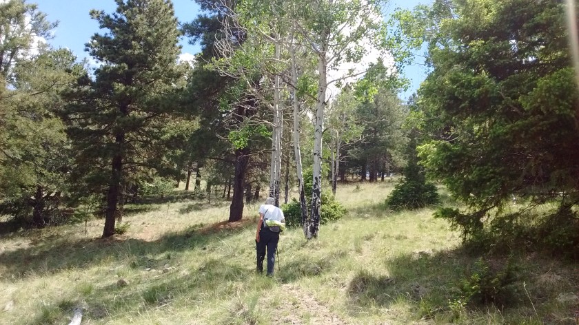
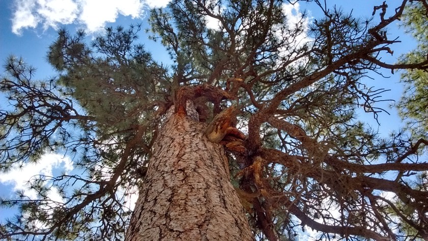
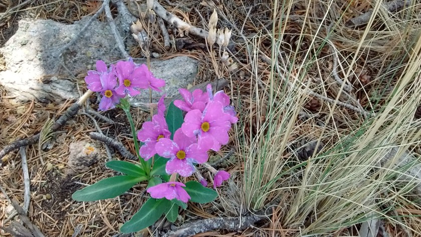
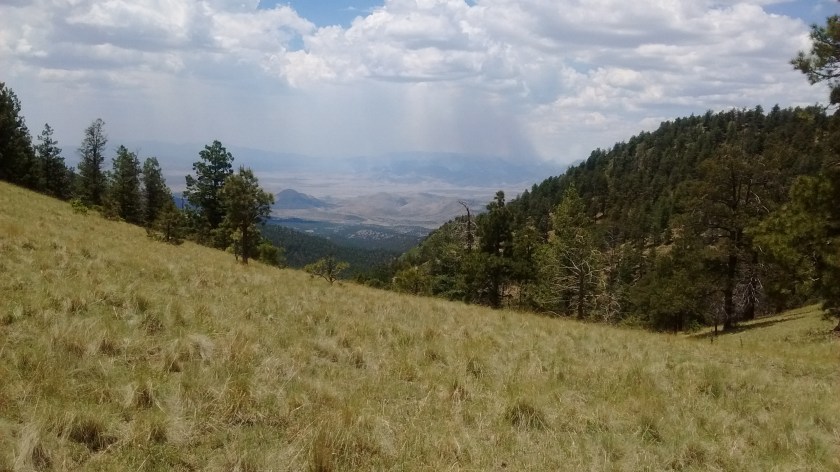
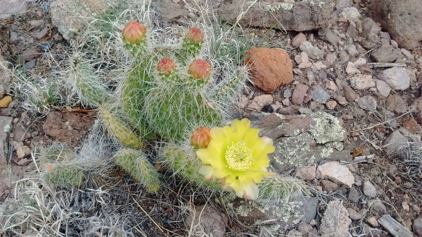
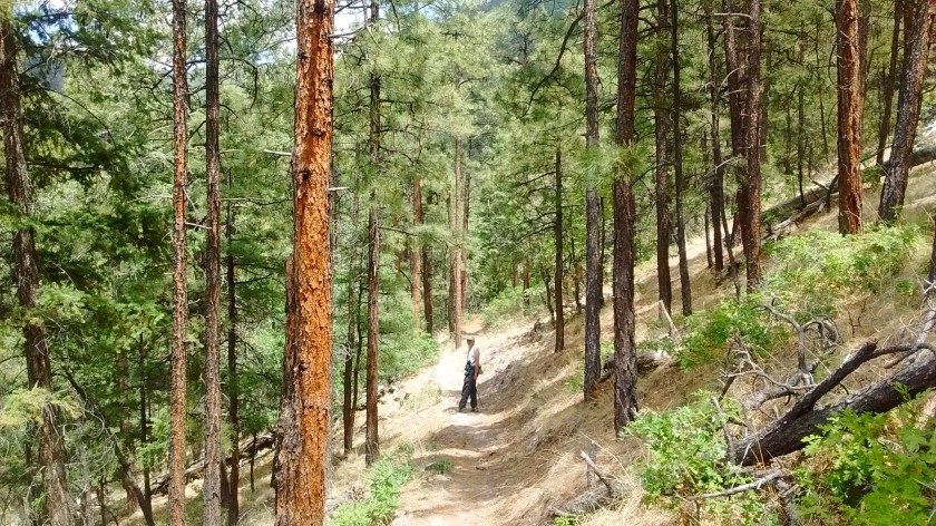
Starting point.We were fooled at this point. We thought our destination was the ridge ahead but turns out there was much more hiking to another ridge behind that one.Looking north. The town of Magdalena is down at the base of the mountains.Resting in the shade of a nice, big alligator juniper tree.The halfway point. A brochure from the ranger station showed the Hop Canyon trail was 2.5 one-way, but somebody was confused because there was still 2.5 miles to go before getting to the ridge.Lee just kept on trudging along.There were a few aspens at the higher elevations.View of South Baldy, highest point in the Magdalena’s at 10,700 feet.Lots of Ponderosa Pine.Looking east from the ridge towards Socorro, which is behind the small mountain.The flowers look like phlox, but not the leaves. They were abundant on the top of the ridge.Forest fires in the San Mateo Mountains to the southwest of the Magdalena’s.Cute little cactus flower.Thunderclouds and a few rumbles on the way down but didn’t develop into any rain.Are you coming?
Canyon de Chelly (pronounced d’SHAY) National Monument was, in my mind, just another one of those tourist places that people flock to because they can see ruins of ancient Pueblo Indian Cliff dwellings. I would always get it confused with Chaco Canyon and couldn’t remember if it was in Arizona, Utah, or New Mexico. But now that I’ve actually been there I’m not going to be forgetful or confused anymore.
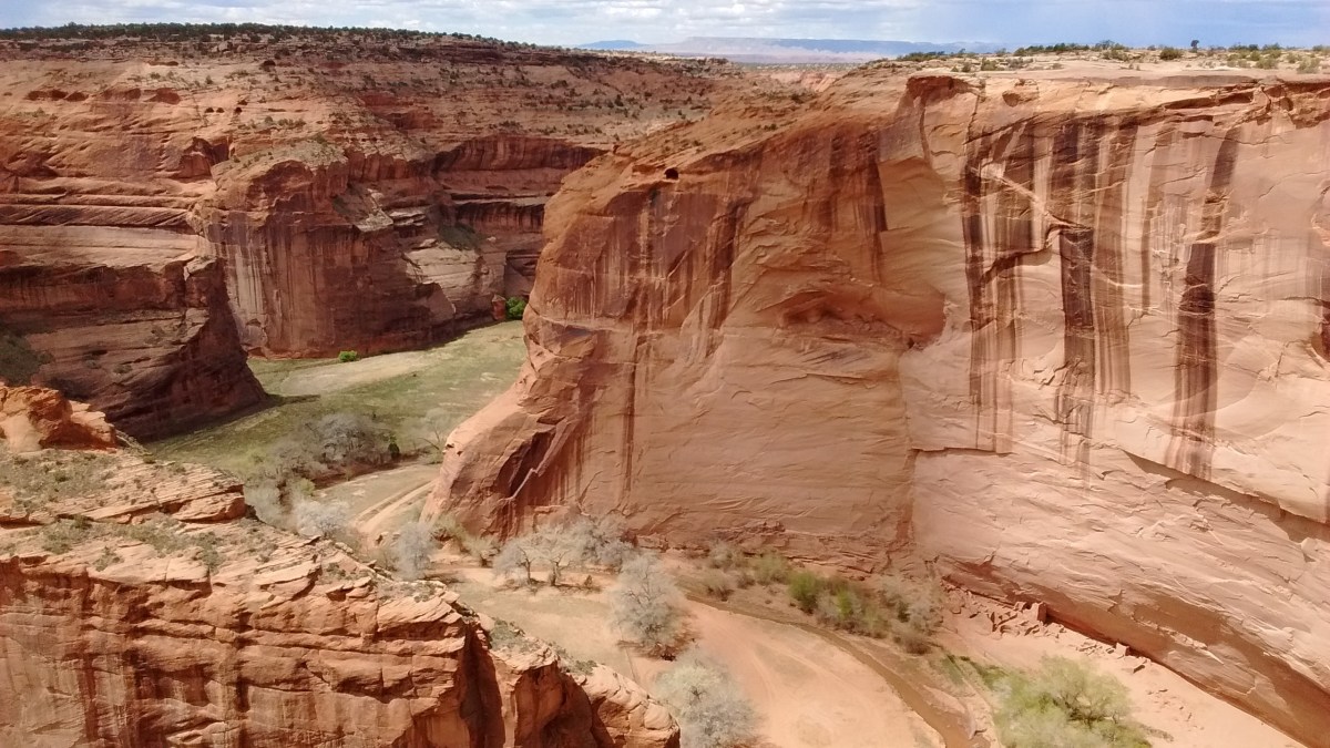
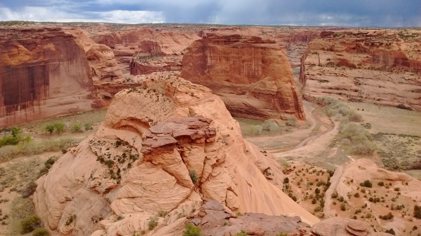
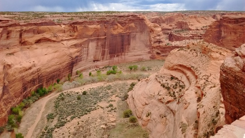
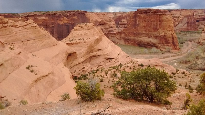
I was totally awestruck by the beauty of this immense gash in the earth’s surface that appears before you as miles of eroded red sandstone cliffs when you stand on the edge, peering down at the small stream bed below. Although Indian ruins are part of the experience here, it’s a small part unless you pay big money to take a guided Jeep tour into the bottom of the canyon. The monument is within lands owned by the Navajo Tribe and the bottom of the canyon is off-limits unless you are a tribal member or are escorted on an authorized tour. For the rest of us, a road that circles the rim provides a number of overlooks where you park and walk to viewpoints with informative signs that describe the historical significance of what you see below in the canyon.
Much of the history is a sad indictment of the white man’s campaign in the 1800’s to drive the native inhabitants out of the farms and villages they had built in the canyon. At this time it was the Navajo people who lived there, not the Anasazi, who were the ones that built the dwellings carved into the cliff walls. Ruins of the cliff dwellings can be seen as tiny specks in the distance when you are standing on the overlooks.
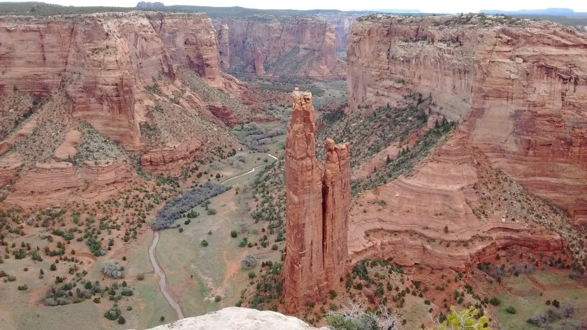
Viewpoint of Spider Rock, the 800-foot sandstone spire rising up from the canyon floor.Bottom right corner of photo, just above tree, you can see ruins known as Antelope House.
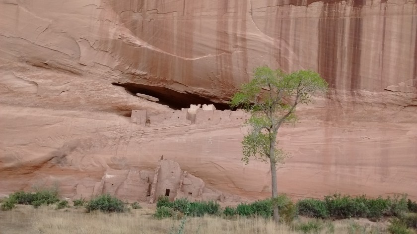
There is one place at Canyon de Chelly where a hiking trail allows you to go into the canyon without a permit or authorized guide. At White House Overlook a sign explains the ruins that you see on one of the cliff walls across the canyon. This dwelling was built and occupied about 1,000 years ago. It is named for a long, white plaster wall in the upper dwelling.
From the White House Overlook a 2.5-mile round-trip trail leads you down to the bottom of the canyon where you can stand in front of the ruins. Even though rain clouds had started to gather and we heard thunder in the distance, we headed down the trail into the canyon.
Looking into canyon before starting down trail that leads to White House Ruins.Middle of photo, a slot in the far canyon wall is where the White House Ruins are located.Partway down White House Trail. Notice the hikers on the trail ahead of us.Descending White House Trail, almost to the bottom.White House Ruins up close, after you get to the bottom of the canyon.
The threatening rain brought us just a few sprinkles before we got back up to our car at the top of the canyon. This visit to Canyon de Chelly was certainly not a major hiking experience but it was a memorable trip and one that I’m thankful we were able to take.