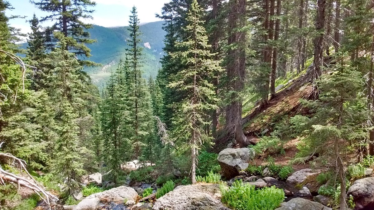
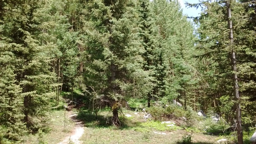
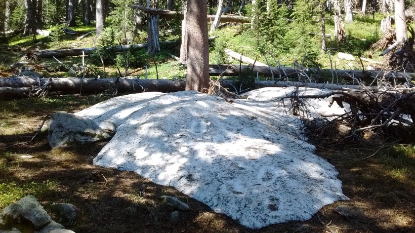
We are having a heat wave here in the Southwest, but one of the benefits of living in northern New Mexico is that you can grab your day pack, drive a couple of hours, and find yourself at the start of a trail leading up into the cool, mountain forests. Today we hiked with some friends on a trail that starts at the Santa Fe ski area (about 10,200 foot elevation) and in just over 3 miles leads to a gorgeous, little alpine lake at 11,400 foot elevation. Unbelievable that after so many hot days in Albuquerque there were still some spots of unmelted snow in the woods around the lake and on the slopes above the lake.
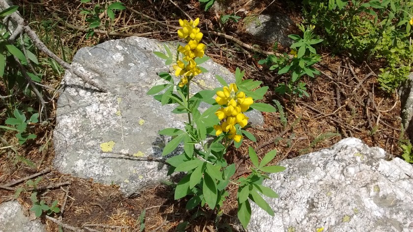
The mountains are calling.Rio Nambe is the stream that drains from the lake and much of the trail follows the stream.View looking back at Santa Fe Baldy.Mountain meadow on the way to the lake.Nambe LakeSnowbank in the woods near the lake.Golden Pea.
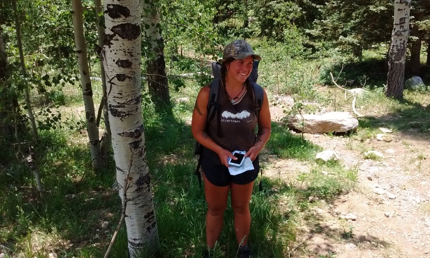
About a mile from the end of our hike we met a young woman who was just completing a month-long wilderness hike of 600 miles in northern New Mexico. She is what is known as an “ultra-lite long distance hiker”. The pack she was carrying didn’t look much bigger than a day pack, yet she said it contained all of the food and gear she needed, including tent and sleeping bag. The number of miles she has hiked by herself in the wild on numerous routes is incredible. Check out her blog to learn more.
I lived at the foot of New Mexico’s Sacramento Mountains for many years, but didn’t realize until this week the outstanding hiking opportunities in that part of the state. We’ve lived in Albuquerque almost 4 years and certainly haven’t exhausted all of the local hikes in this area. But sometimes it’s fun to get away for a couple of days and see some new territory.
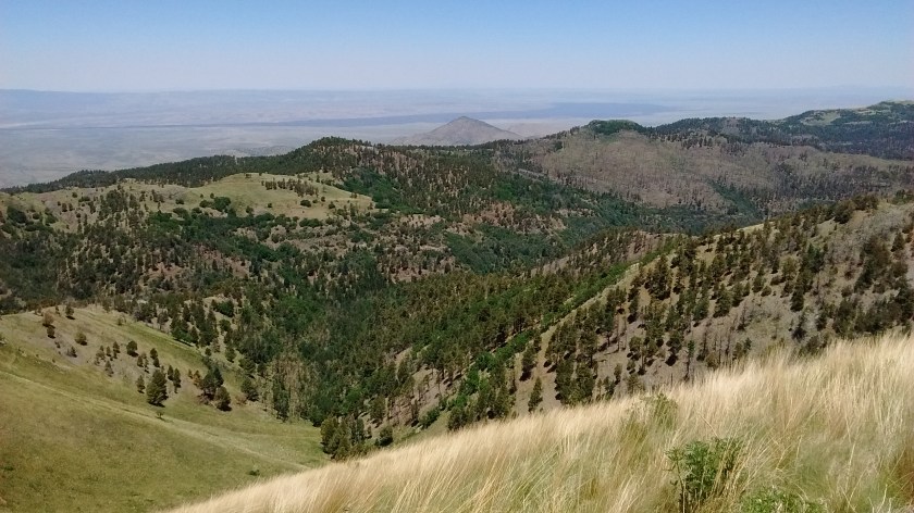
It takes about 2-1/2 hours to drive from Albuquerque to Carrizozo, NM, which is a good launching point for accessing the hiking trails in the northeastern part of the Sacramento Mountains. 50,000 acres of the northern Sacramento Mountains has been designated as the White Mountain Wilderness, so named because of the highest peak, 11,973-foot Sierra Blanca (means “white mountain” in Spanish). Sierra Blanca isn’t part of the wilderness; it’s part of the Mescalero Apache Reservation and off limits for hiking. But that doesn’t mean there is any lack of hiking trails; 110 miles of hiking trails, according to one source I read.
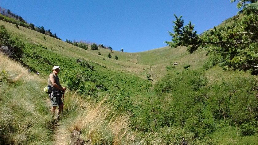
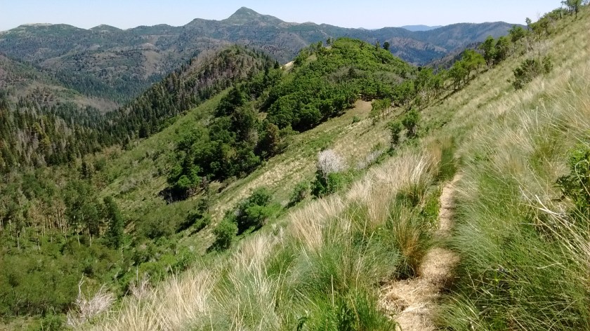
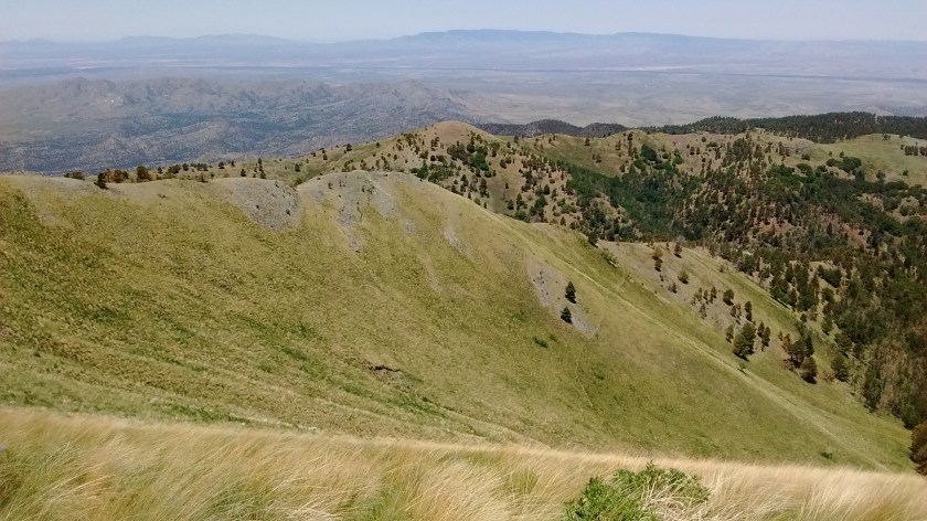
With 2 days to hike we didn’t make a dent in the 110 miles, which leaves us open for future explorations. The first hike we did was from the western side of the ridge, which isn’t as easy to access and generally has steeper, more rugged terrain. It was an exhausting hike, almost 6 miles straight up, starting at an elevation of 6300 feet and ending at 9300 feet. We started too late in the day and had to head back down before we reached the top. But we could see the ridge line within striking distance and that motivated us for the next day’s hike.
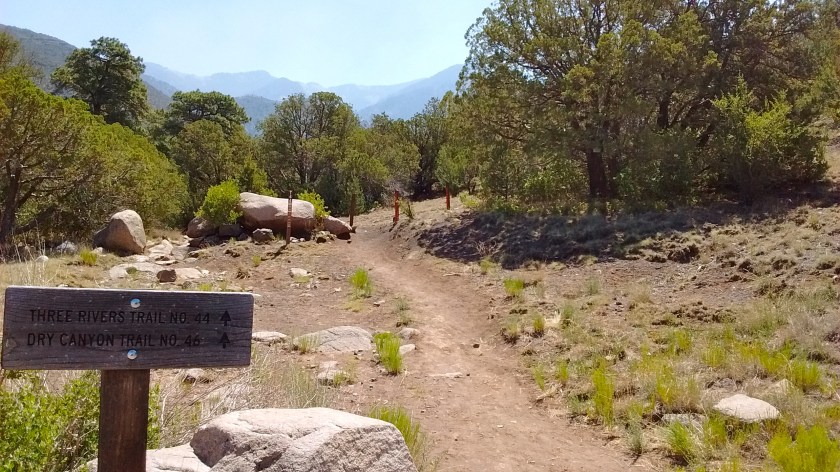
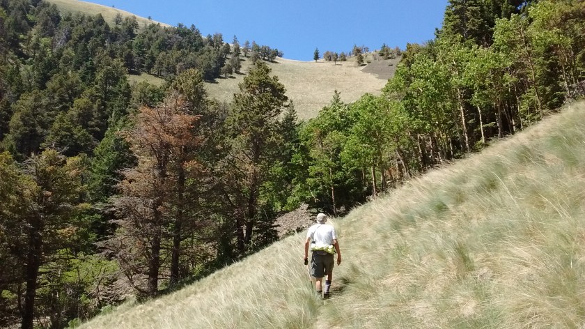
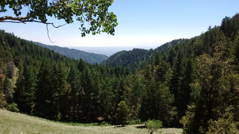
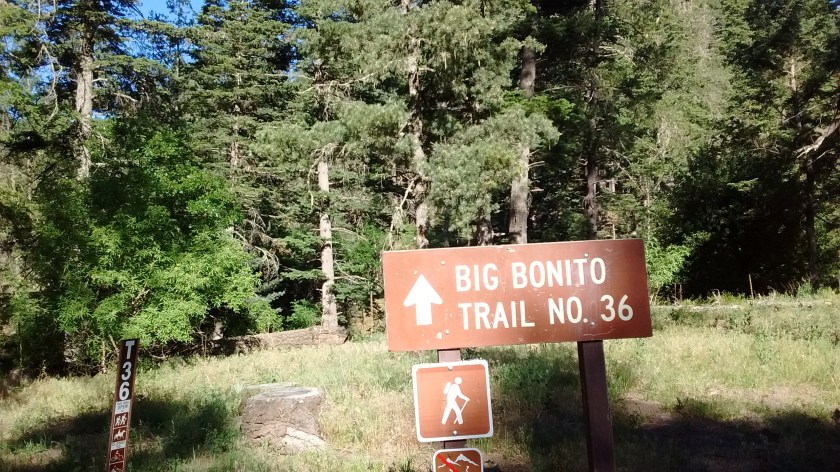
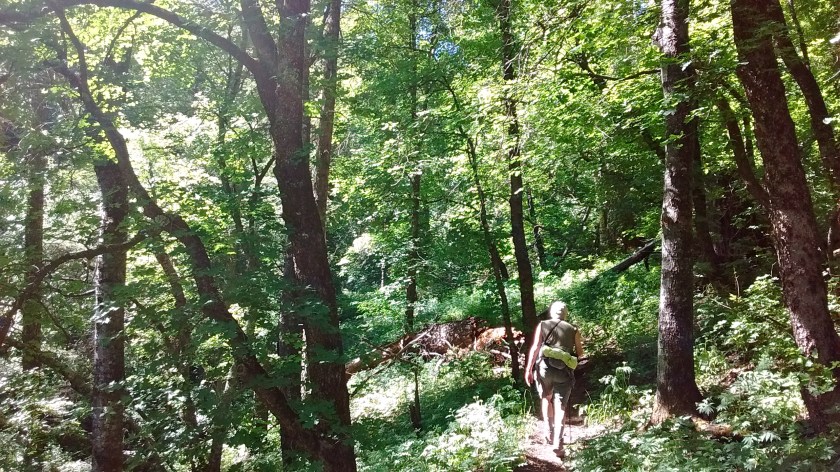
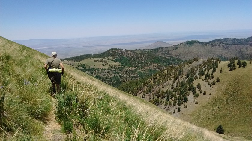
On the second day we drove around to the eastern side of the mountain. A rutted dirt road leading to the trailhead wasn’t very pleasant to drive on, but it did lead us upwards into the mountains so that the starting elevation of the hike was 7800 feet, instead of 6300. For that hike we did a loop that was a total of 10.5 miles, with a high point of 9900 feet. A lot of the trail was back and forth across a small stream. It was much more shaded, too, and not nearly as tough of a climb as the previous day.
If you look at the map, you will see the first day’s hike as a one-way red line, since I didn’t record the track on the way down. The blue line is the second day’s loop hike. Notice how close we were to reaching the junction at the ridge line. It doesn’t look far on the map, but we knew there would still be a lot of switchbacks, almost a mile left to hike before that red line would meet the blue one. Maybe next time.
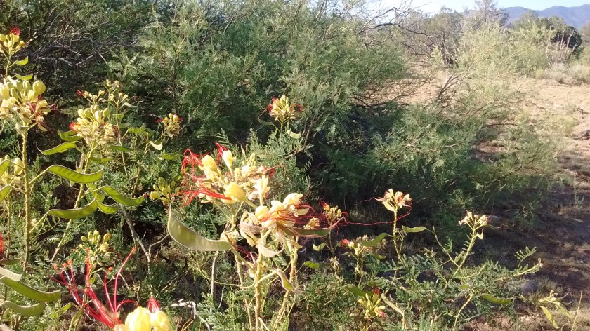
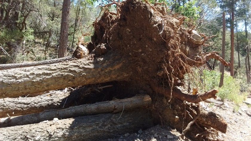
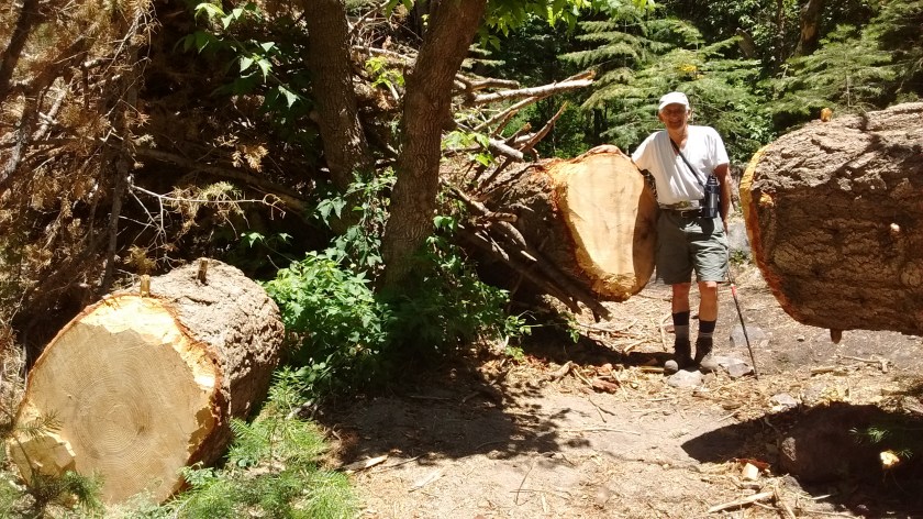
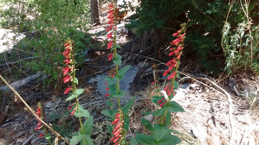
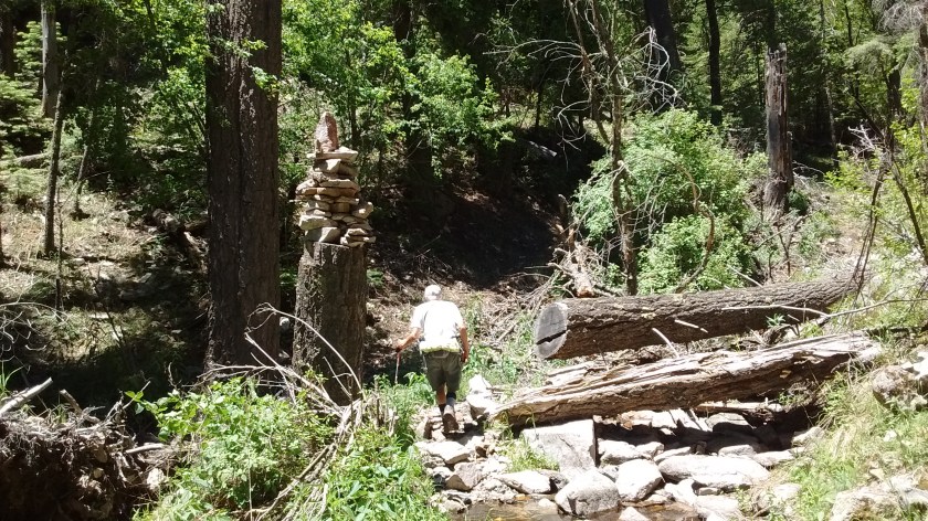
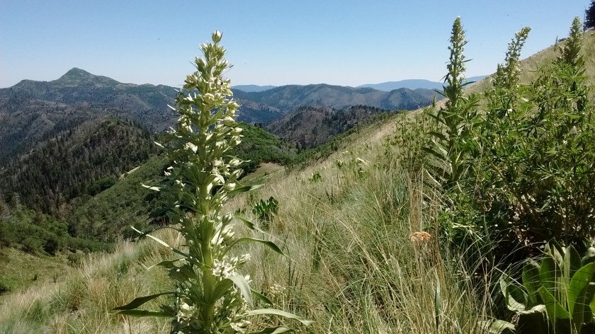
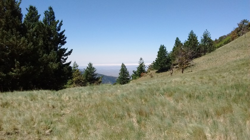
Mesquite bushes in blossom along the road on the drive into 3 Rivers.First day’s hike was on the 3 Rivers Trail–almost 6 miles straight up.One of the many blowdowns on this trail. When we were here in the spring the trail hadn’t been cleared and hiking was almost impossible.Someone did a lot of trail clearing. Since it’s a wilderness area all work has to be done with hand tools; crosscut saw, in this case.Scarlet penstemon were prolific.Don’t think I’ve ever seen a cairn quite like this.It doesn’t look far to that ridge, but would have been another hour of hiking to get there.View looking back the way that we came up from 3 Rivers.2nd day’s hike started on the Big Bonito Trail, much more inviting than the start of the 3 Rivers Trail.Nothing like walking through cool, shady woods on a hot June day in New Mexico.From this point there was still about an hour of hiking to get to the top.Looking north at Nogal Peak.I remember the Green Gentian plant from our trip to Colorado last summer. I never expected to see them in southern New Mexico.From the ridge, looking southeast you can see the White Sands National Monument in the distance.Carrizozo is out there in the desert somewhere. The black ribbon on the desert floor is the lava beds at Valley of Fires.View to the west.On top of the world.