Sandstone Bluffs

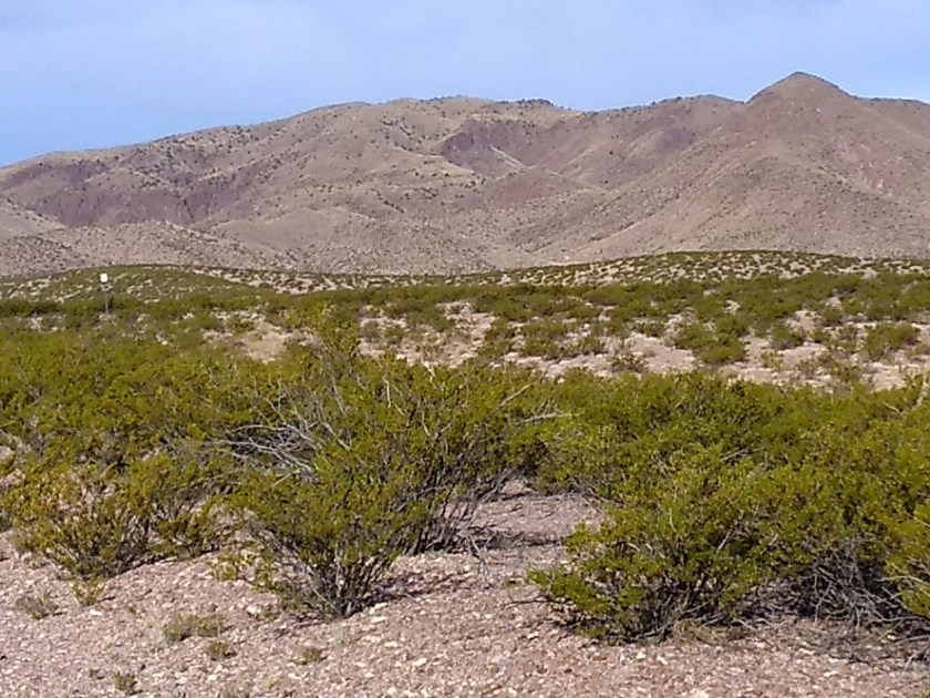
Sandstone Bluffs is like an out-and-back hike because the trail follows a line of narrow bluffs for several miles before turning around and heading back. But the fun part is that you have a choice of walking on top of the bluffs or walking through the desert at the base of the bluffs. Since the wind was rather chilly when we started we chose to start hiking at the bottom where we would be more protected from the wind.

The trail at the base is unofficial and the challenge of starting the hike that way is figuring out exactly where to climb down from the bluffs. We wandered back and forth along the edge and finally took a guess at what looked like the best way to get down. After we got home I researched a track of this hike from 2 years ago where we had done it the opposite way. I was surprised to see that we had picked the correct spot because it didn’t seem like it when we were slowly threading our way down the steep, rocky slope.

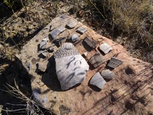
Another interesting aspect of hiking at Sandstone Bluffs is the opportunity at many spots to find pottery shards left from the time when native peoples lived in the area. It’s against the law to take any of them, but we like to gather them together in one spot to make a nice arrangement for someone else who might be walking this way. A couple of examples:


There are some petroglyphs at the far end of the hike that we have seen on previous hikes here. But we weren’t sure exactly where they were and found out later we hadn’t walked quite far enough.

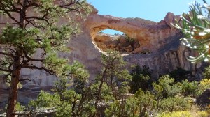
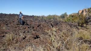
The next couple of photos are from a previous hike here. We did see the rock bridge on this hike but my picture of it wasn’t very good. And we didn’t get as close to the lava rocks as before and that is another thing that we like about hiking Sandstone Bluffs.

Lost in Chupadera Wilderness

Actually, when I saw this sign I knew I was no longer lost, but had found my way back to the trail. And, considering the type of terrain I was hiking in, it’s probably not accurate to describe my experience of getting off the trail as being “lost.”

I had set off to hike the 9-1/2 mile Chupadera Wilderness National Recreation Trail, which I have hiked before.  The first couple of miles traverses Chihuahuan desert scrub dominated by creosote bush and prickly pear cactii growing in loose, gravelly soil.  Recent rains had caused the surface here to erode with multiple, small ruts weaving over and around the trail.  Since this is a wilderness trail there are no trail markers.  As I walked the first mile I was having difficulty figuring out if I was on a trail or on an eroded section of gravel.

When I finally spotted some rock cairns I thought all was well.  Further along, the trail crossed under a power line and started heading down an old gravel road.  What I failed to notice was that the trail and road overlapped for only a short distance.  I kept walking on the road, eventually figuring out that there were no more rock cairns and that the road was curving back towards the parking area instead of heading west towards Chupadera Peak.

img_20181029_085334464
A friendly rock cairn.
wrong marker
I thought I was OK when I saw the sign in the distance but it was only a boundary sign when I approached it and I knew I was no longer on the trail.

Once I realized I had lost the trail I had two choices–either backtrack to the last cairn I had seen or continue forward and see if I could reconnect to the trail. As I said, it’s hard to be truly lost in this terrain because the mountain is directly visible ahead to the west and if you get on a ridge the Rio Grande is visible behind to the east. Plus Interstate 25 bisects the trail about 2-1/2 miles from the parking lot.

When the trail gets to the Interstate there is a hiker tunnel that goes under the road. I pulled up Google Maps on my phone and by looking at the satellite imagery I was fairly certain I could see where the tunnel was. I decided to take the continuing forward option, leaving the gravel road and bushwhacking across the desert towards what I guessed would be the tunnel.

When I reached the fence line that separates the refuge from the highway, I wasn’t at the tunnel so I had to make a guess if I should follow the fence line north or south. Fortunately, I had correctly picked the tunnel on the satellite imagery. It showed the location was south of where I was and I didn’t have to walk much further before I found the tunnel. At that point I knew I was back on the trail–Whew!