Ball Ranch

I had heard about Ball Ranch, a section of BLM land less than an hour’s drive from town, that has areas to hike through, but I didn’t know much about it. Then last month I learned more about it from the latest edition of “60 Hikes Within 60 Miles of Albuquerque”.  At a talk given by co-author, David Ryan, he said that it is one of his favorite places to hike because of a large area there that is covered with petrified wood. That captured my interest.

Getting there involves another one of those dreaded stretches of rough New Mexico dirt roads. In addition, since it is surrounded by Pueblo tribal lands, there is a locked gate at the entrance to the road that crosses tribal land to get to the BLM land. You have to go the BLM office in town and sign out a key for the time you plan to hike. Thanks to the information in the book, that was easily accomplished.

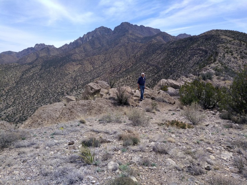
I also carried the book along on the hike, knowing that there wouldn’t be any established trails to follow. Many times on BLM hikes we get off track, even with specific directions and maps, but that didn’t happen this time.

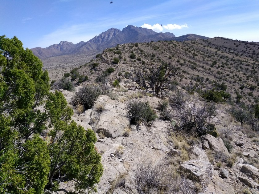
The first part of the hike had us walking in an arroyo that was trampled down with hundreds of fresh hoof prints and obvious signs of the presence of a large horse herd. I thought at any moment we might round a bend and see some wild horses. No such luck.

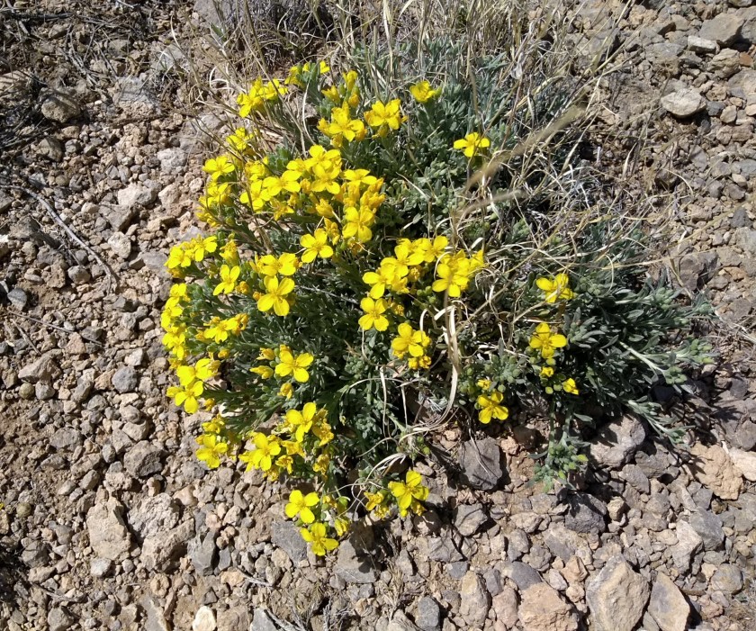
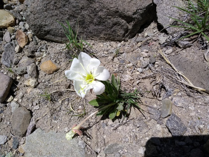
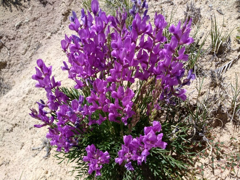
But Lee did see some wildflowers to photograph and I enjoyed gazing at the many-layered, hardened mud walls of the arroyo.

Some spring wildflowers

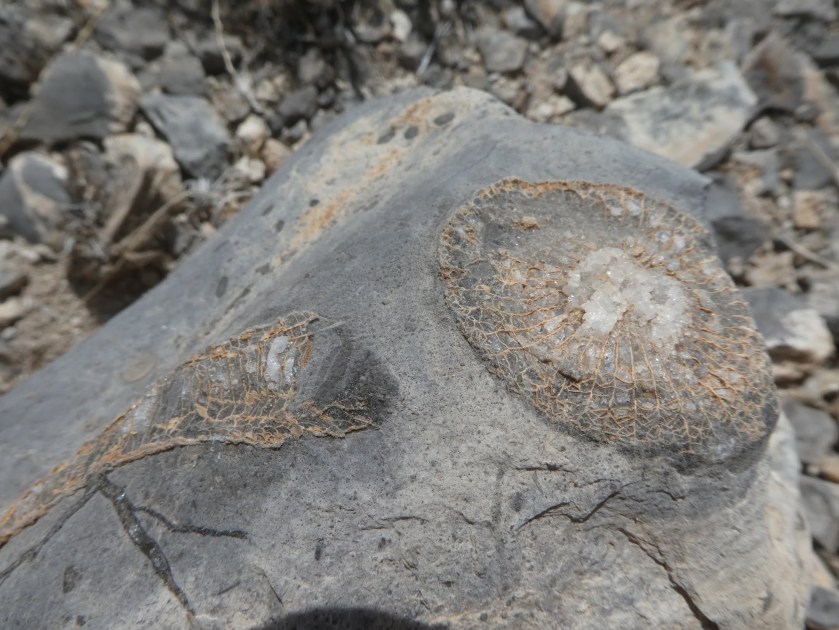
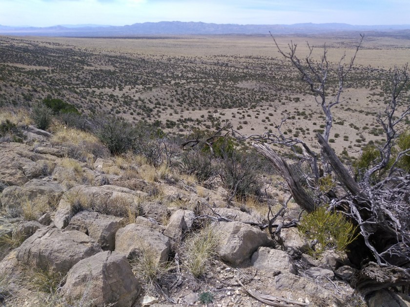
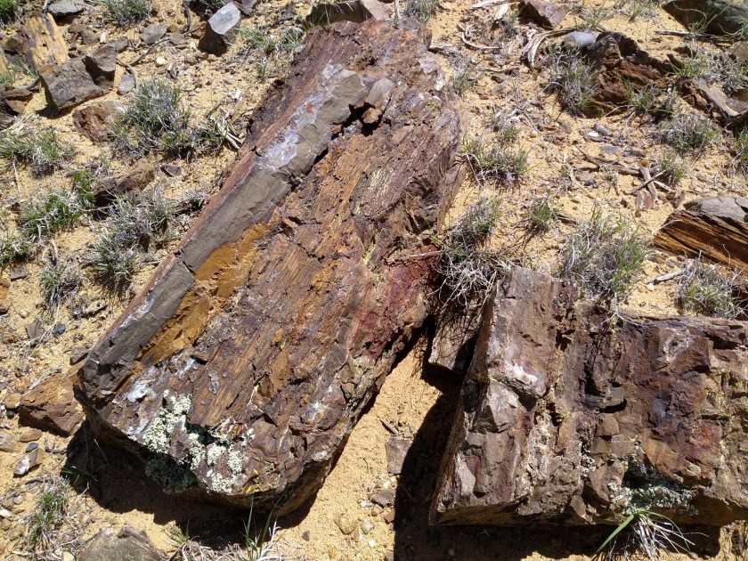
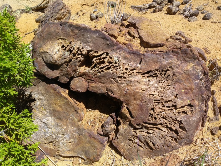
When it came time to climb out of the arroyo for the side trip to view the petrified wood, we weren’t sure at first that we were in the right place. But then we started to see chunks of petrified wood scattered on the sandy hillsides around us. The more we looked the more excited I got. It is simply amazing to see so much petrified wood in one place.

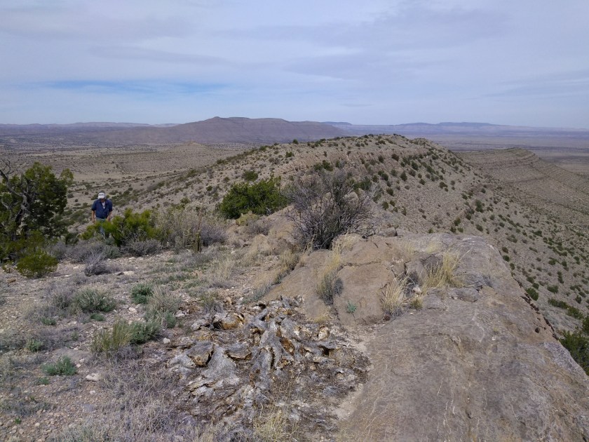
A fun hike for viewing geology and flora, even without seeing any horses. Back at the BLM office the person at the desk said that there are more wild horses than the grazing can support. The BLM tries to round them up but they head off into the surrounding tribal lands where the BLM doesn’t have the authority to enter. Maybe next time we will see some horses.

Sierra Ladrones Hike

Sierra Ladrones is Spanish for “thieves mountains” and is the name of the isolated, jagged peaks visible on the horizon south of Albuquerque. It is said that Navajo and Apache raiders had hideaways there and that thieves and outlaws could elude their pursuers in the rugged terrain.

Today most of the Sierra Ladrones is part of a BLM Wilderness Study Area. There are no established trails up to the peaks but they are so prominent as they rise up from the surrounding desert that you can easily see where you need to go. The challenge is trying to find a way to get close enough to the base of the mountains where you can start hiking.

The southeast side of the mountain is part of Sevilleta National Wildlife Refuge and the public is allowed access on those roads only as part of a guided tour. Several years ago I had the opportunity to go on a group hike partway up the southeast side. The terrain was unbelievably rugged.  It’s one of the hardest hikes I’ve ever done and we only got to a saddle where we could look down the north slope and also see the highest peak looming over us to the west.

Today we followed directions in the 60 Hikes Within 60 Miles of Albuquerque book for a hike that starts from the northwest side of the Ladrones.  After leaving the interstate it took 45 minutes to drive over the very rough 18-mile dirt road that traverses the scrub desert and barren range lands to reach a long ridge that slopes off the mountain making possible a relatively gradual ascent up towards the peak.

It was an interesting limestone ridge to hike up.  There was always a view of the surrounding vast emptiness in all directions if you looked around and if you looked down at your feet there were multitudes of fossils embedded in the limestone.  We only went up about 3 miles before turning around. With no shade anywhere on the trail it isn’t a hike to do in the summer, but for a spring day it was perfect.  Fall would also be good and after having the summer to get in better shape maybe we would have enough energy to go further next time.

img_20190327_150949827
Some spring color provided by the bladderpod.
img_20190327_143600912
View to the west from the ridge.
img_20190327_143015166
Peaks up ahead.
18a
Fossils.
img_20190327_114203325
Cacti getting ready to bloom.

img_20190327_113408372

img_20190327_123850597
Looking west off the ridge.
img_20190327_125301791
As far as we got before turning around.
img_20190327_134756224
Heading back down.