Our mid-winter mini vacation to enjoy three days of hiking in southern Arizona turned out to be three days of hiking in snow. But, of course, compared to places like Colorado or the Northeast the snow we encountered was only a minor annoyance. And even that could have been avoided if I had thought to bring along a pair of dry socks for each day’s hike. My hiking boots aren’t waterproof and usually that isn’t a problem. But especially on the first day, by the time we finished the hike, my feet were thoroughly soaked and ice cold. Dry socks never felt so good when we finally got back to our motel.
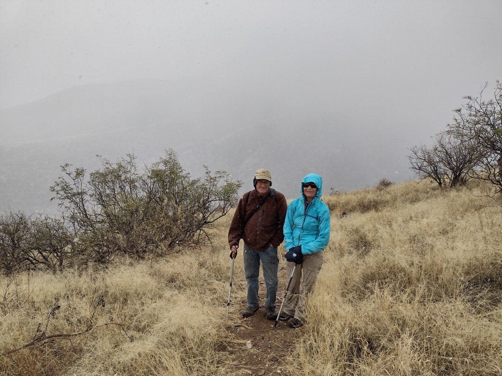
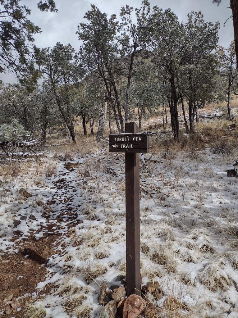
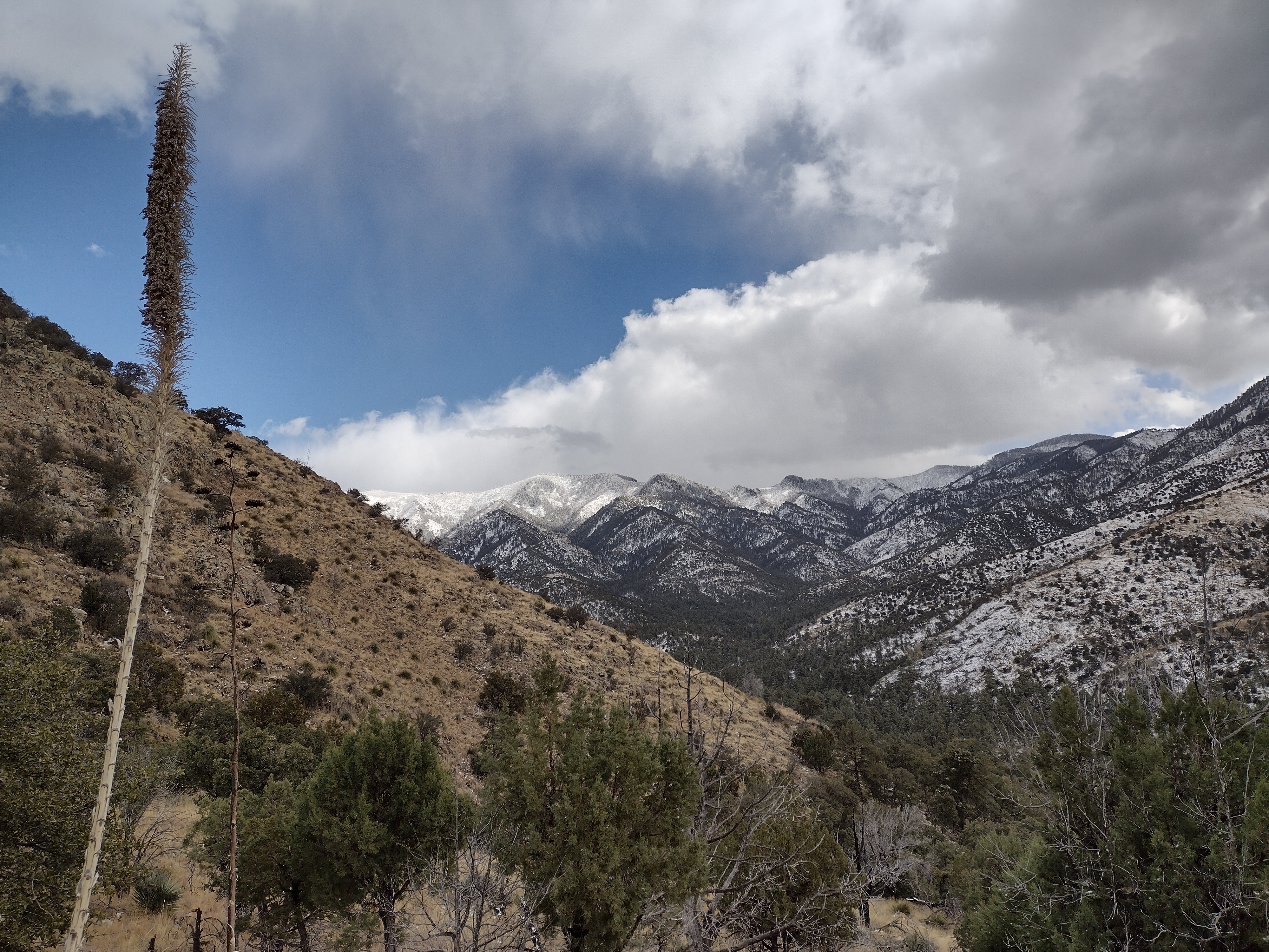
The loop trail in the Whetstone Mountains that we hiked on the first day was one that Lee and I had done on a trip here a couple of years ago. This time we were joined by Mary, who had driven down from Tucson. Her first words were “it’s already pouring rain in Tucson.” The three of us had been closely following the weather forecast and from the gathering clouds it was obvious that moisture was on the way. But it wasn’t a major storm front so we decided to head up the trail and turn around if it got too bad.
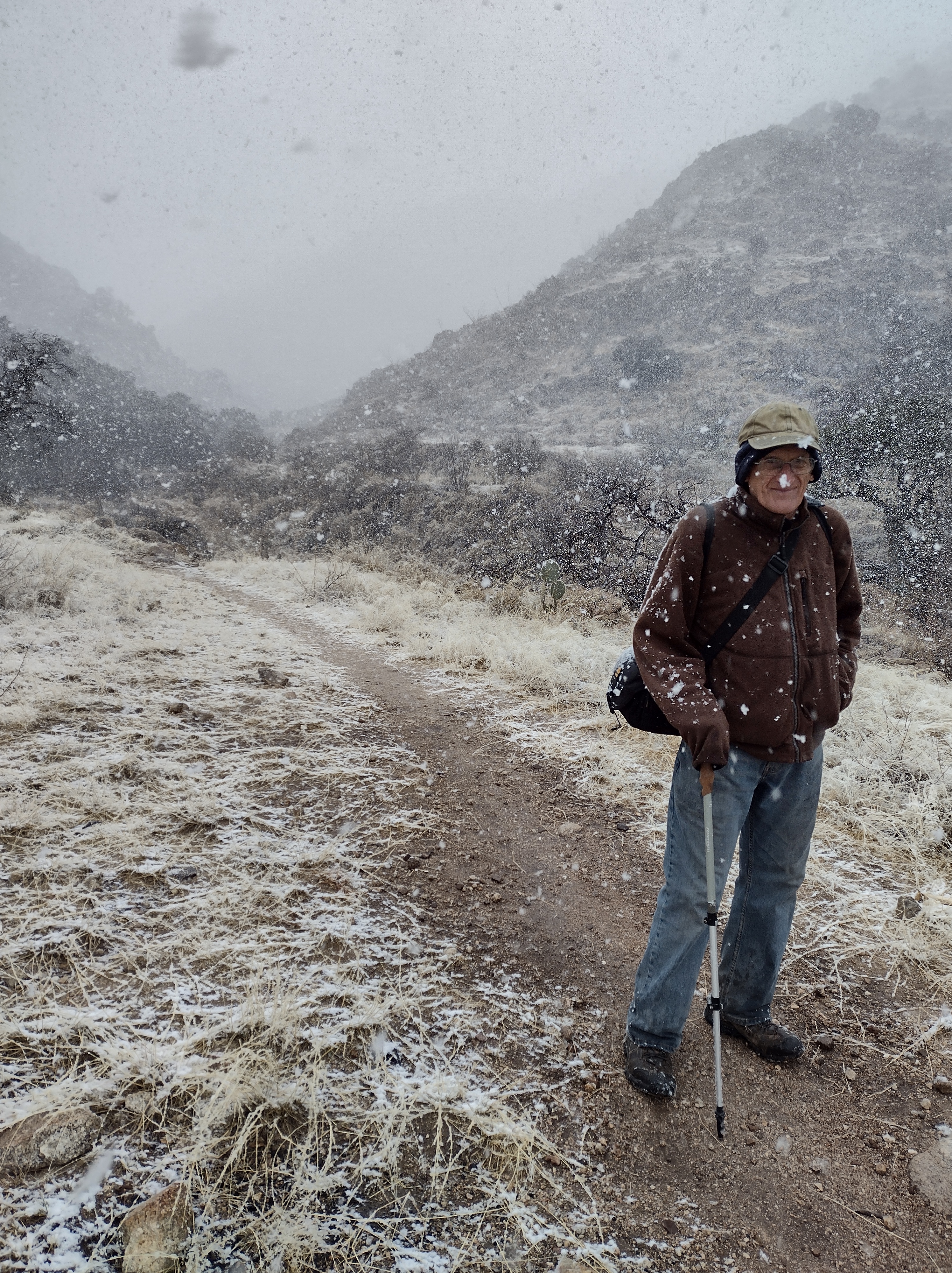
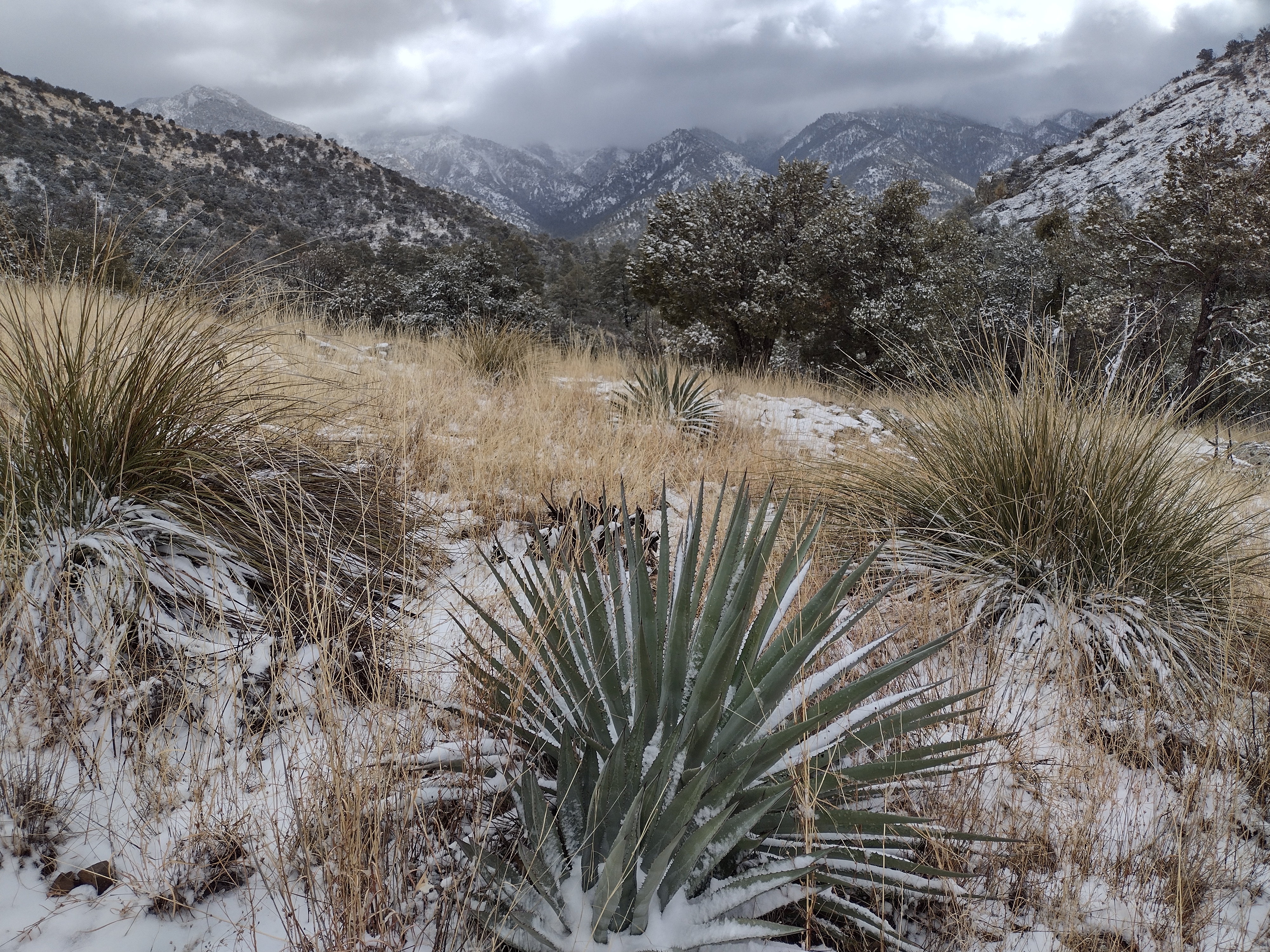
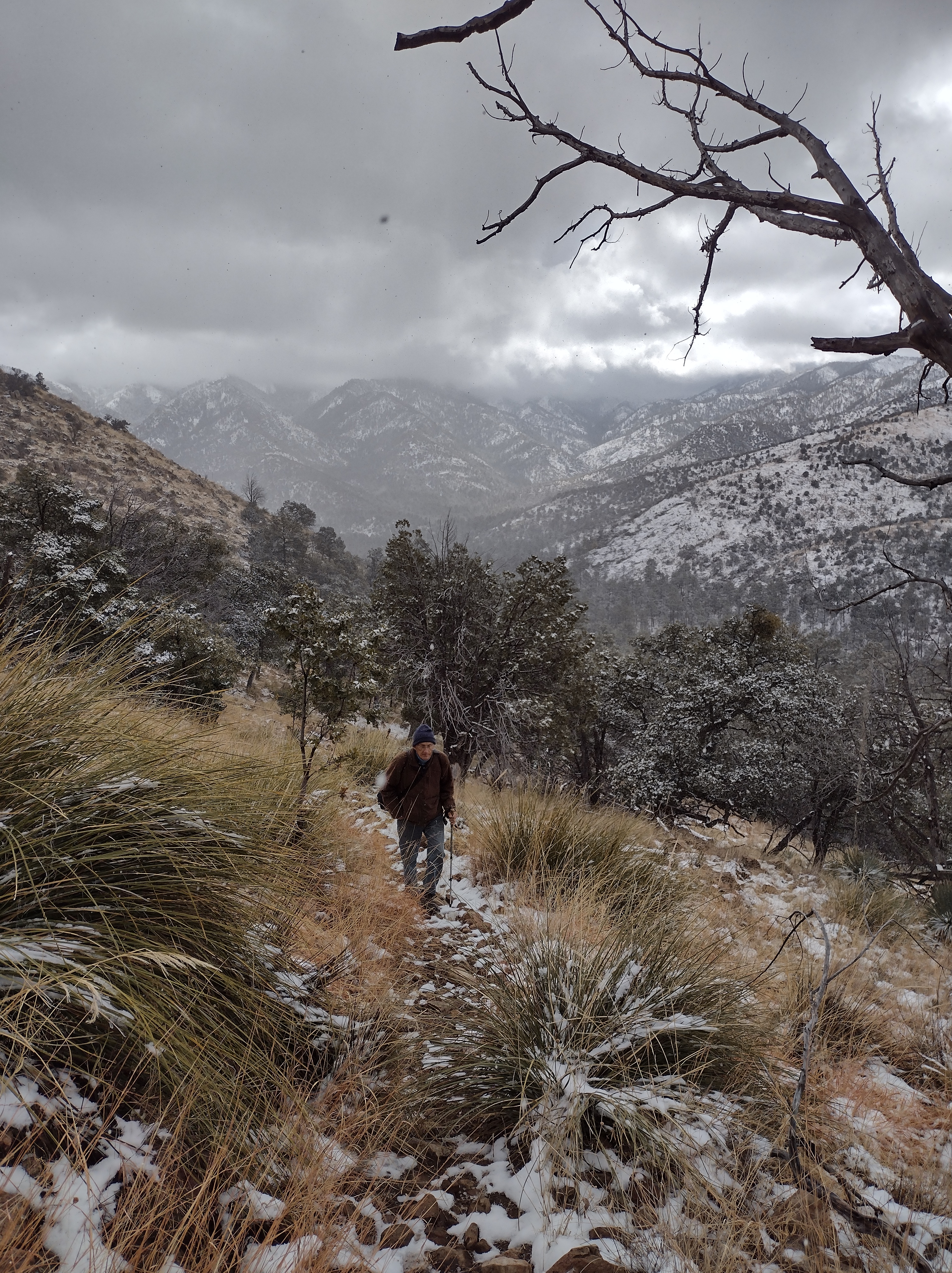
After wrapping around the south facing side of the mountain for about a mile and a half the trail makes a turn towards a saddle on the northwest side. As we rounded the corner we could see the dark, heavy clouds coming at us through the pass. It was decision time. Between the three of us no one wanted to be the wimp who voted to turn around so we zipped up jackets, tightened our hoods and forged ahead.
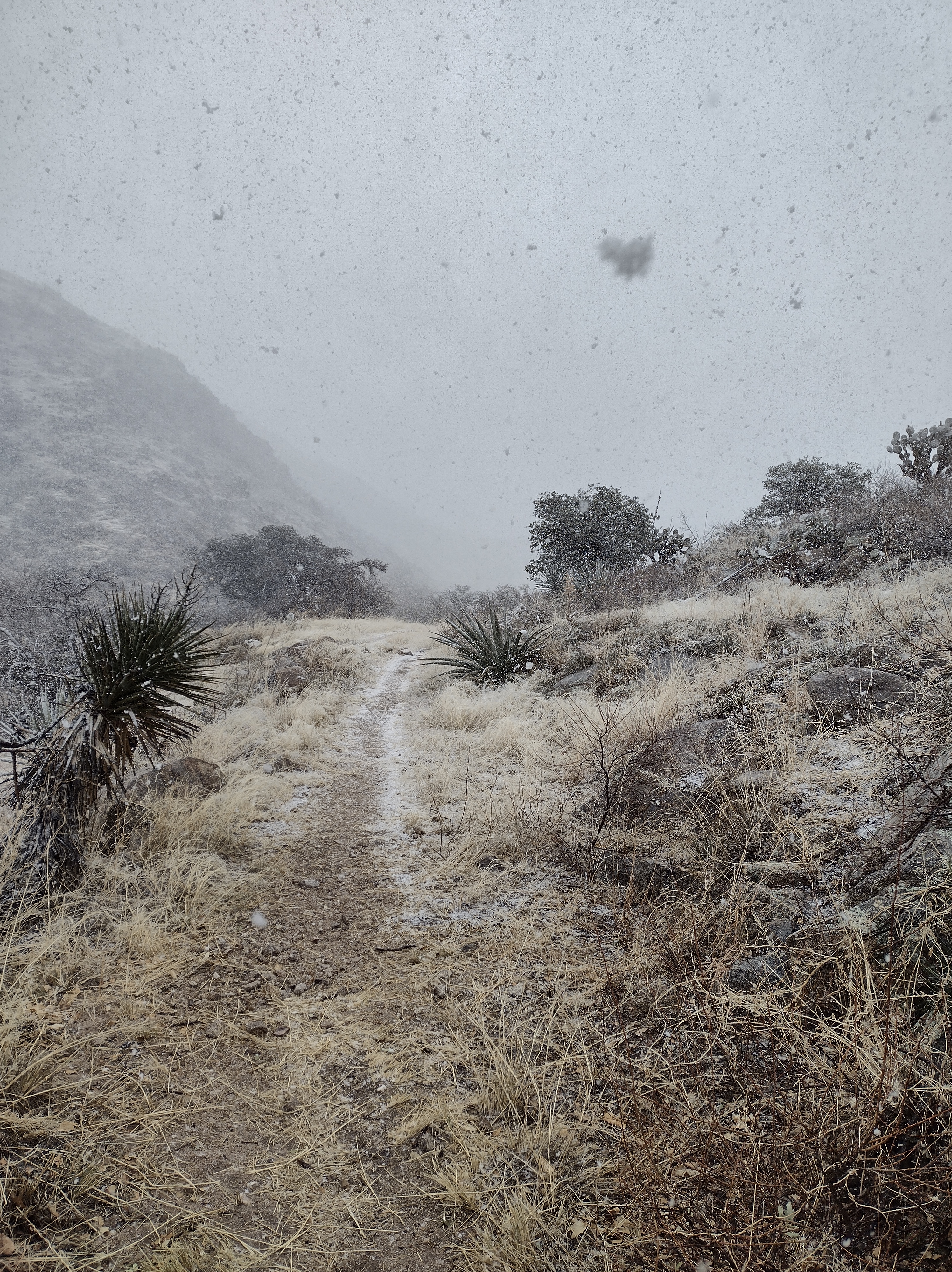
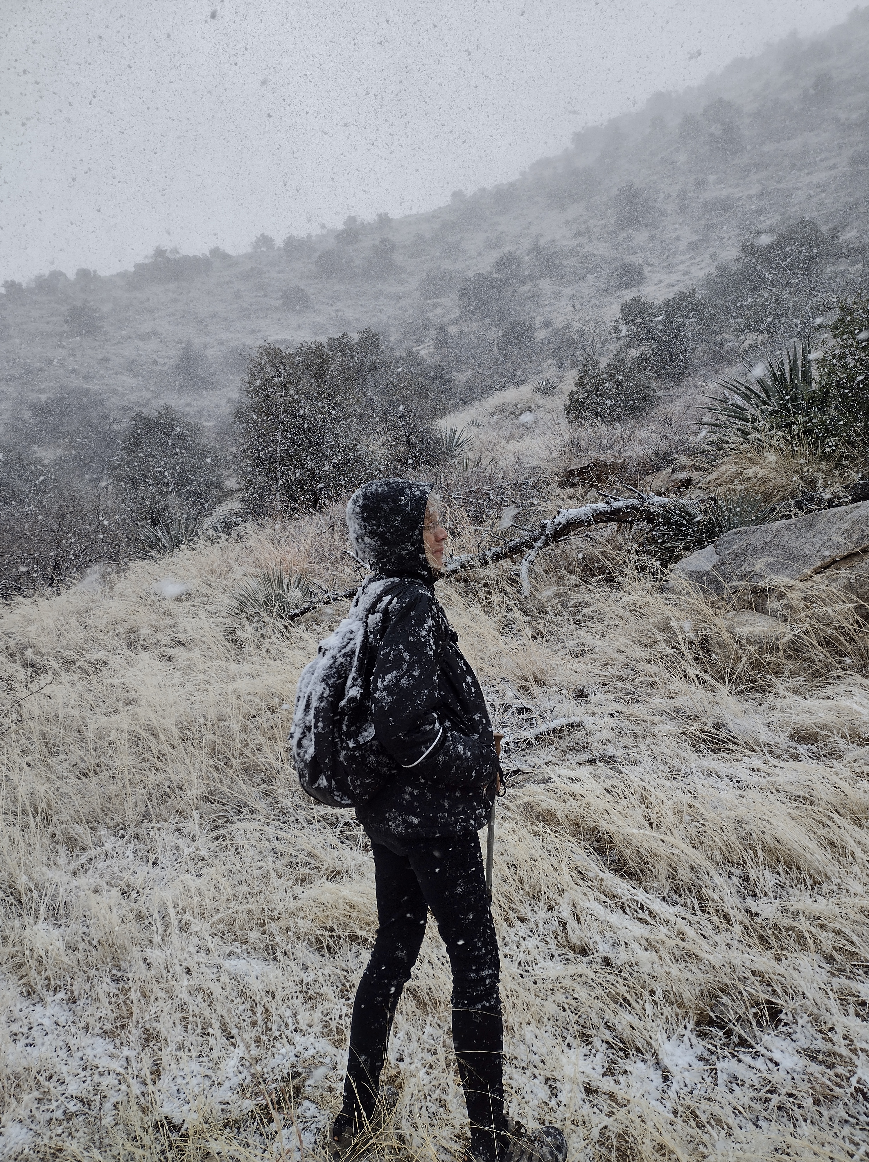
From the weather forecast it was rain that we had expected, but, in the mountains, conditions are quite different from the valleys below. The precipitation started off as sleety pellets which progressed to wet, sloppy flakes as we made our way through the pass and down into the canyon on the other side. We probably would have been more thoroughly soaked if it had been raining. Making sure to watch our steps on the slippery rocks, we enjoyed the novelty of the falling snow which ended as soon as we got to lower elevation.

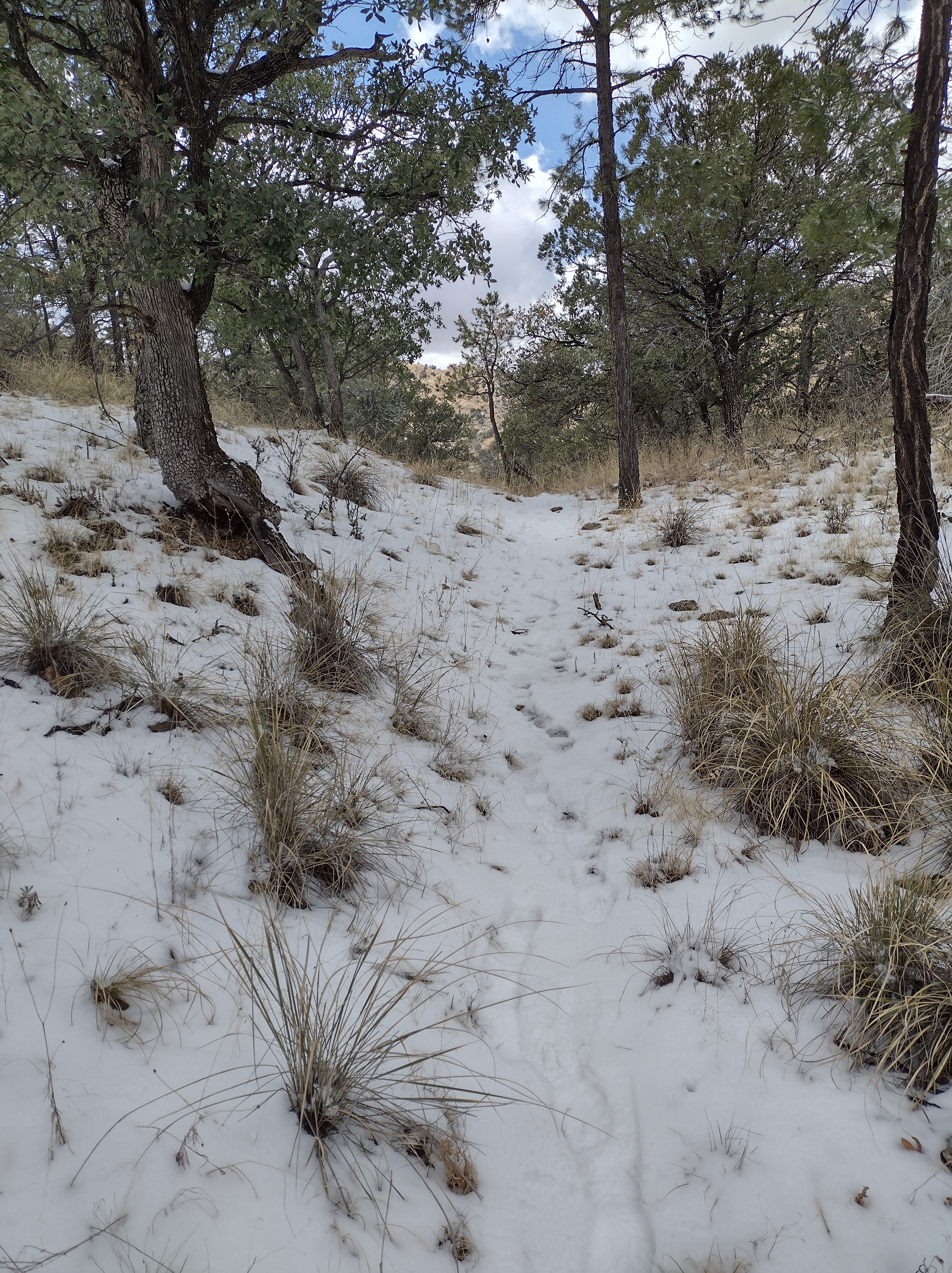
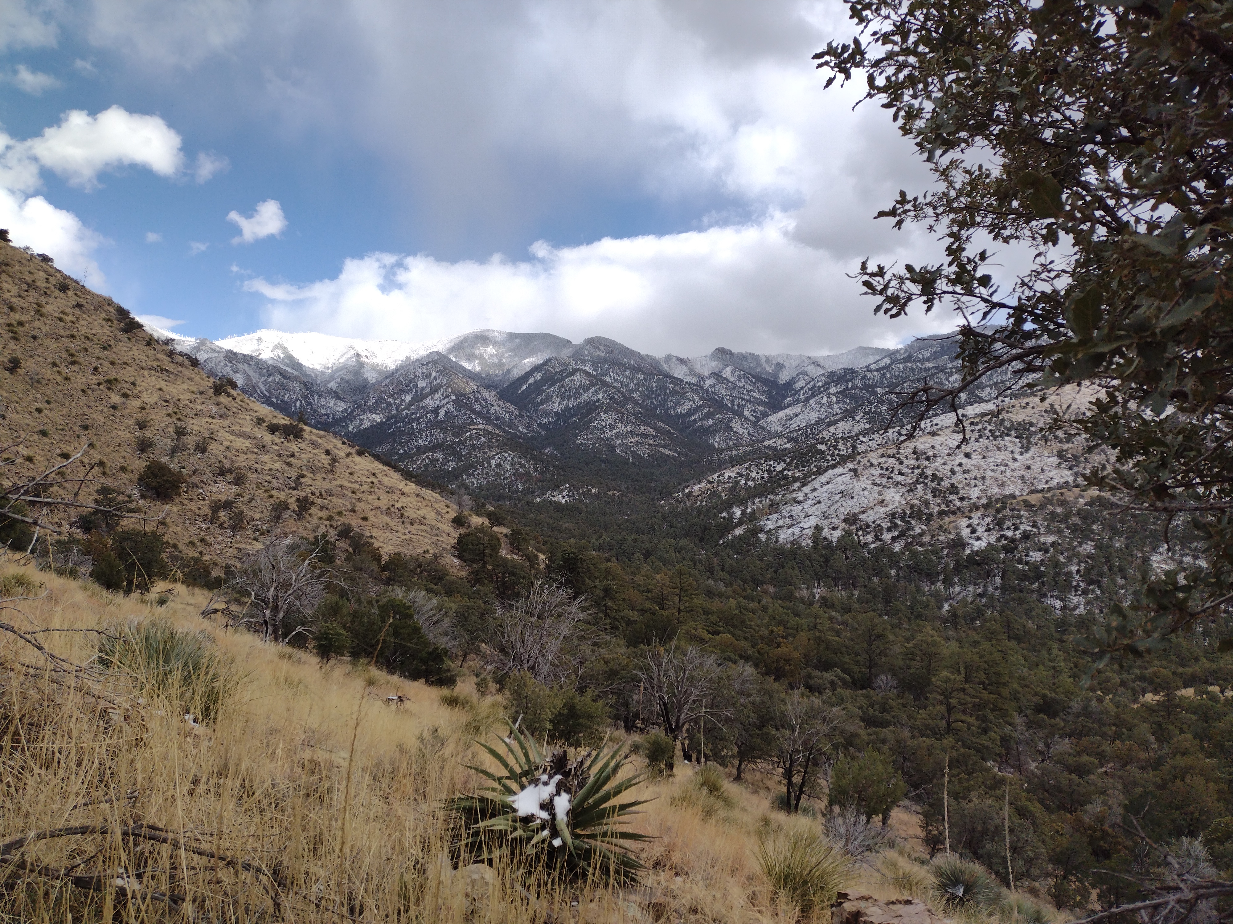
As expected, the storm system had moved through by the second day and, although there were some lingering clouds, we decided to check out a trail in the Chiricahua Mountains that Lee had studied on the Coronado National Forest map. Getting there required driving up a dirt road that headed straight into the mass of dark clouds hanging around the peaks of the mountain range. As we gained altitude it became obvious that the originally planned trailhead would not be the best idea. Instead, we found a forest trail that started at a lower elevation.
The clouds fought with the sun, keeping us guessing if it was going to clear off or continue with periodic flurries of snow. We kept moving and managed to stay warm, although the temperatures hovered just above freezing all day. A cleared off rock outcropping appeared just in time for our lunch break. The clouds moved aside long enough for us to enjoy some warmth. The hike was an out and back so that by the afternoon on our way down more of the clouds had moved off the peaks and we could see how much more snow we would have encountered if we had done one of the trails at a higher elevation. We’ll save that for warmer weather.
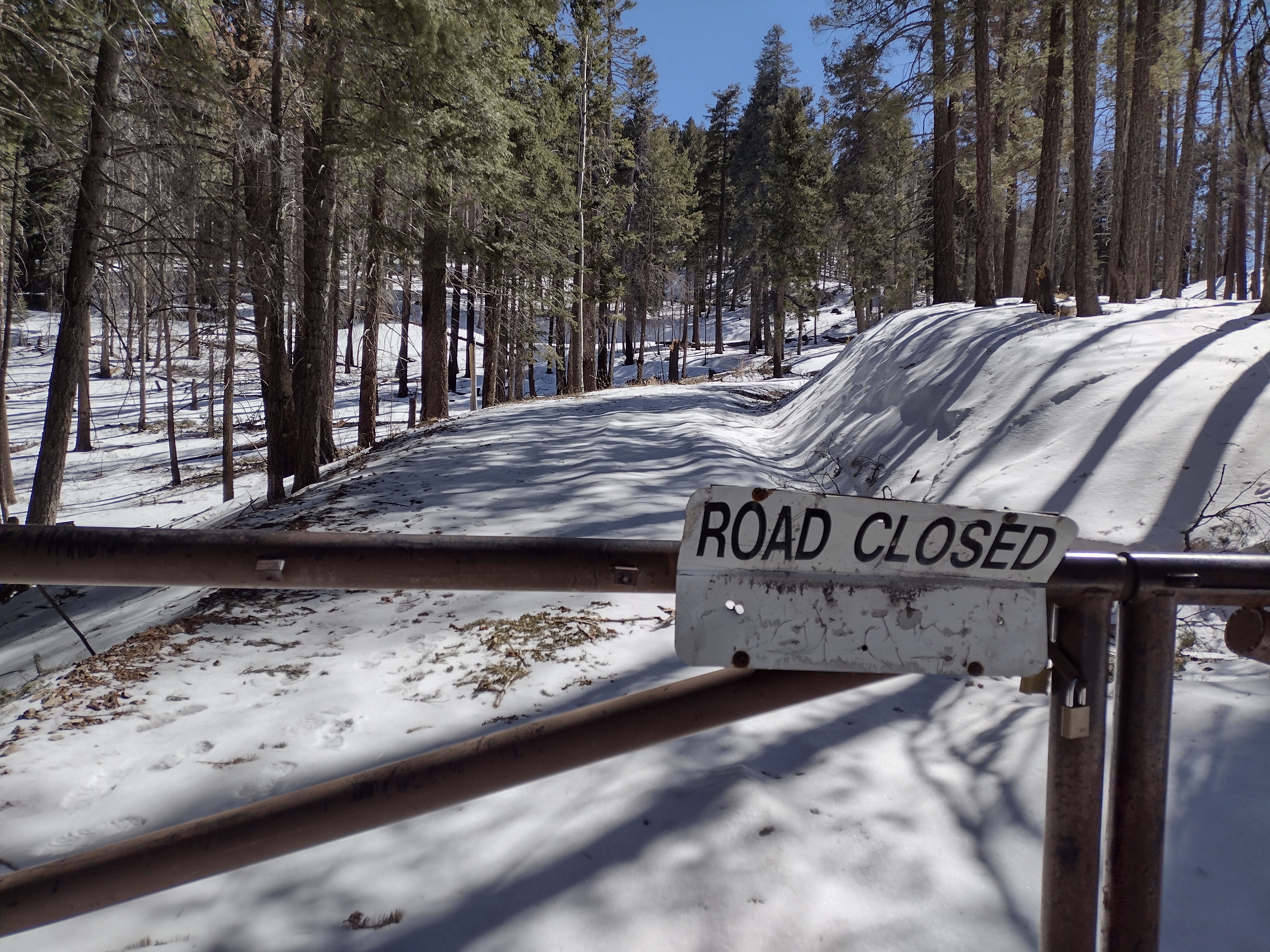
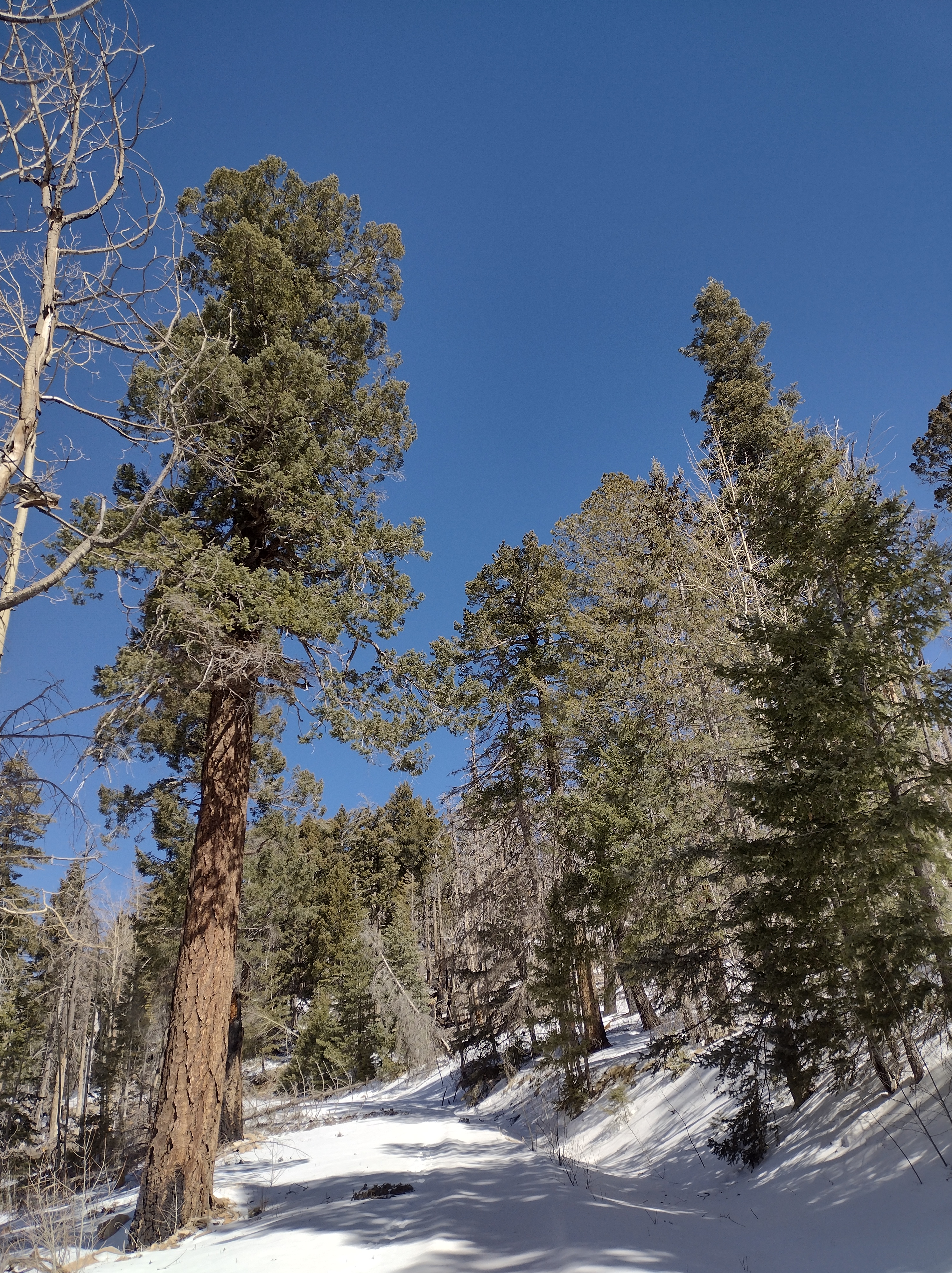
For today’s hike we once again made an adjustment to our plans after an up close look at the conditions. There were no clouds today, even on the mountain peaks. We were aiming for a hike on Mt. Graham, which has a paved, scenic road that leads up to the top with various National Forest campgrounds and trailheads along the way. Snow was visible on the top of the mountain but we thought maybe we could get on the south facing side and find some clear trails.
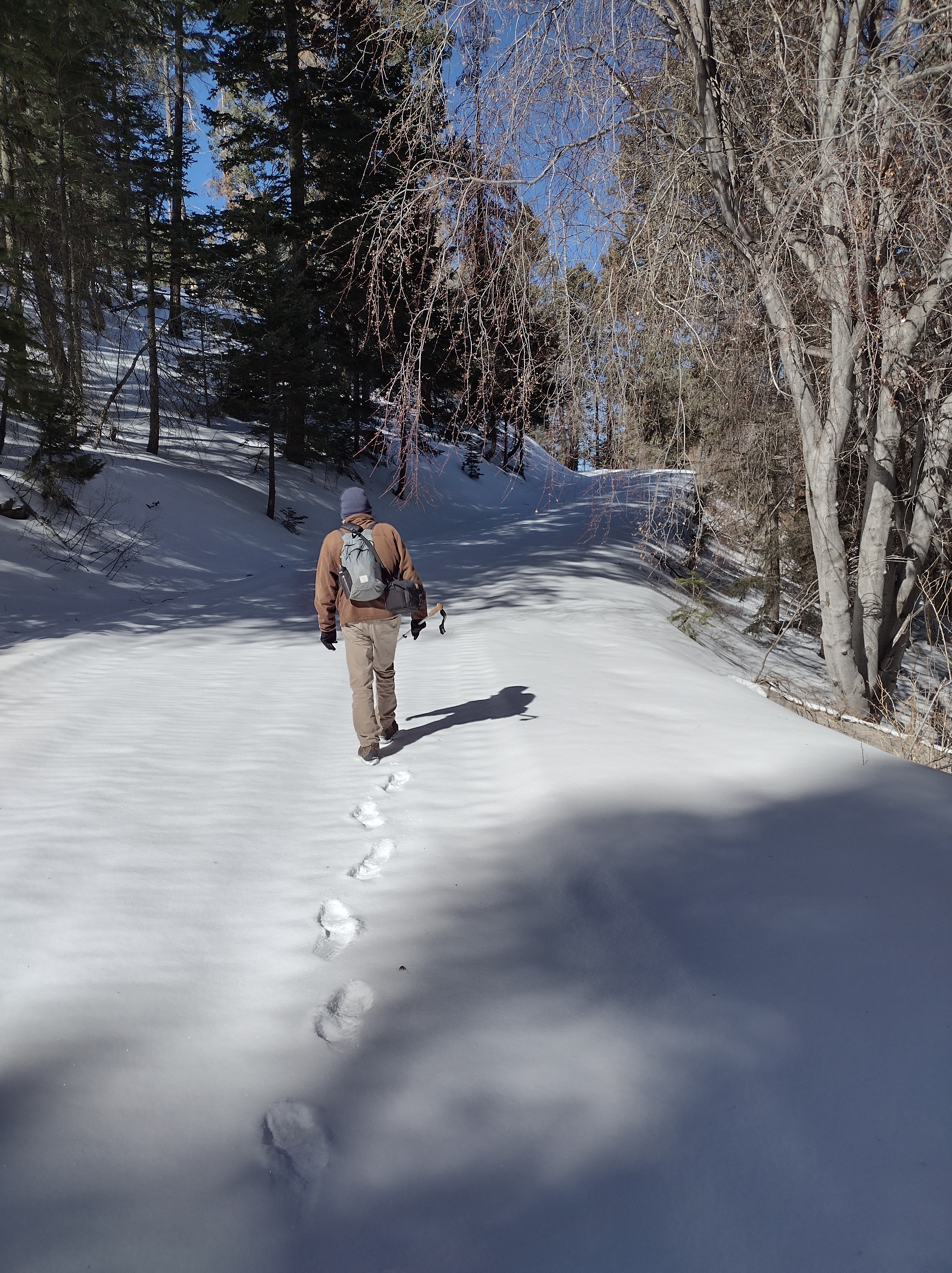
Slowly winding our way up the road, we encountered ever more icy, snow covered spots on the road. We reached the entrance to a campground where there was supposed to be a trailhead if you walked through the campground. Right away we could see that there was too much snow to even drive into the campground. There was a cleared pullout across the road where we were able to park. And just a few hundred feet back down the road was a side road that led up to the Heliograph Lookout Tower. The road to the lookout was closed but we could see that it had been cleared off at some point making it passable. We were able to walk the 2.3 miles up to the lookout, enjoying the bright winter sunshine and clear views from the top. Not the best hike to have to walk up a fire road the whole way but if you don’t prepare for winter in the mountains you have to make the best of it. And we are pretty good at doing that!


I really enjoyed your description of our hiking experience on Wednesday! I definitely was not going to be the wimp who voted to turn around! Once I regained feeling in my hands, I was glad we persevered.