We have long been interested in hiking on the 800-mile section of the Continental Divide Trail (CDT) that passes through New Mexico. Since we aren’t backpackers, we just pick up sections of it here and there on days when we are looking to explore something new. I’ve written about our experiences a number of times, and have gathered up photos and pieces from previous posts on this page.
A section of the CDT west of Cuba around Mile 634 that ascends Eureka Mesa continues to elude us. After unexpected events interfered with plans we had discussed earlier in the week for a hike there, I was sure that we were finally going to be hiking on it Wednesday. We got an early start and headed up Highway 550 to Cuba.
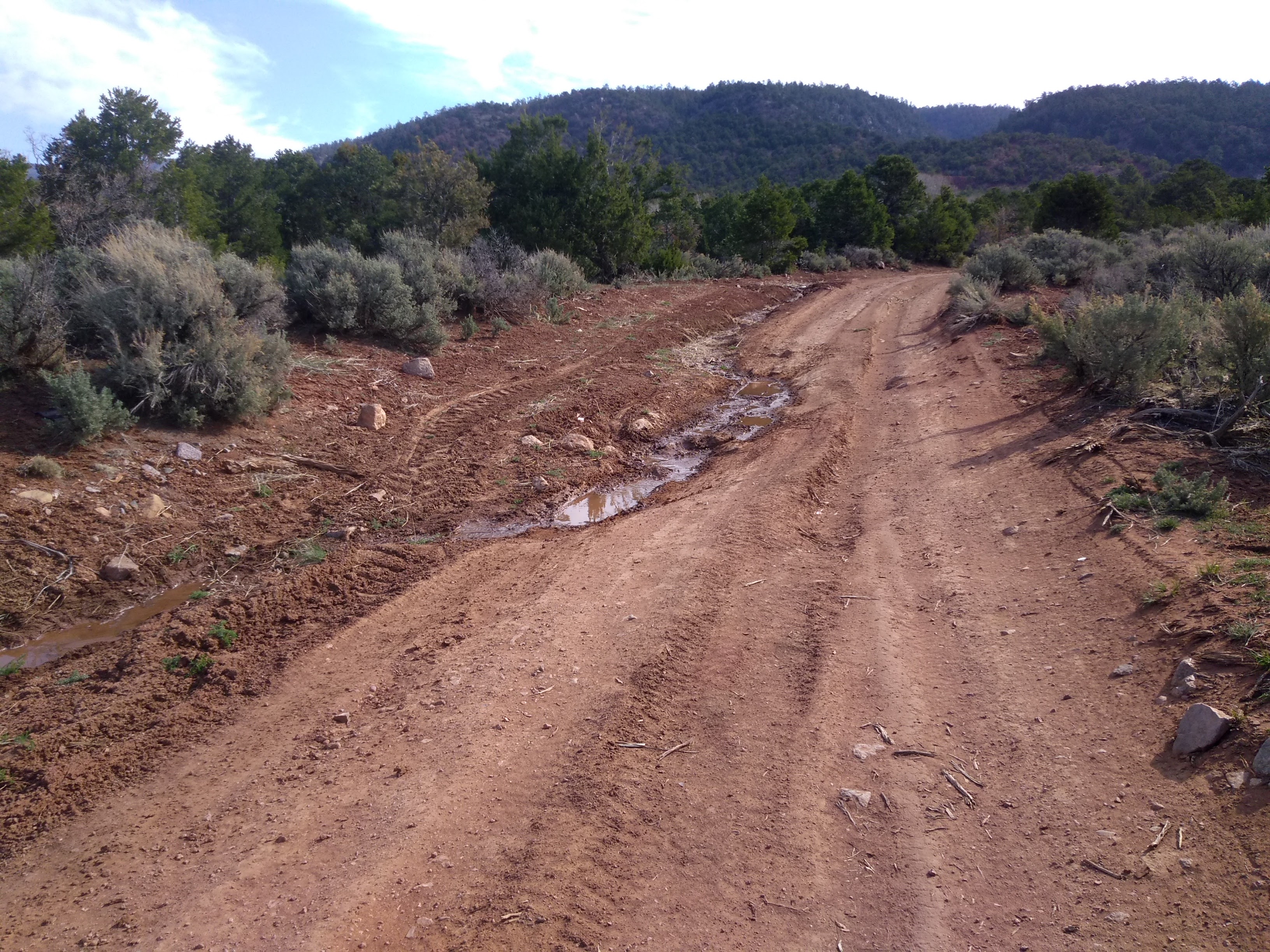
The app that I have on my phone showed the trail leaving Cuba on Highway 126 following the highway for several miles and then making a left turn to head up the Mesa. We didn’t know the details of what to expect and I was surprised to see that the turn off from Highway 126 was not on a trail but on a dirt road. That meant we could keep driving on the dirt road which eventually turned into a Forest Road and then at some point we should see a CDT marker where we could park and start our hike.
As with most Forest Roads we soon reached a point where the road was impassable in our car. According to the app, we weren’t too far from the point where the trail would leave the road so we pulled over and parked. The road had become impassable because of the erosion from what I assumed was spring runoff. There was still a small trickle of water running down one side of the road.
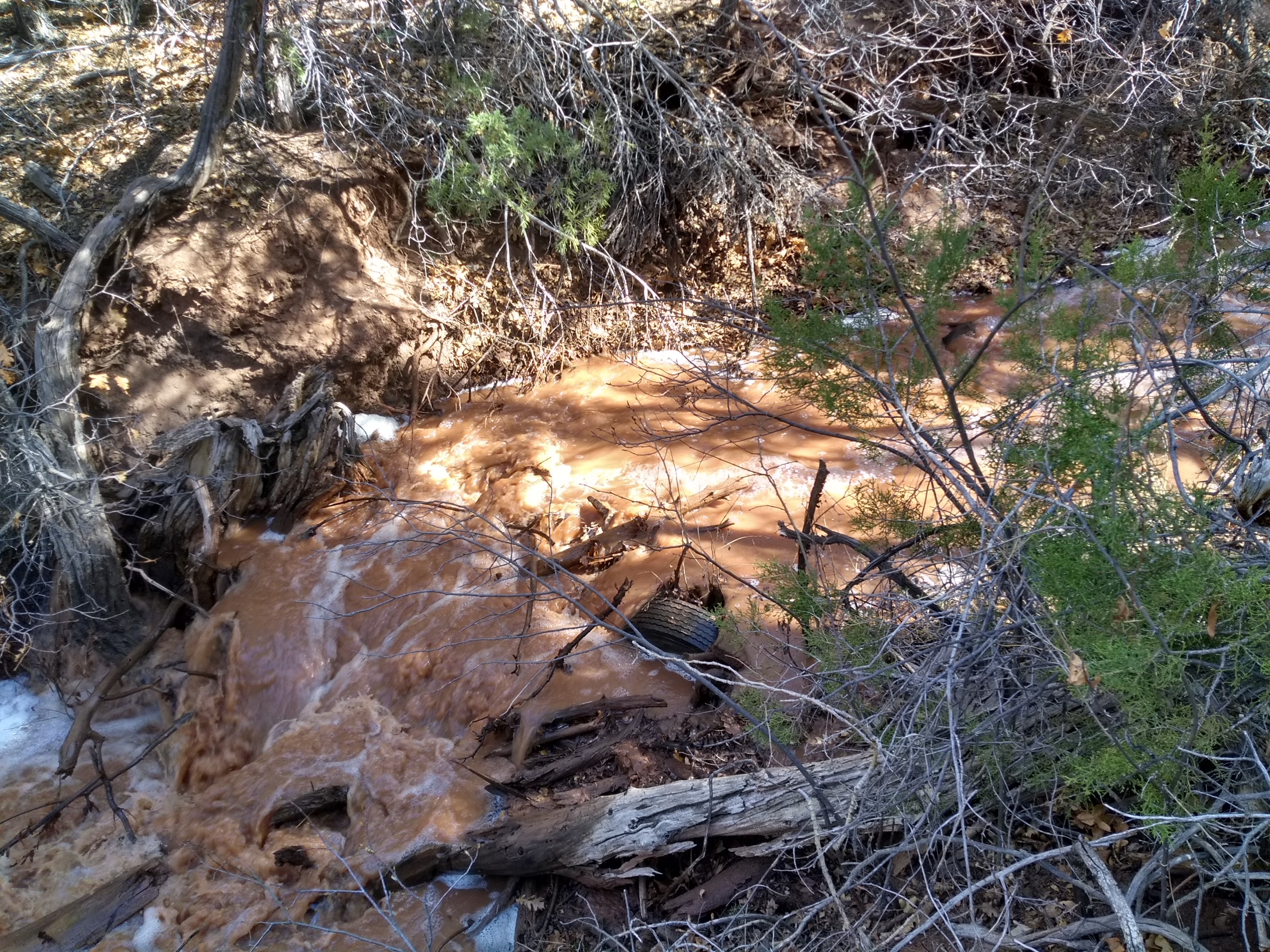
After walking a short distance up the road the reason for the water became evident. There was an irrigation ditch with a massive flow of water coming with such volume that some of it was overflowing into the road. I had noticed on our way into Cuba that a number of the fields along the highway were flooded with irrigation water. San Gregorio Reservoir is located up in the mountains, not too far from where we planned to get on the CDT, and Lee guessed that the water was being released from the reservoir for downstream irrigation to the farms around Cuba.
I think the planning that went into constructing this section of the CDT failed to account for what would take place here in the spring. We had barely turned off the road and started to trek up the trail when we encountered our first obstacle. A feeder stream going into the irrigation ditch was a rush of muddy water with no apparent way for us to cross. We eventually found a way to jump across, barely missing a fall back into the water as we landed on the steep bank opposite. It would be a challenge to cross it again from the opposite direction.
I was relieved that we had made it across but barely had time to catch my breath when we discovered a second stream branch that needed to be crossed. I was all for just taking off my shoes and wading across but Lee wasn’t about to agree with that plan. So we set off through the woods, backtracking and hoping we could cross somewhere down by the road where there was a culvert and then go back to find the trail. When that didn’t pan out we decided that this section of the CDT was going to have to wait for another day.
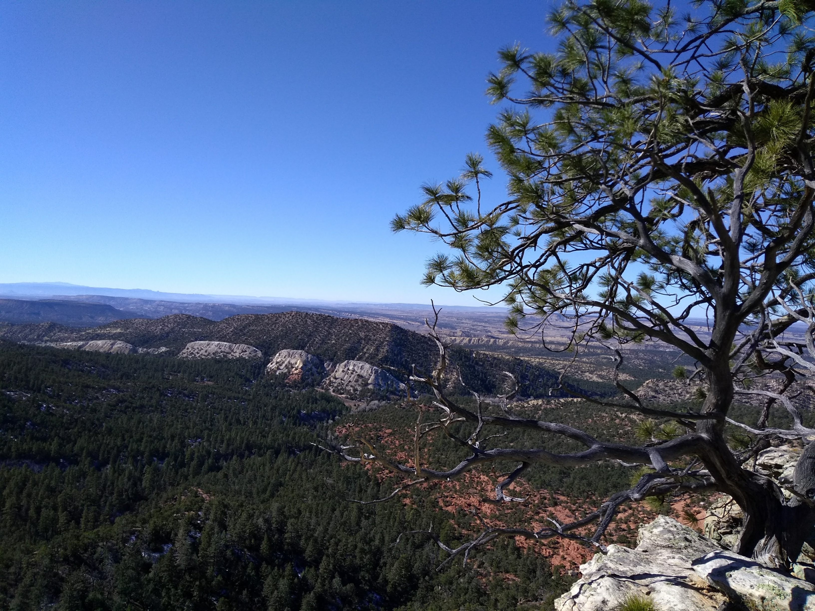
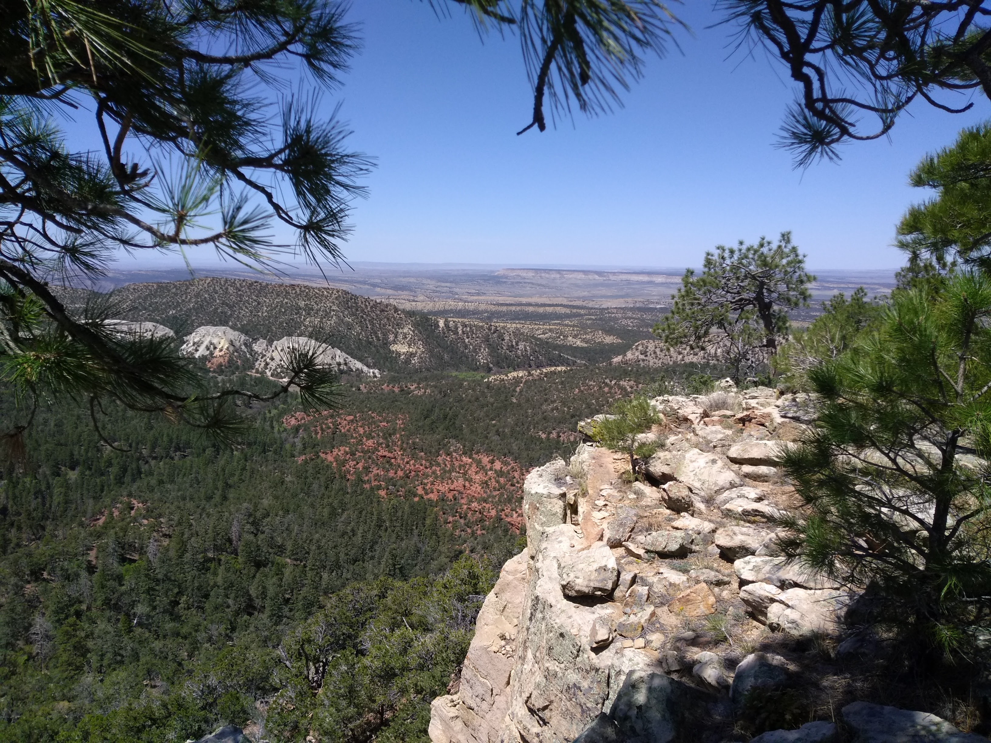
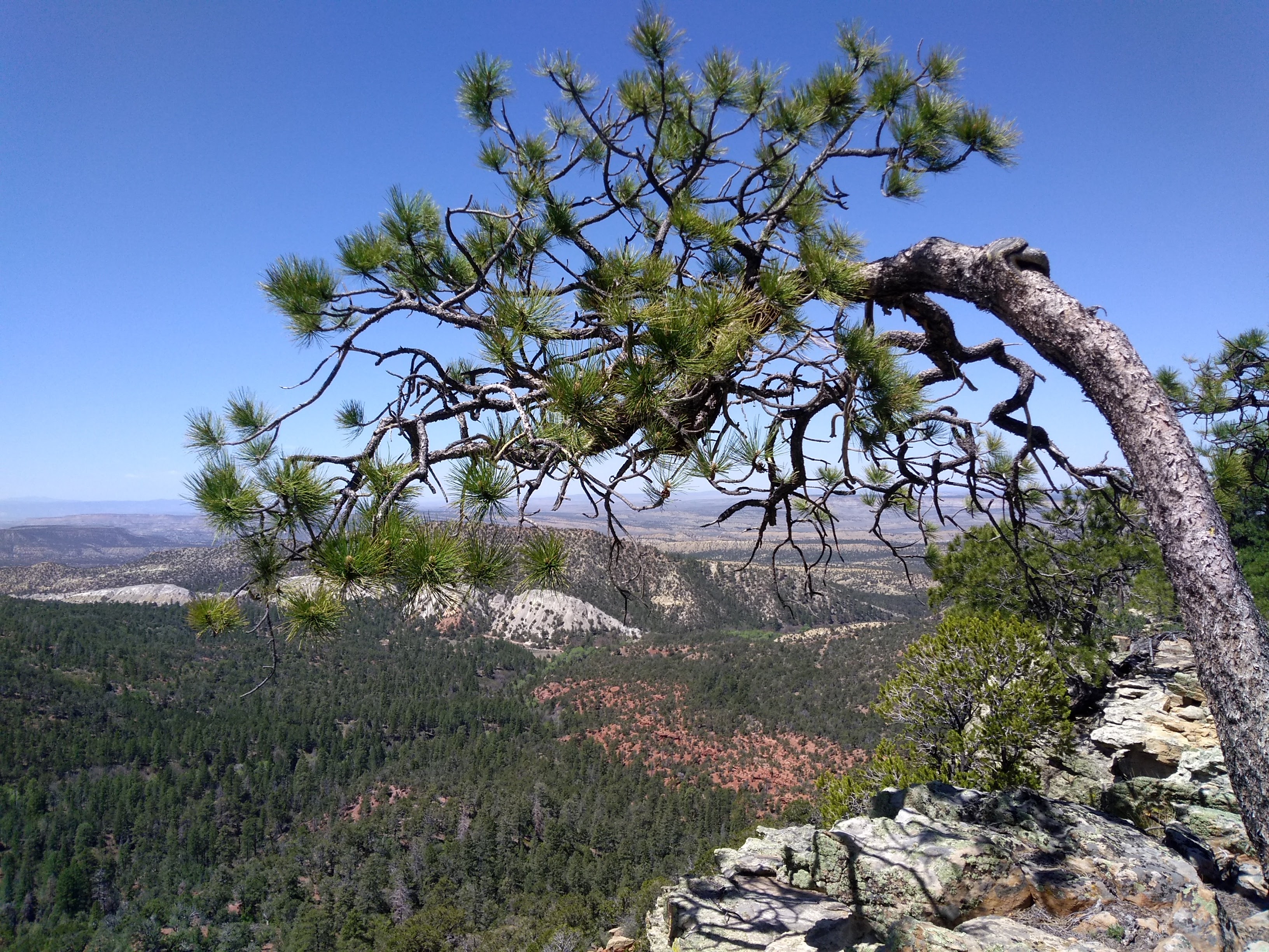
Since we were already in the Cuba area we drove a few miles south along Highway 11 for an alternate hike off another Forest Road to an obscure spot I’m thinking should be called “Lee’s Overlook.” There aren’t any trails and we have gotten to it several times in the past by bushwhacking up the wooded slope. This time Lee had another idea that it could be reached by an unmarked dirt road from what appears to be a campsite used by hunters. Walking on a dirt road may not count as doing a hike but for the entire 5 miles of the hike we never saw a vehicle or another person.
I told myself it would be the same as if we were on a section of the CDT with the added benefit of getting to the overlook. There may not have been any overlooks on the trail we were originally planning to hike. A good reminder to myself that circumstances may not turn out the way we want but with the right attitude it’s possible to enjoy the alternative.
A post that doesn’t share some scenic photos can’t capture the experience very well. Since we had been to the overlook a number of times before I didn’t take any photos this time. But a picture is worth a thousand words and beautiful National Forest scenery remains the same from year to year, so I am posting some of our photos from previous hikes to the overlook.


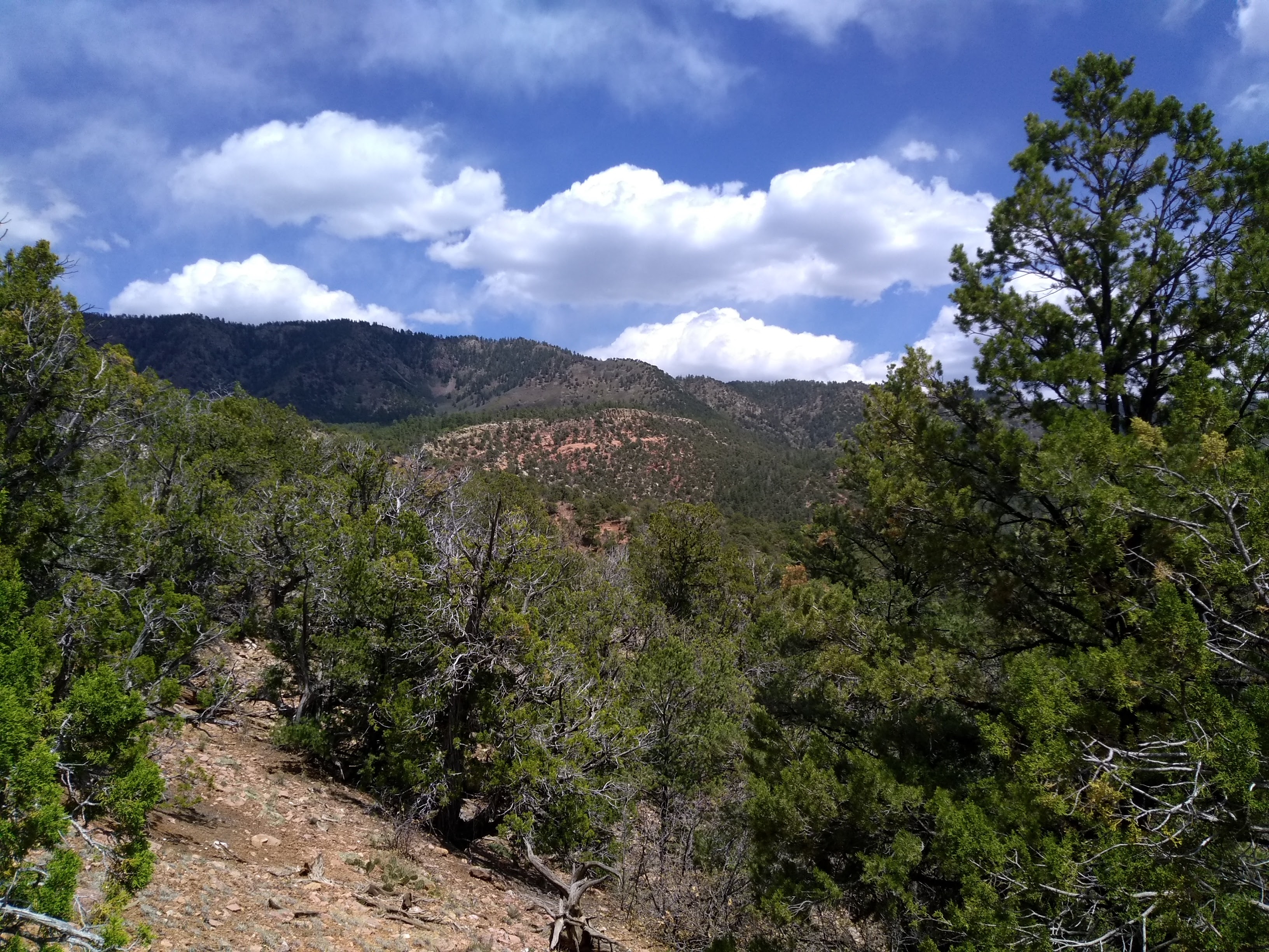
I also looked up some photos from a previous hike that went around the San Gregorio Reservoir, the source of that irrigation water that blocked our way on the CDT.


Well, you know, backpackers just wade through the streams and trek on