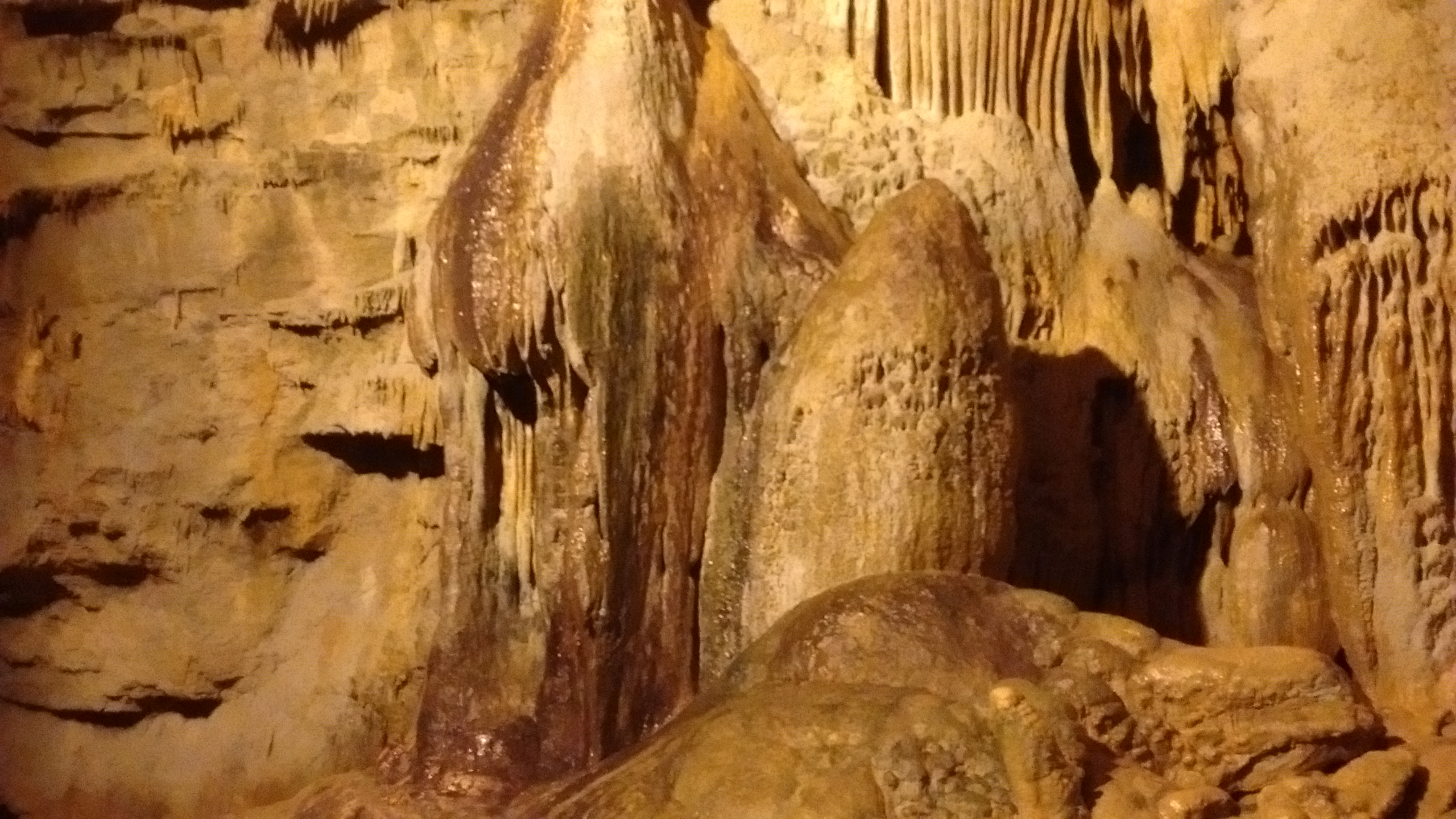
Wildflower Weekend

IMG_20150717_092129521
We spent a wonderful weekend as amateur wildflower enthusiasts, taking part in the 2015 Annual Conference of the New Mexico Native Plant Society. One of the first things that we learned was why a conference of the New Mexico Native Plant Society was being held in Durango, Colorado. Every state and region has its own unique native plants. Southwestern Colorado and El Paso, Texas, are 2 regions where the native plants are more closely related to neighboring New Mexico. Hence, the 8 chapters of the New Mexico Native Plant Society include an El Paso, Texas, chapter and the San Juan chapter, which hosted this year’s conference “Flora of the High San Juans”.

Driving home from Oregon last year, we passed through Durango, Colorado, and, until this weekend, that was my only acquaintance with the San Juan Mountains. Being out in the mountains on the 2 field trips that we had signed up for, I got excited, not only for the wildflowers we saw, but for the incredible scenery and hiking opportunities in the San Juans. I hope that one of these days soon we will be able to spend more time there enjoying the area.

One of the flowering plants that I was not familiar with until this weekend is the tall, impressive Monument Plant, also known as Green Gentian. They are perennial and grow for many years before blooming. In a given area the blooming is synchronized so that all the plants flower at the same time. We happened to walk through one of those areas on the first day’s field trip and the surrounding slopes were covered with the tall, stalky, blossom-covered plants, reminding me of a lush version of Arizona hillsides covered with giant saguaro cacti.

monument plant close
Monument Plant aka Green Gentian
monument plant2
Hillside covered with Monument Plants.
monument plant
Monument Plants along the Pass Creek Trail.

For both of our field trips we drove north from Durango on Hwy 550 towards Silverton. The first day we stopped at the Coal Bank Pass parking area and walked across the highway, where we hiked partway up the Pass Creek Trail.

View of Hwy 550 from Pass Creek Trail.  Larkspur in foreground.
View of Hwy 550 from Pass Creek Trail. Larkspur in foreground.
Turnaround point and lunch stop on Pass Creek Trail.
Chainpod pea.  Interesting because you could see the seed pods, hanging together in a dangling chain.
Chainpod pea. Interesting because you could see the seed pods, hanging together in a dangling chain.
Bittercress.
Bittercress.
Heartleaf Arnica
Heartleaf Arnica
Globe Flower
Globe Flower
Along Pass Creek Trail.

The second day we drove almost as far as Silverton, stopping at the Molas Pass Summit to look at Botrychium (moonwort), a wild fern that you would never think to look for, except that we had an expert botanist in the group who has studied them extensively. From there we drove to Little Molas Lake, one of the trailheads for the Colorado Trail. We didn’t walk very far on the Colorado Trail, as the wildflowers weren’t as abundant as expected. Most of our time was spent walking through marshy areas and along the shore of the lake.

View from Molas Pass.  Hwy 550 is in the upper left corner and Silverton is around the curve in the valley to the left.
View from Molas Pass. Hwy 550 is in the upper left corner and Silverton is around the curve in the valley to the left.
View of Turks Head and Grand Turk from Molas Pass.
Looking south from shore of Little Molas Lake towards West Needle Mountains.
Yellow Paintbrush
Yellow Paintbrush
King's Crown
King’s Crown
Colorado Trail near Little Molas Lake, looking east at Grenadier Range.

Our last field trip of the weekend was very different from the other two. We spent Sunday morning on an ethnobotany tour, led by a ranger at Aztec Ruins National Monument. This meant we were back in desert country, walking through an arroyo and up a mesa, learning the many uses that have been found over the centuries for the native plants in the Four Corners area. A lot of restoration work is being done at the monument to get rid of invasive species and encourage the growth of native species.

Learning about a plant (can't remember the name!) in an arroyo at Aztec Ruins.
Learning about a plant (can’t remember the name!) in an arroyo at Aztec Ruins.
IMG_20150719_120553573
Rocky Mountain Beeplant

Colorado Camping

Weather is always an unpredictable factor in planning a camping trip, especially if you plan to camp in Colorado. The rugged beauty of Colorado mountains and valleys is a big draw, but all of that lush greenery doesn’t get there by magic. It takes winter snow and summer rain and lots of it.

We experienced some of that summer Colorado rain this week when we set out for South Fork, Colorado, to camp and hike for a couple of days in the Rio Grande National Forest. When we arrived Monday afternoon we barely had time to set up our tent before a thunderstorm blew in through the mountain pass drenching everything and dropping the temperature about 15 degrees. Fortunately, it stopped raining before dinnertime and we were able to crawl out of the tent to cook dinner and then take an evening walk around the reservoir before dark.

Big Meadows Campground is along the shore of Big Meadows Reservoir.  Spruce beetle infestation has killed many of the firs.
Big Meadows Campground is along the shore of Big Meadows Reservoir. Spruce beetle infestation has killed many of the trees.
reservoir
Looking north from trail around Big Meadows Reservoir. Campground is visible on the east shore.
south fork
From north end of Big Meadows Reservoir, the South Fork of the Rio Grande flows north to join the Rio Grande River.

Throughout the night Monday we were periodically awakened by the sound of rain and thunder. Although we stayed dry in our tent, by the next morning it was obvious the day would be too cold and wet for the hike we had planned in the nearby mountains. Instead, we drove back south about 50 miles to the San Luis Valley, where we spent the day exploring Great Sand Dunes National Park. It was cloudy all day, even in the valley, and the temperatures barely warmed up to 60 degrees.

The dunes are behind Medano Creek.
The only way to get to the dunes was to wade across Medano Creek.  This is wading back across to the visitor center after we climbed the dunes.
The only way to get to the dunes was to wade across Medano Creek. This is wading back across to the visitor center after we climbed the dunes.
Cloudy day meant we missed the view of Sangre de Cristo Mountains as the backdrop to the dunes.
Cloudy day had its advantage.  It was a long hike to the highest dune and would have been very hot on a sunny day.
Cloudy day had its advantage. It was a long hike to the highest dune and would have been very hot on a sunny day.
Tough hiking, but we made it to the top of the highest dune.
These dunes are massive.  We only saw a small portion of them.
These dunes are massive. We only saw a small portion of them.

By Wednesday morning we were ready to pack up and head back to New Mexico where there was a better chance of clear skies and warmer temperatures. On our way to Colorado, traveling on US285, just before the Colorado border, we had noticed the interesting peak, San Antonio Mountain, just west of the highway. It sits by itself out in the sagebrush plains on the west side of the Rio Grande Del Norte National Monument. There aren’t any established trails on the mountain, but it is BLM land, open to the public, except for one small area of private land. We decided that on our way back to Albuquerque we would stop there and investigate.

The one road access from US285 dead ends at a fence with a closed gate, blocking the way to the private land. We parked our car by the gate and then began our trek around the private land and up the grassy slope of the mountain. We didn’t make it all the way to the top, but had a good time looking at wildflowers and the views to the east. All that open land and blue skies was a nice welcome back to New Mexico.

Not as green as Colorado but nice to see some blue sky.
Walking across field towards San Antonio Mountain.
Lupine on San Antonio Mountain
Interesting to watch a bumblebee as it pollinated the lupine flowers.
Indian paintbrush on San Antonio Mountain.
From partway up San Antonio Mountain looking east.  Highway 285 in the distance and beyond that Ute Mountain on Rio Grande del Norte National Monument.
From partway up San Antonio Mountain looking east. Highway 285 in the distance and beyond that Ute Mountain on Rio Grande del Norte National Monument.