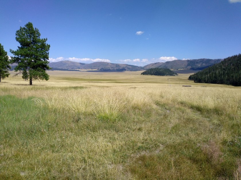
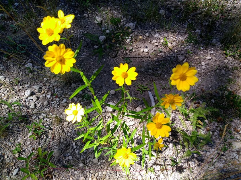
It’s hard to describe the experience of hiking in the Valles Caldera. You’re not going to see any breathtaking mountaintop views but, for me, being out in that vast, empty space is special enough that it almost takes my breath away. And then I’m always impressed by the stillness and quiet as you gaze out over the huge valley floor of the caldera.
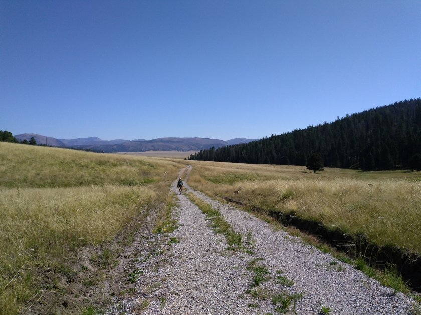
Most of what are labeled as hiking trails in the caldera are actually old roads used in the days when the area was owned by ranchers. You usually have to walk out in the open for quite a ways until you reach the tree-covered slopes. On a day as hot as today that can be less than enjoyable.
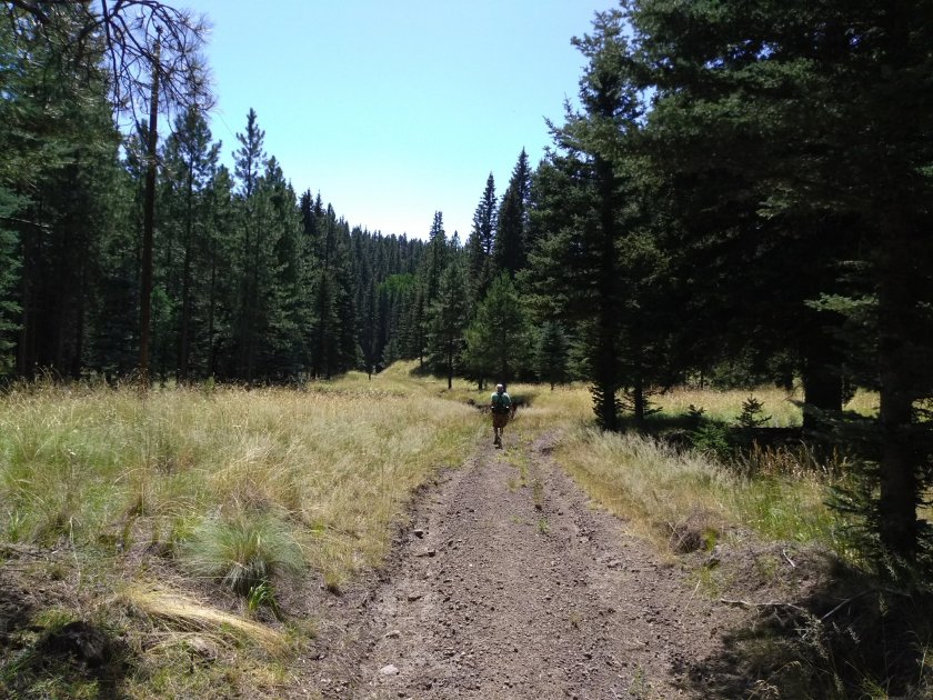
There was more elevation than I had expected. After a mile or two the road was overgrown with dried grasses and vegetation that scratched my legs and filled my socks and shoes with prickers. I was berating myself for not bringing gaiters. By the time that we came to the huge, washed out gully that had to be crossed if we wanted to go any further I was quite cross. But we managed to find a way to climb down into it and back up the other side. Shortly after that was our lunch stop so I started to feel better.
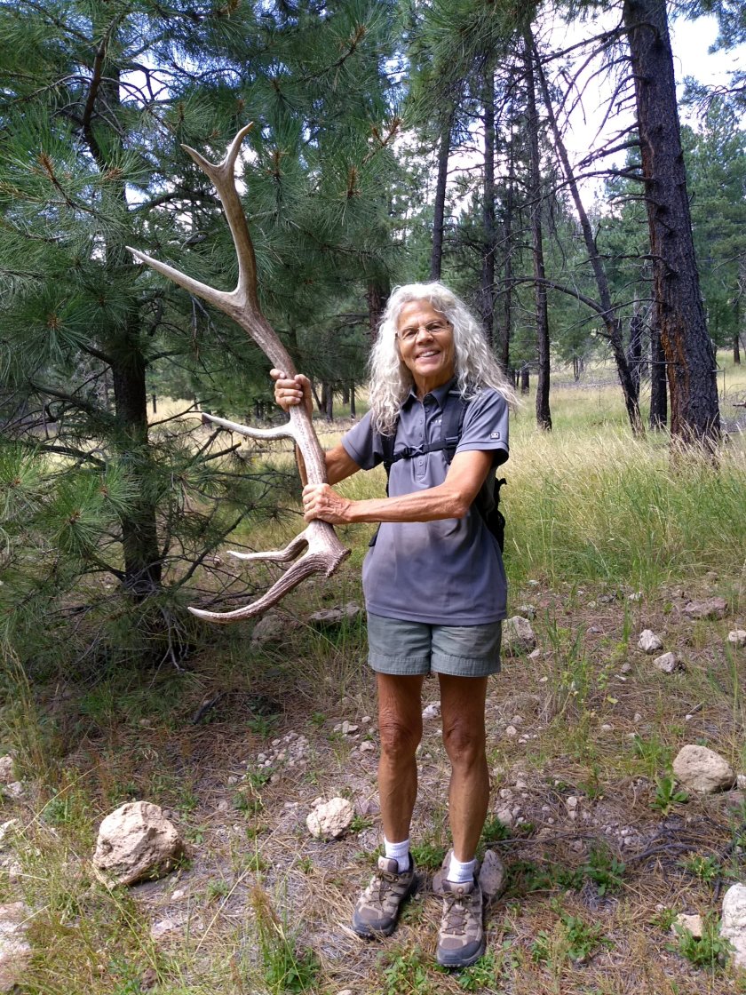
The highlight of the day for me was the treasure that I found on the way back. It was laying right by the gully crossing and I can’t believe I didn’t see it before. The caldera is a protected area and I couldn’t have brought it home even if I wanted to. But I was content to marvel at the thought of the huge bull elk that left it behind. Then I left it behind for the next passerby to admire.
My idea for an overnight getaway was to rent an AirBnb for one night in either Angel Fire or Red River and then hike somewhere the next day in the Carson National Forest. We haven’t done much hiking there because it’s a bit far too far from Albuquerque for a day trip. We could have camped, but I didn’t feel like roughing it.
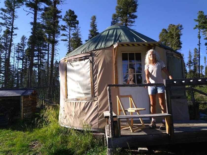
When I searched for Airbnb rentals there were quite a few, since both towns are close to ski areas and are popular tourist destinations. But one result that popped up captured my attention. A business called Enchanted Forest Cross Country Ski Area in Red River was advertising yurt rentals as a “glamping” experience. Think of glamping as camping for city slickers.
We would have the benefit of spending the night in an isolated clearing in the forest without having to set up a tent or sleep on the ground. The yurt would have a camp stove, basic cooking utensils, bunk beds and water in it. We would need to bring sleeping bags and our food. No running water, no electricity, and no indoor plumbing so we’d still be roughing it to a certain extent. But it sounded like a fun outing so we booked it and made our plans.
When we got to Red River yesterday afternoon the temperature was in the high seventies, which, compared to Albuquerque’s 90-plus degrees, felt quite comfortable. It didn’t take long, though, to work up a sweat. Getting to the yurt was not a simple matter of driving up to the front door and unloading our gear. You have to leave your car at the entrance to the ski area and then hike the backwoods trails to get to your yurt. Ours was a mile and a quarter hike, which turned out to be almost 2 miles because we got lost.
The area is a maze of color coded trails supposedly marked with plastic streamers on trees and trial names that match a map printout. But the letters and numbers on the map were barely legible and some of the trail markers were either missing or in need of repair. Lee had his gear on his back but my only backpack is a small one for day hikes. I knew I would need extra clothes and a warm sleeping bag for the chilly night temperatures and was happy to take advantage of a hand wagon that was available at the parking area to haul gear. Even with that help, though, it was a tough pull uphill and over rough terrain until we finally found our yurt.
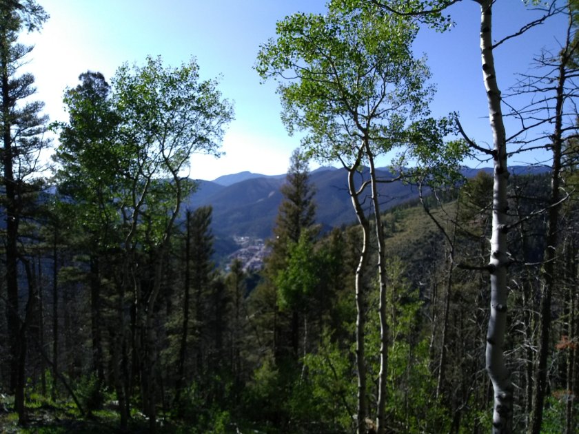
Sure beats having to pitch a tent and sleep on the ground!A trail near our yurt led us on an evening walk to a couple of nice views, including one overlooking the town of Red River.
Our home for the night was cozy, actually a bit too warm until the sun went down. At 10,000 foot elevation it’s amazing how quickly the temperature drops at night. We’d been sweating that afternoon but by dark were ready for the warmth of our sleeping bags. Overnight temperatures were in the 40’s so by breakfast time we had put on all our extra layers of clothing and were hunting for that first spot of sunlight coming through the trees to warm us up.
Pulling my wagon back down to the car the next morning was much easier, especially since we knew the way.
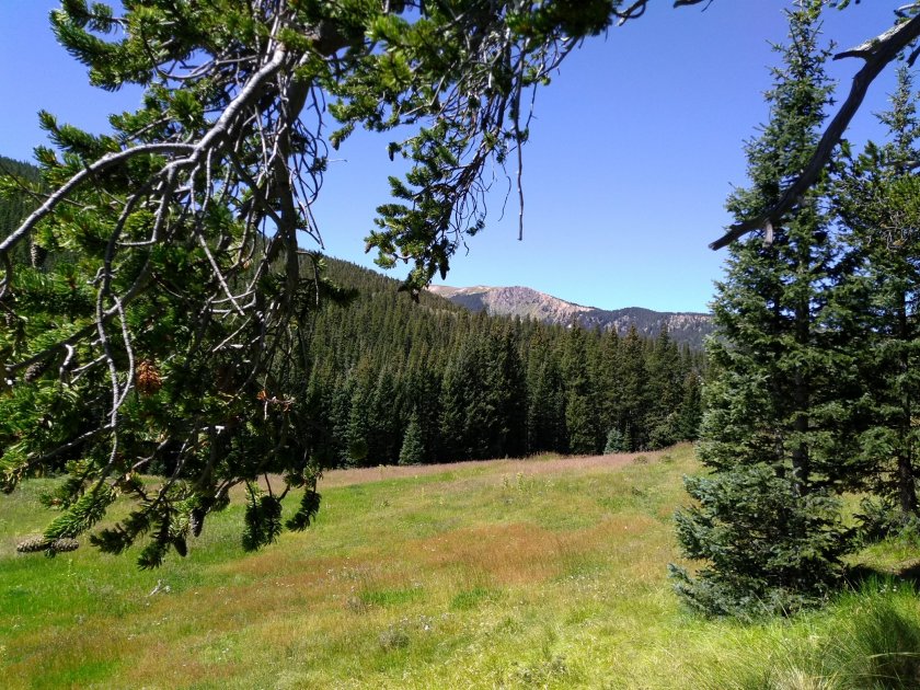
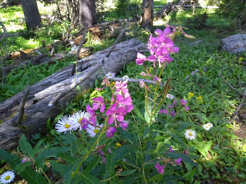
Our hike today was a pleasant 6-mike trek without too much elevation gain. It started up a valley along a tributary to the Red River. We had views along the trail of Wheeler Peak, New Mexico’s highest mountain at 13,159 feet. There were even a couple of small snow fields visible on its crest. But we were content to keep on our valley trail and enjoy the lush meadows beside the stream. It was a perfect day and a wonderful way to end our glamping adventure.