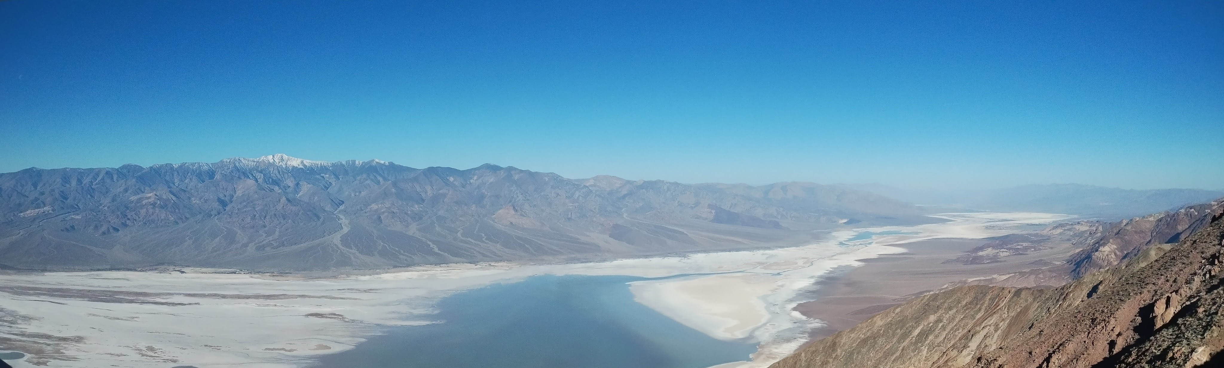
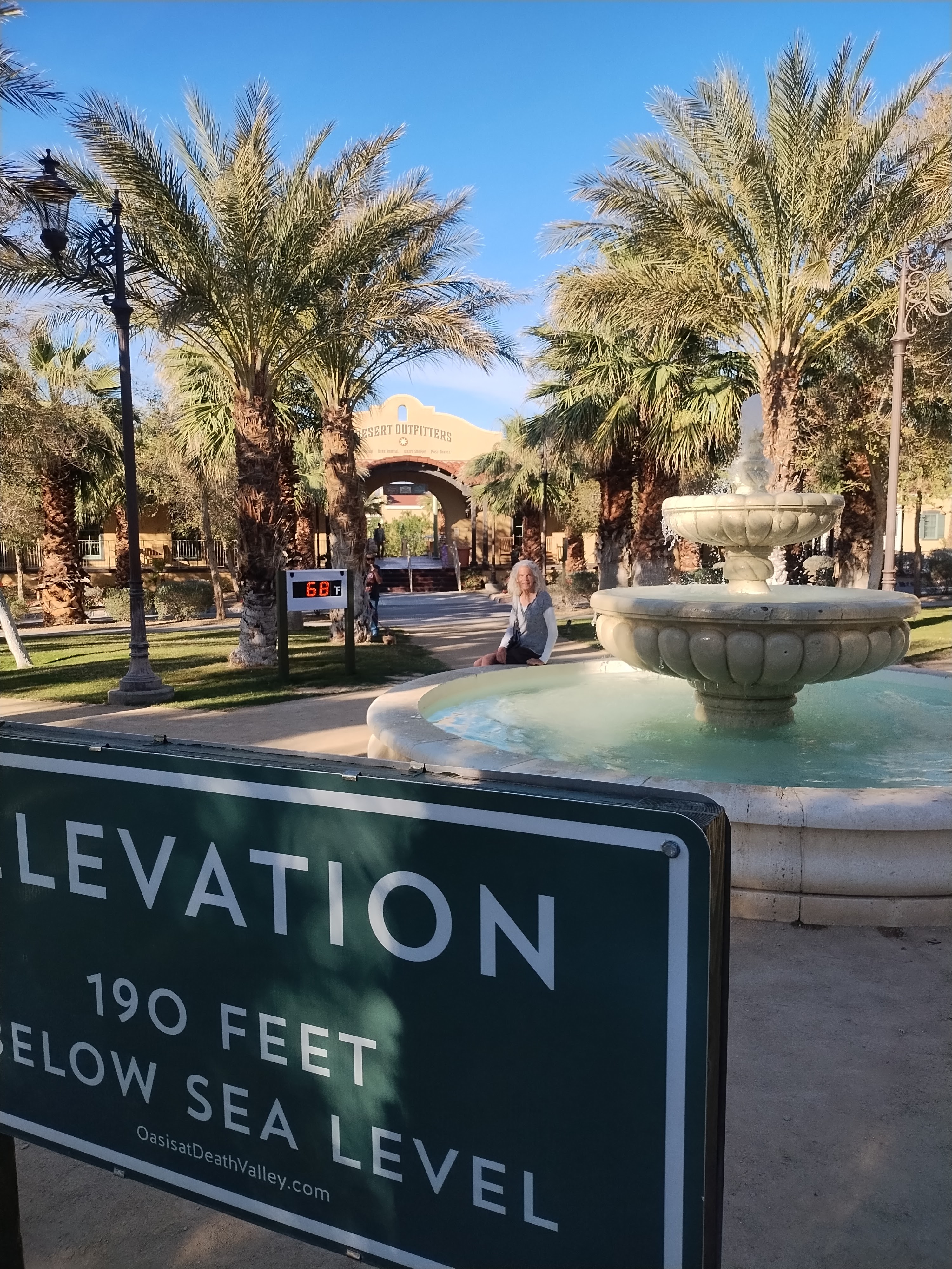
A place that is called Death Valley doesn’t sound like a desirable destination. I suppose in the days when American pioneers were settling western frontiers, it would have been a dreadful place to explore. But for me, living in today’s age of The Machine, it’s a place that refreshes and rejuvenates my spirit.
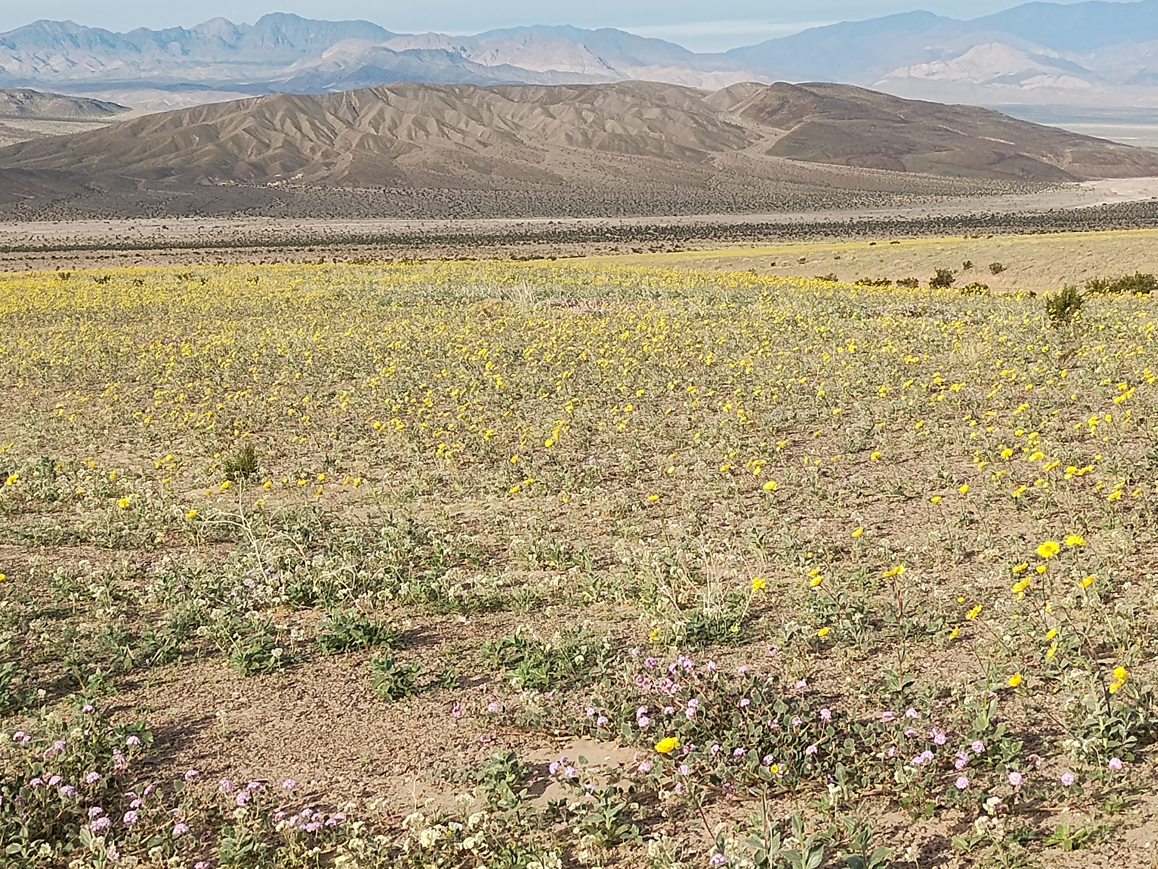
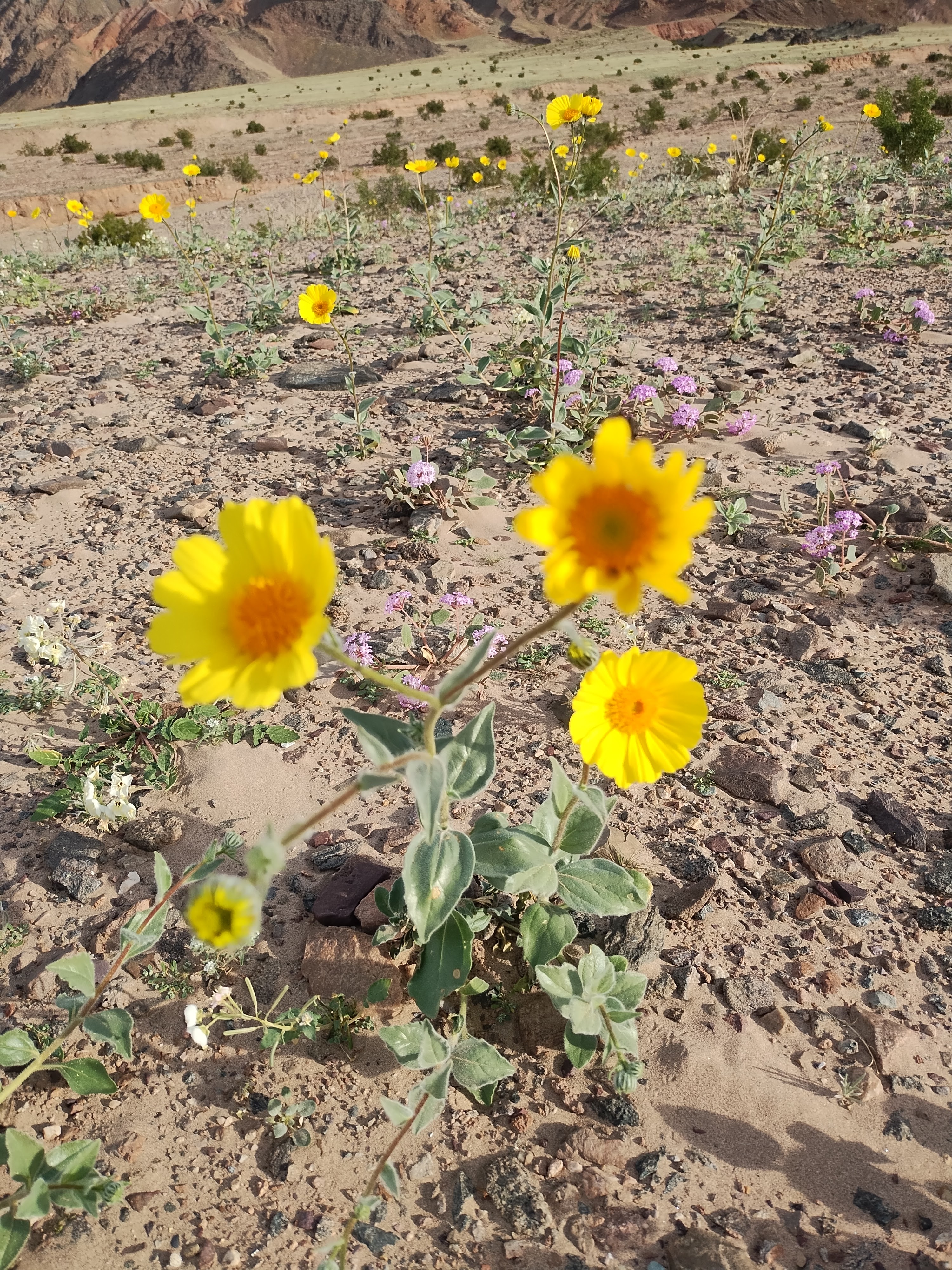
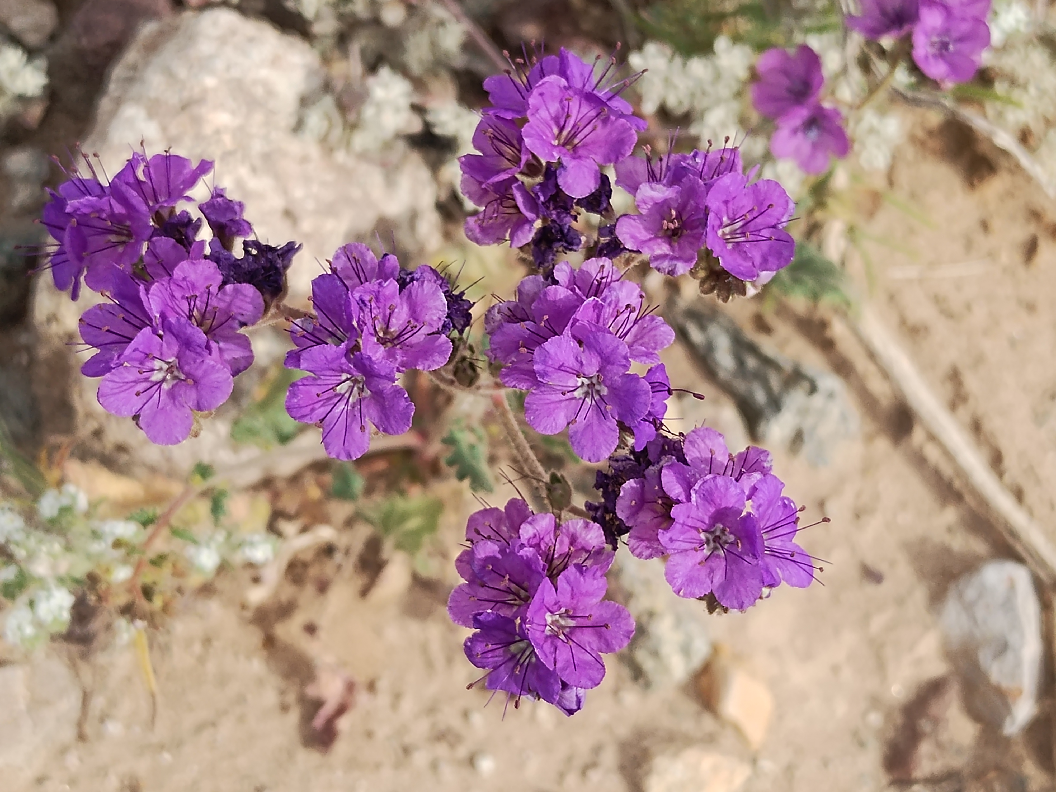
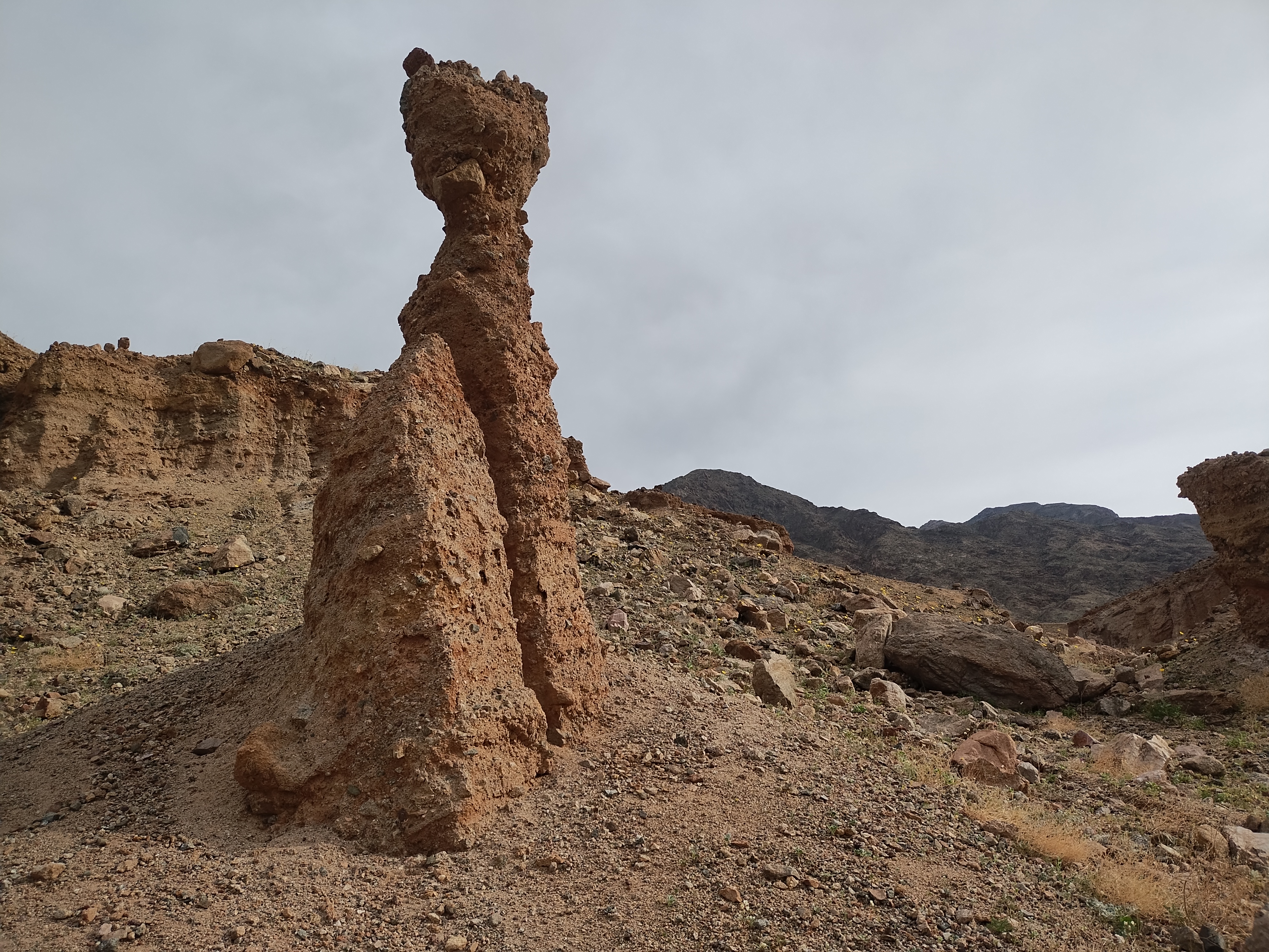
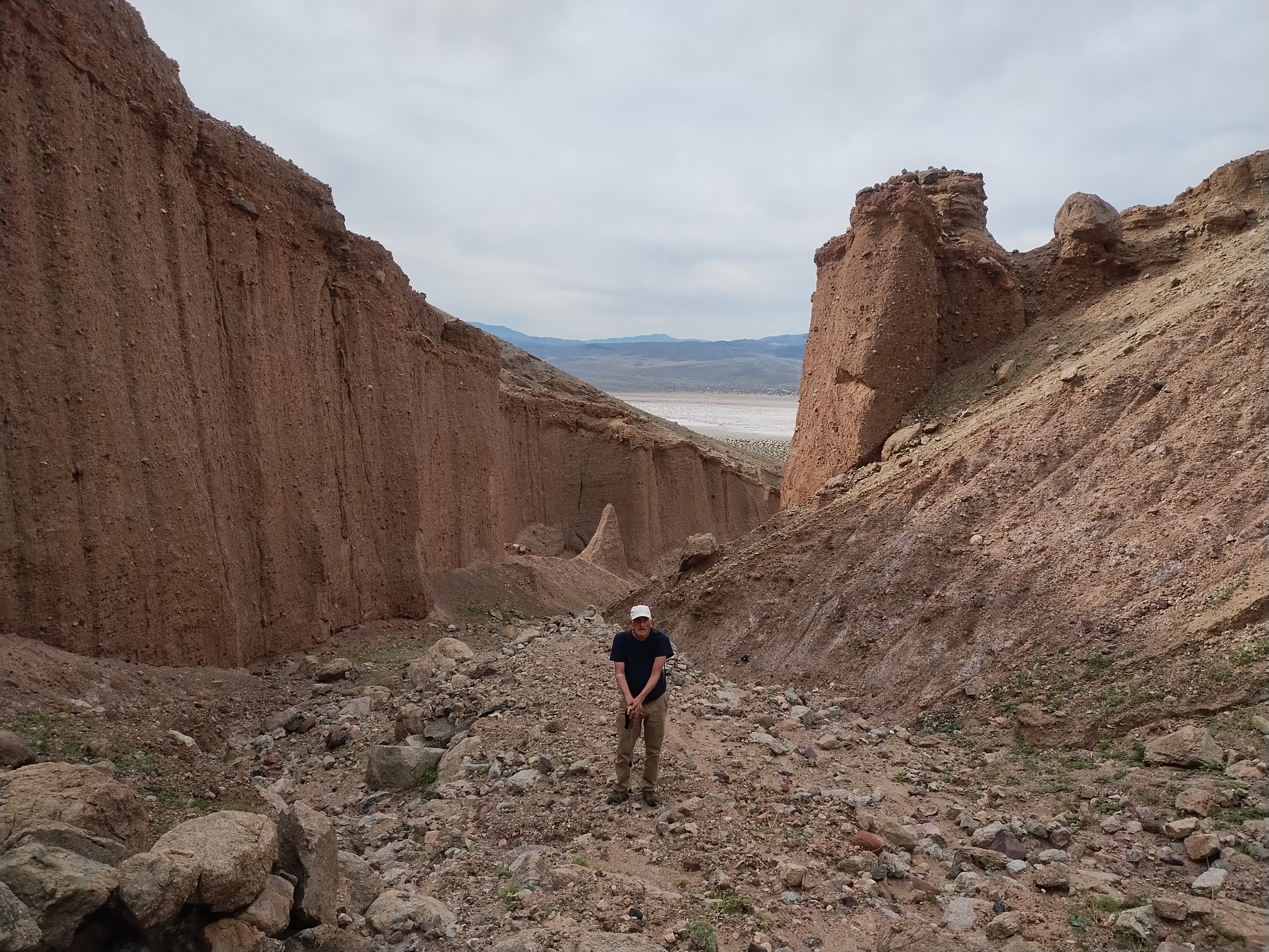
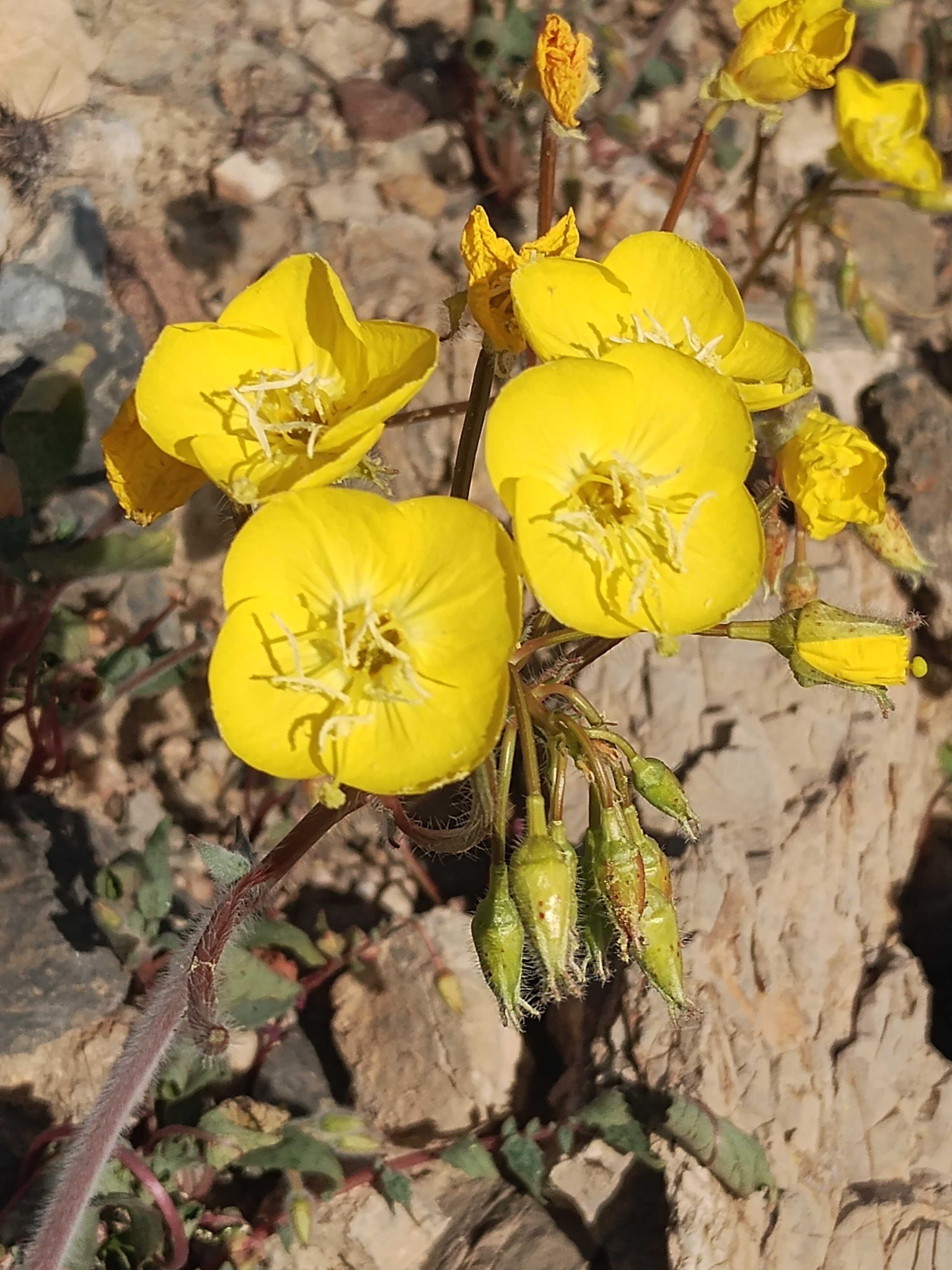
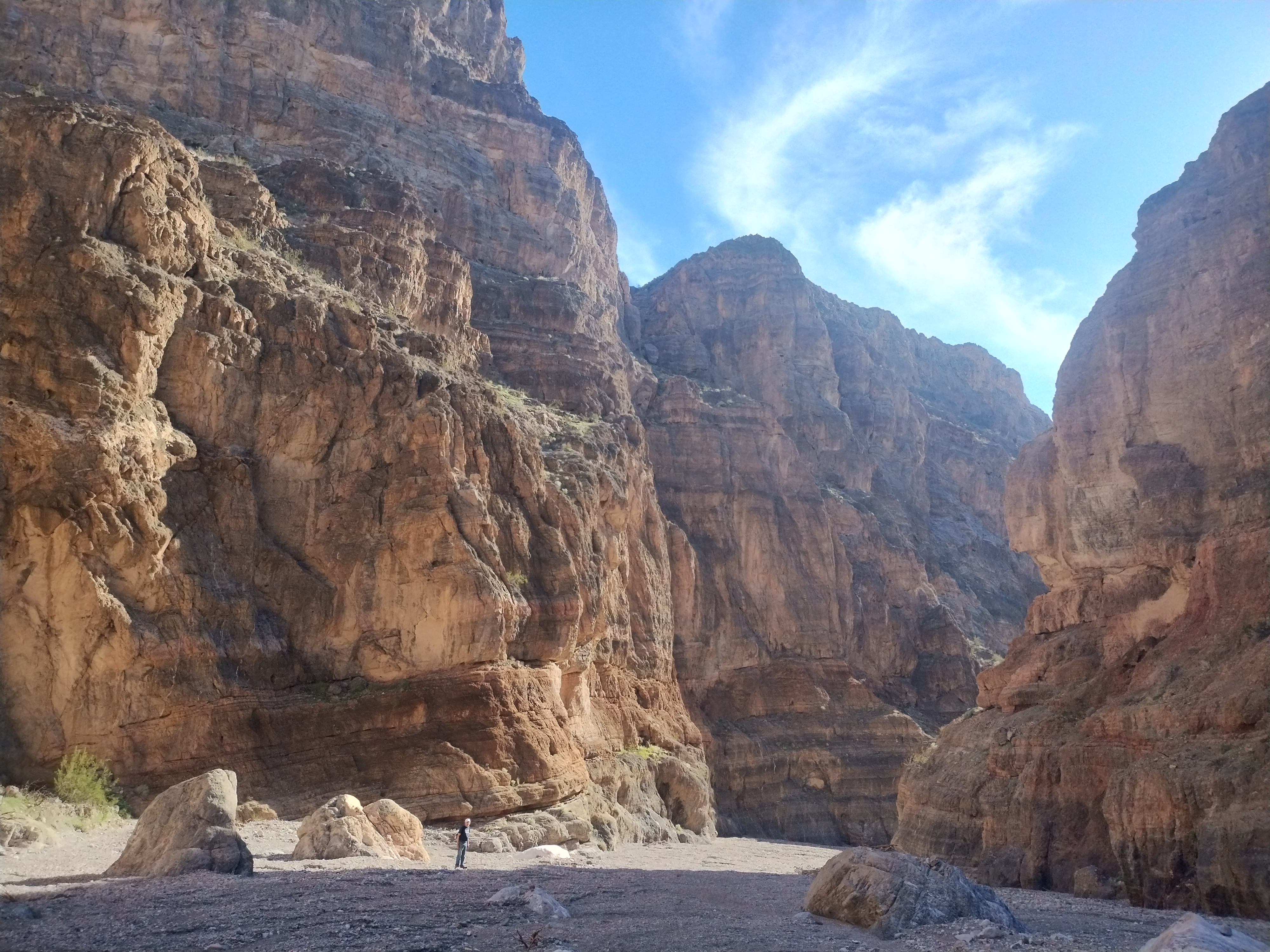
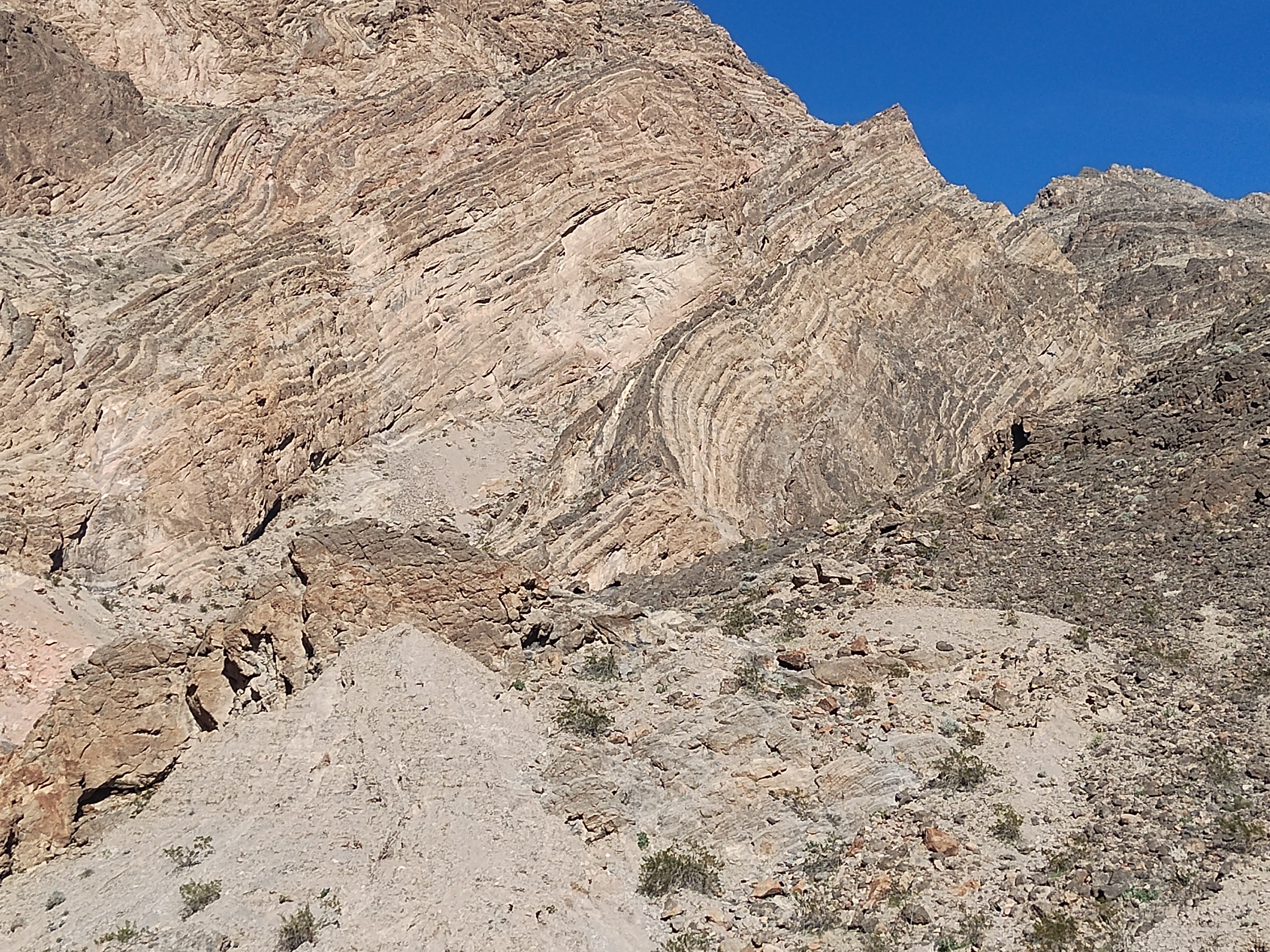
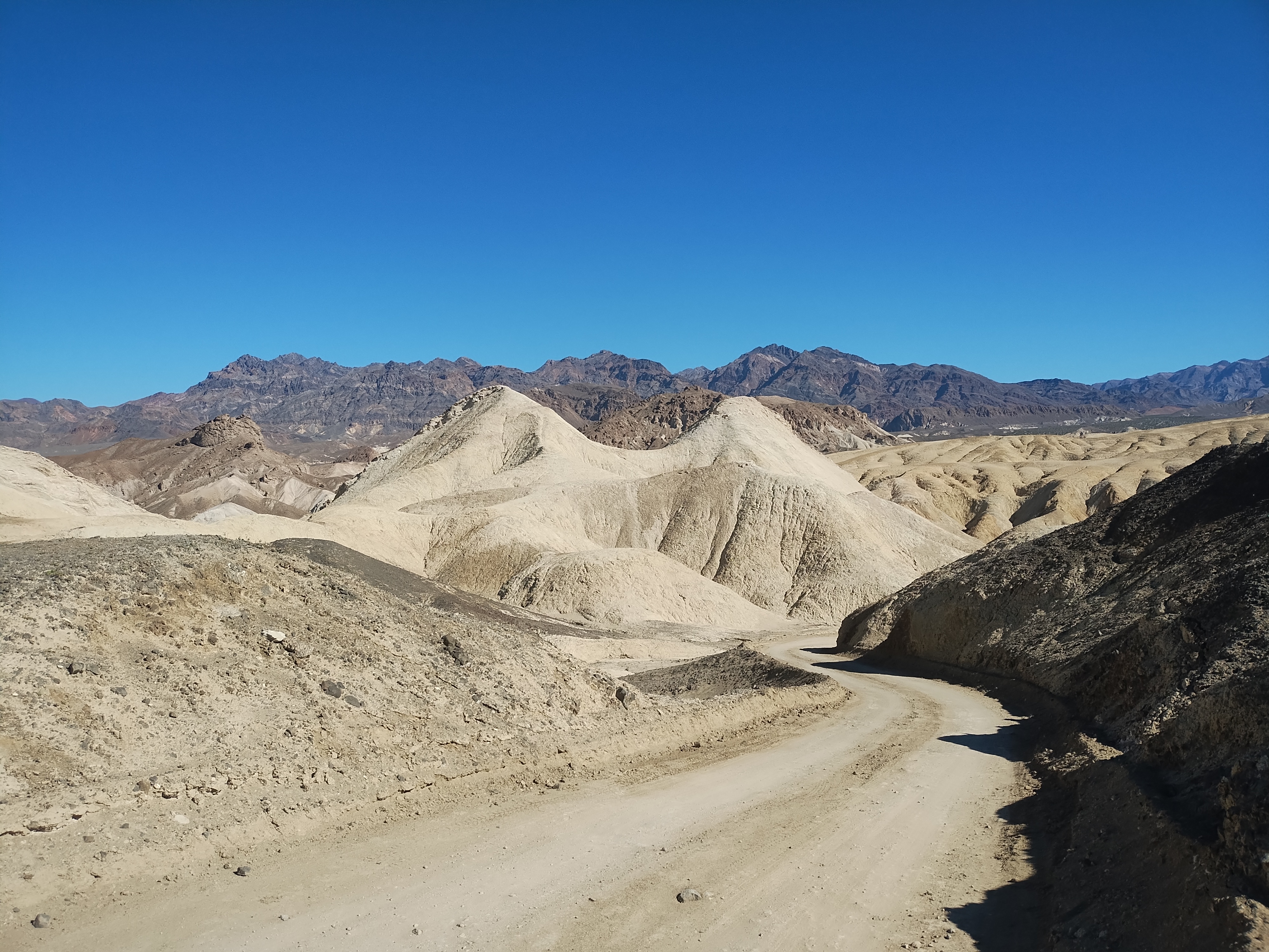
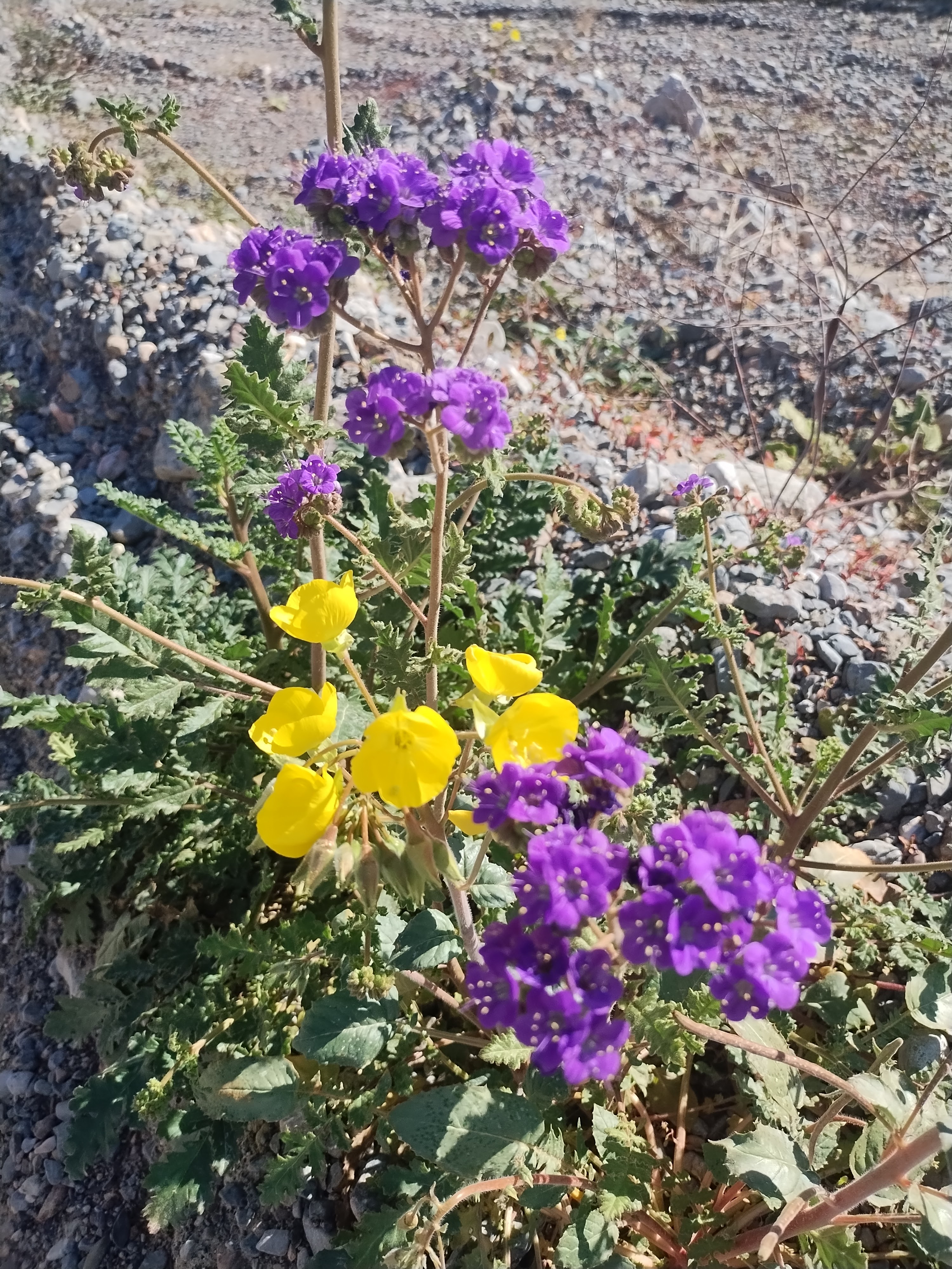
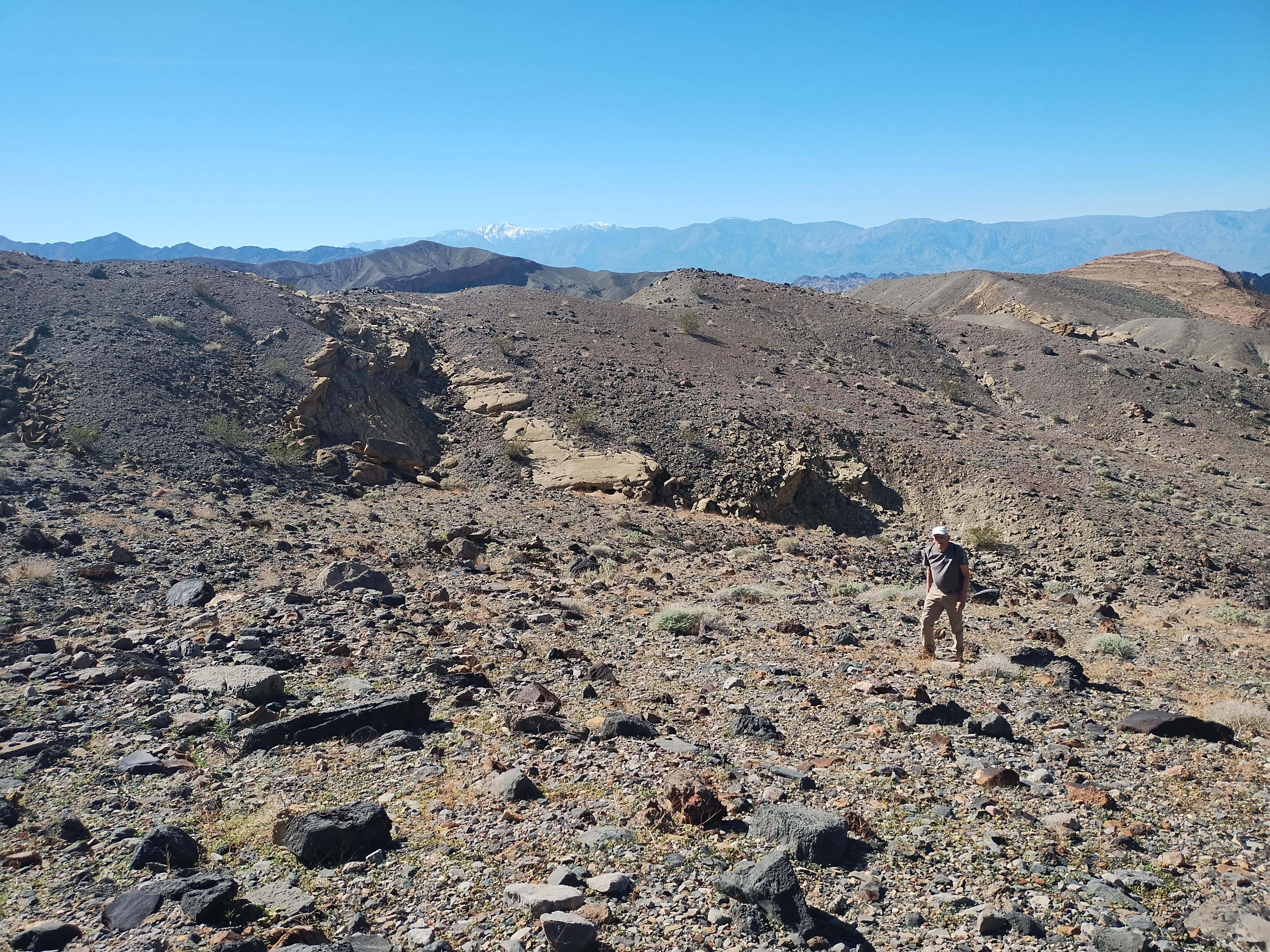
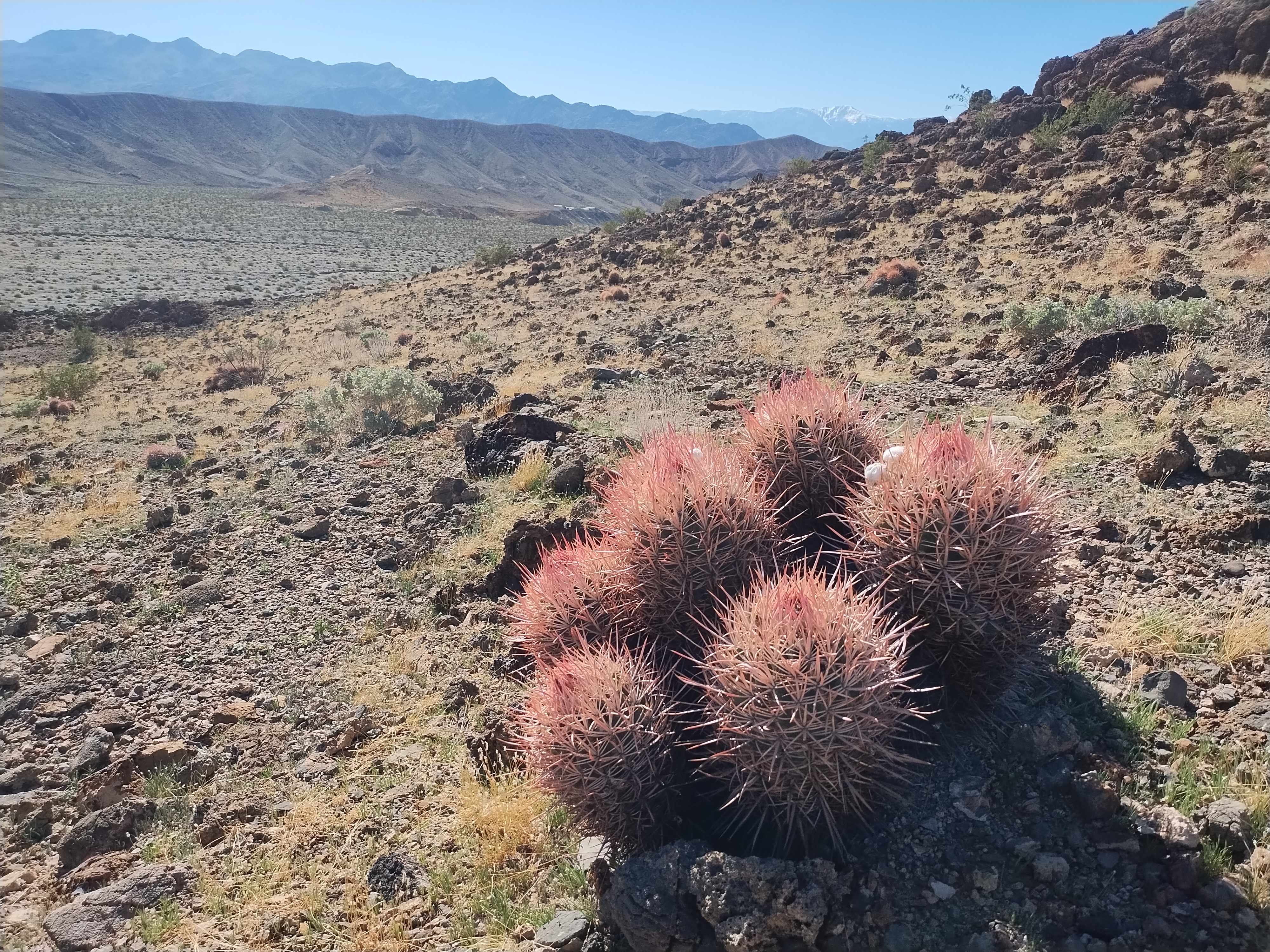
Three adjectives to describe this place come to mind: vast, empty, quiet. I’ve always said that what draws me to New Mexico is the wide open spaces under immense blue skies. Death Valley magnifies that feeling and adds so much more. It’s a geologist’s paradise and, for a wildflower enthusiast coming at the right time of year, it can be a botanist’s paradise.
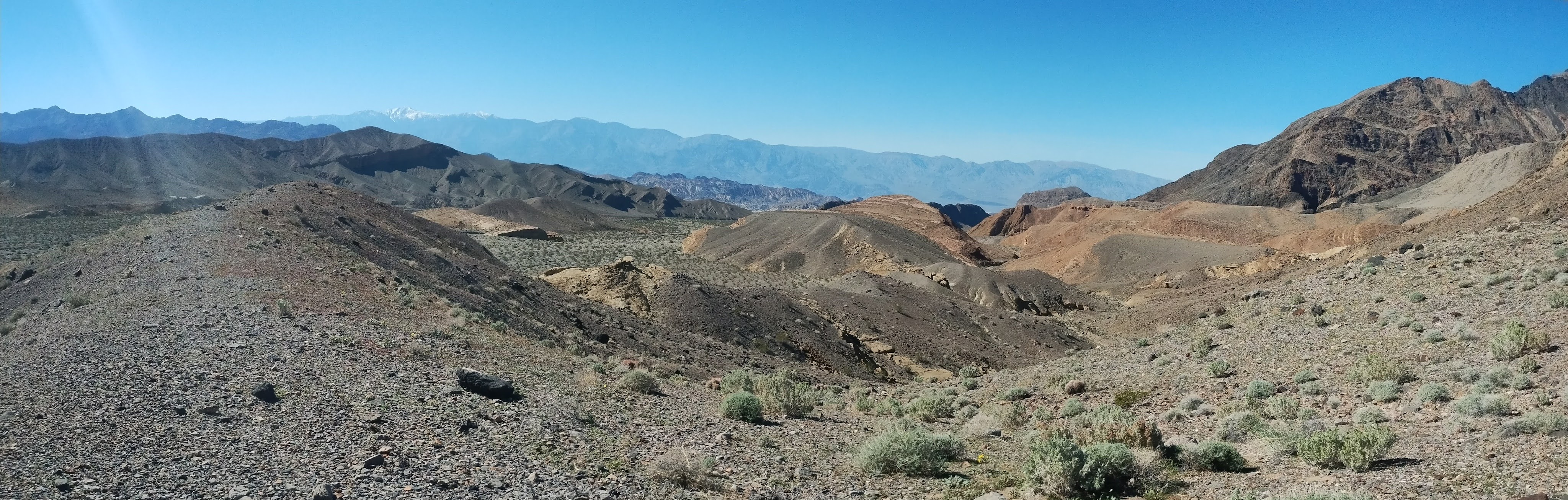
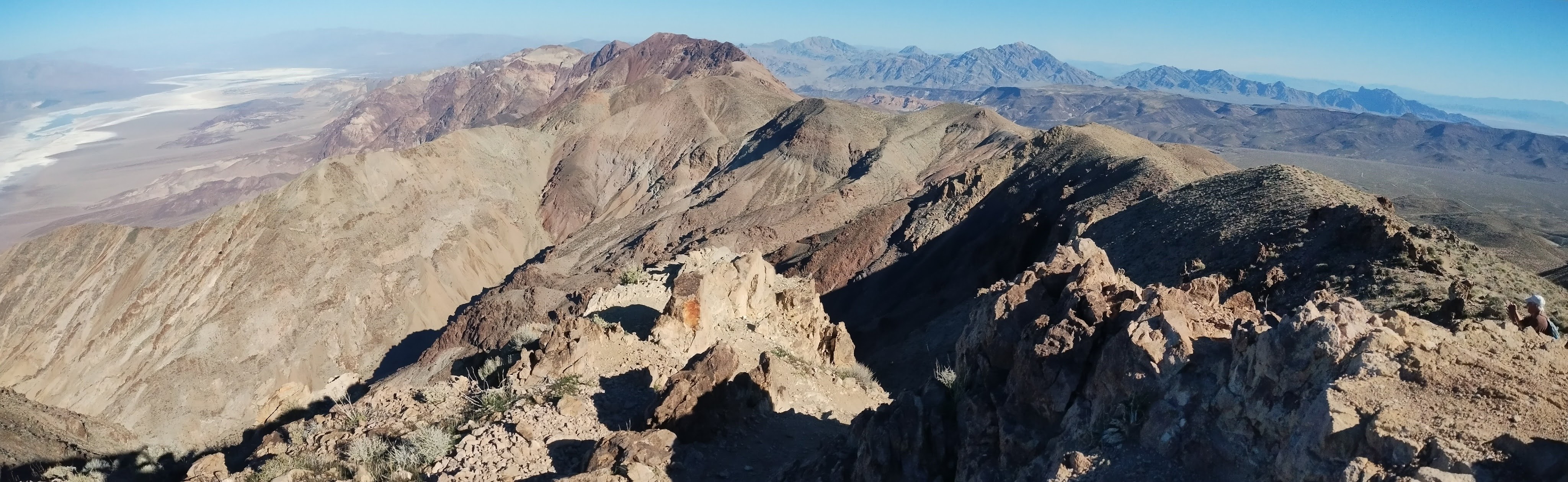
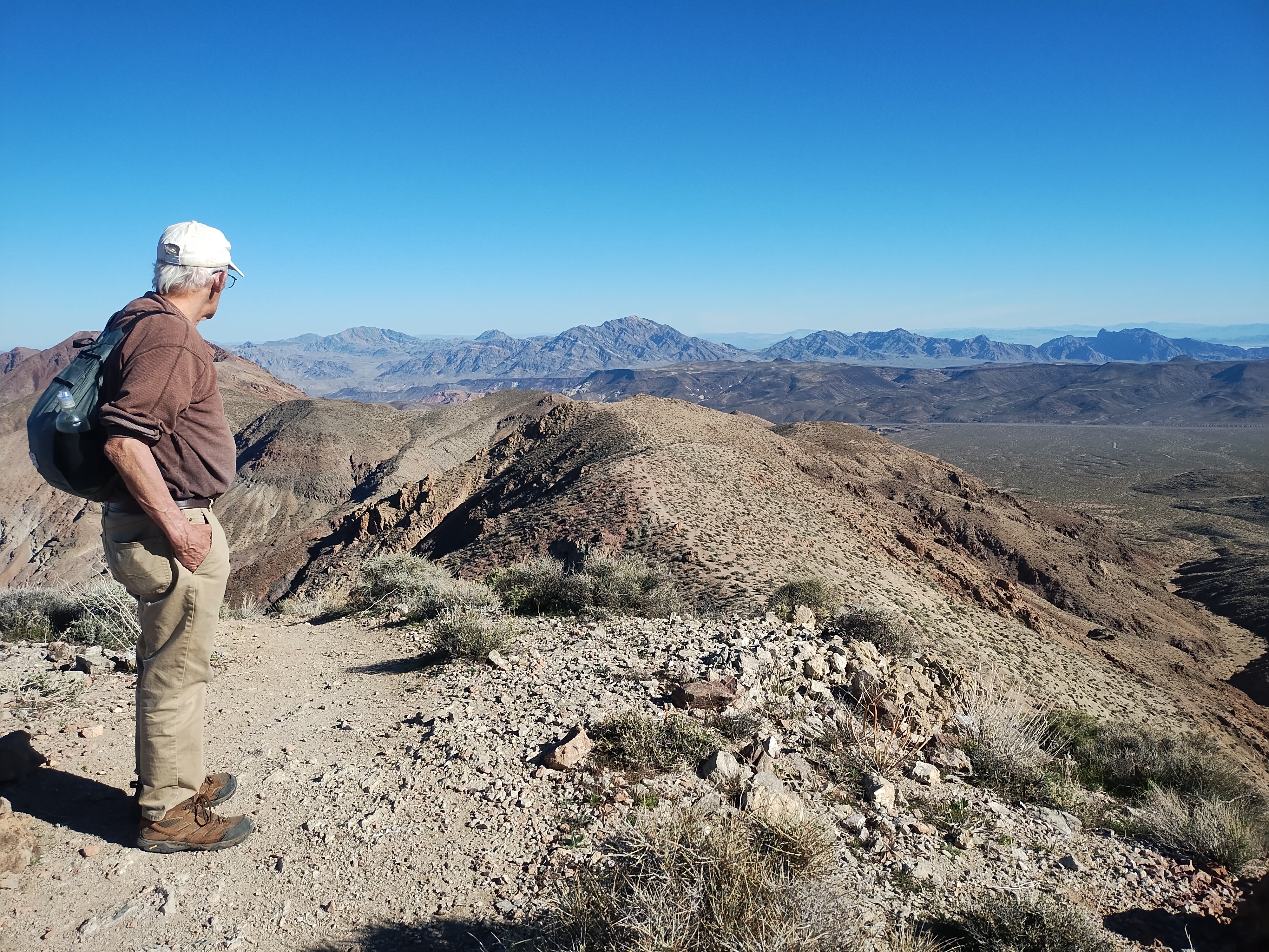
Arriving early in February this year, we caught the beginnings of the spring blooms, enough to keep Lee busy adding to his photo collection. And since mountains, canyons and rock formations are timeless, I took my share of rocky photos.
Rocks in photographs are enjoyable but when you want to get out for a hike they can provide a real challenge. We had forgotten the difficulty of trudging through gravel-filled arroyos or scrambling over piles of boulders or sliding down steep barren slopes. If we totaled up the number of miles we hiked in our 3 days there it wouldn’t be an impressive number. But the joy and peace that come from being in this special part of God’s creation can’t be measured by miles of hiking. I wish I could capture the Death Valley experience in more than a few simple photos, but here are a few photos, anyway.
Our plans for how to spend Thanksgiving Day this year went through several iterations before all was said and done. Lee’s Bible study lesson the day before Thanksgiving emphasized the point that we shouldn’t give thanks on just this one day of the year but, instead, we need to make “thanksgiving” a part of every day. However, there is still this official American holiday to deal with when businesses are shuttered for the day and we are all encouraged to gather with friends and family to stuff ourselves with traditional foods.
Gathering with our scattered family members wasn’t practical for just one day and all of our friends seemed to have other plans. My first thought was to do what we did last year, which was to plan going hiking in a special place. But then I saw an opportunity to volunteer serving Thanksgiving dinner at one of the local city homeless shelters. The two hour late afternoon shift would give us time to eat our own turkey dinner at home before then going out to do something to help those less fortunate.
The week before Thanksgiving I got a call informing me that instead of serving the meal at the shelter on Thursday it would be served on Wednesday. I had to cancel our volunteer shifts since we were already committed to our Wednesday afternoon Bible study. Back to the drawing board.
We could have just stayed home for the day but with a promise of good weather I knew that I wouldn’t be happy sitting home all day. My idea for a hike was to hike at the Bisti Badlands which is too far for our usual one-day hikes but is where we hiked last Thanksgiving. Lee said he would prefer a different place and he suggested a hike at Three Rivers in the White Mountain Wilderness. We would drive to Carrizozo Wednesday after Bible study, spend the night at the motel there and then be close enough for a hike Thanksgiving Day. I made the reservation at the motel.
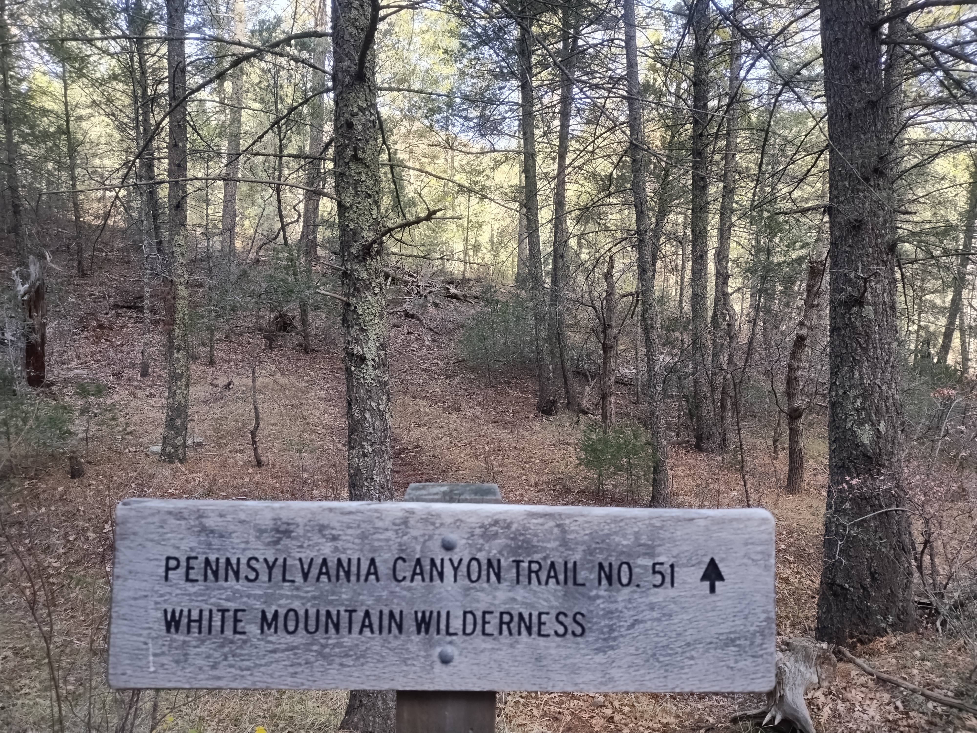
But then the day before we were to leave, Lee did some research and realized that the condition of the trails at Three Rivers would make it less than ideal for hiking. He found another area of the White Mountain Wilderness near Nogal Peak that showed some interesting trails on the Forest Service map. I couldn’t find anything online with detailed information about the trails so we took our chances and Thursday morning we found ourselves at the trailhead for the Pennsylvania Canyon Trail.
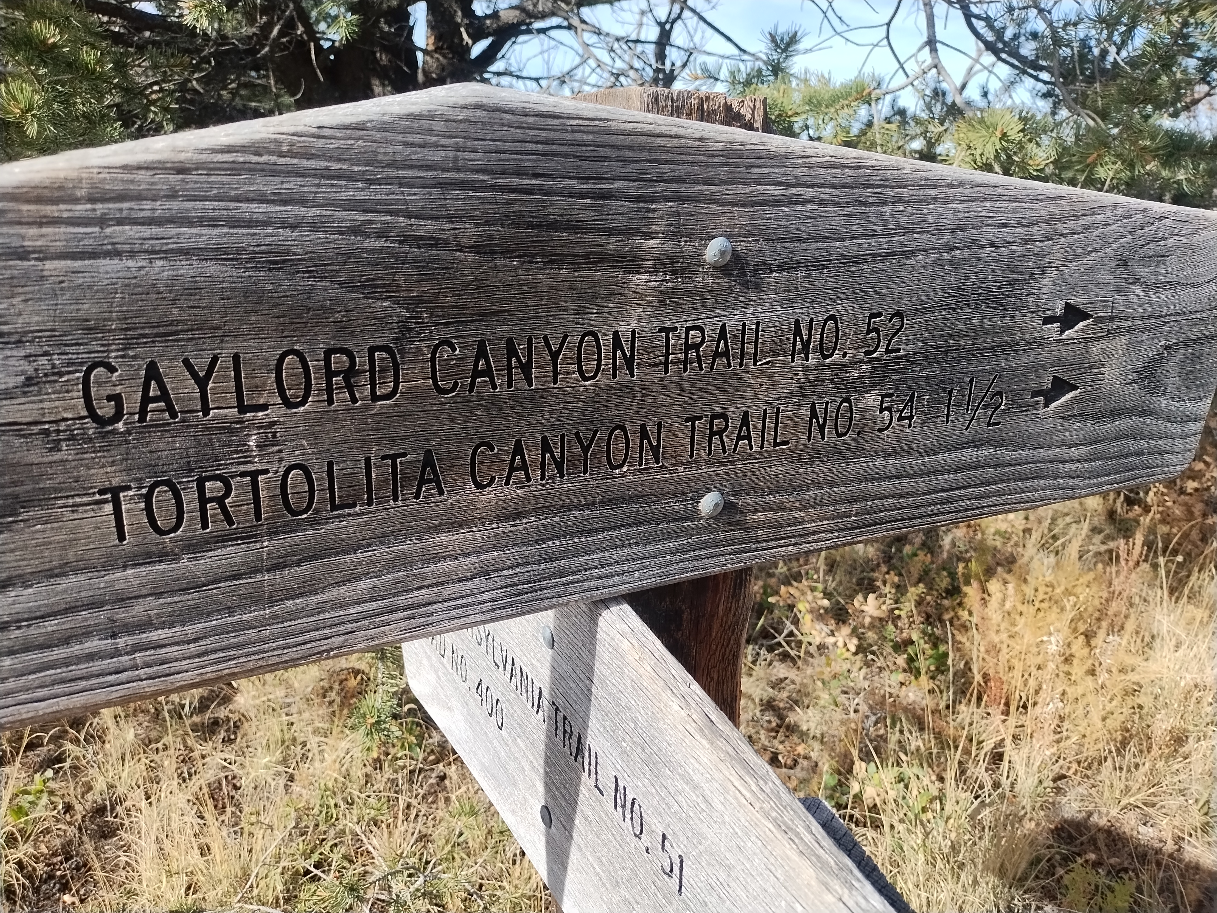
The only information we had about the trail was the Forest Service map, which didn’t show mileage or topography. We weren’t sure how much elevation gain there would be or how far it was to the next trail intersection. Without any particular destination in mind, though, it wasn’t a problem to just start hiking and then turn around when we felt like it.
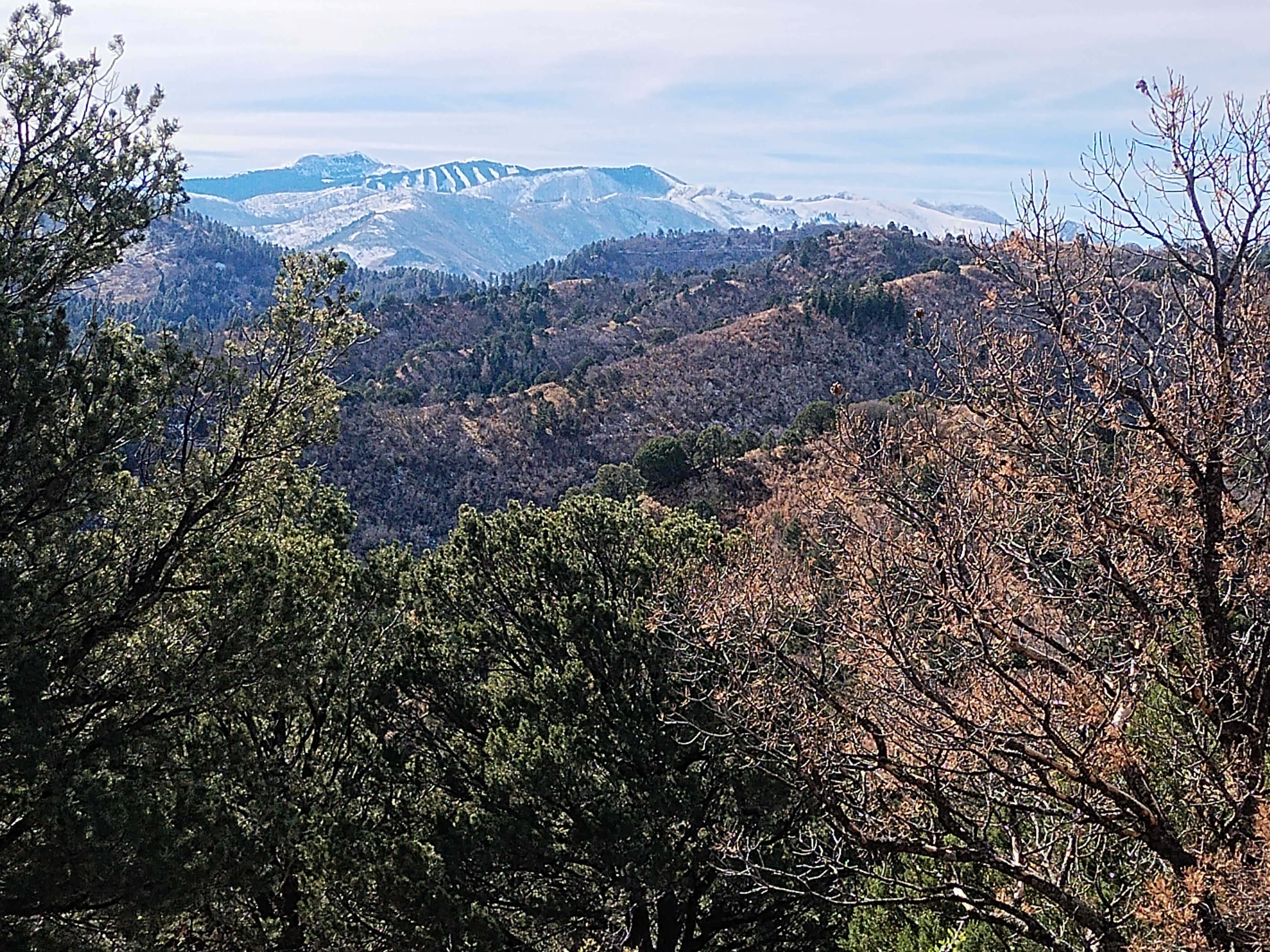
Based on the word “canyon” in the trail name we were thinking it would be a fairly gentle climb up a canyon and were surprised at how much huffing and puffing we had to do before we reached the trail intersection for the Gaylord Canyon Trail–2.3 miles of hiking with 1200 feet of elevation gain. All worth it, though, for the surprising views that we got along the way.
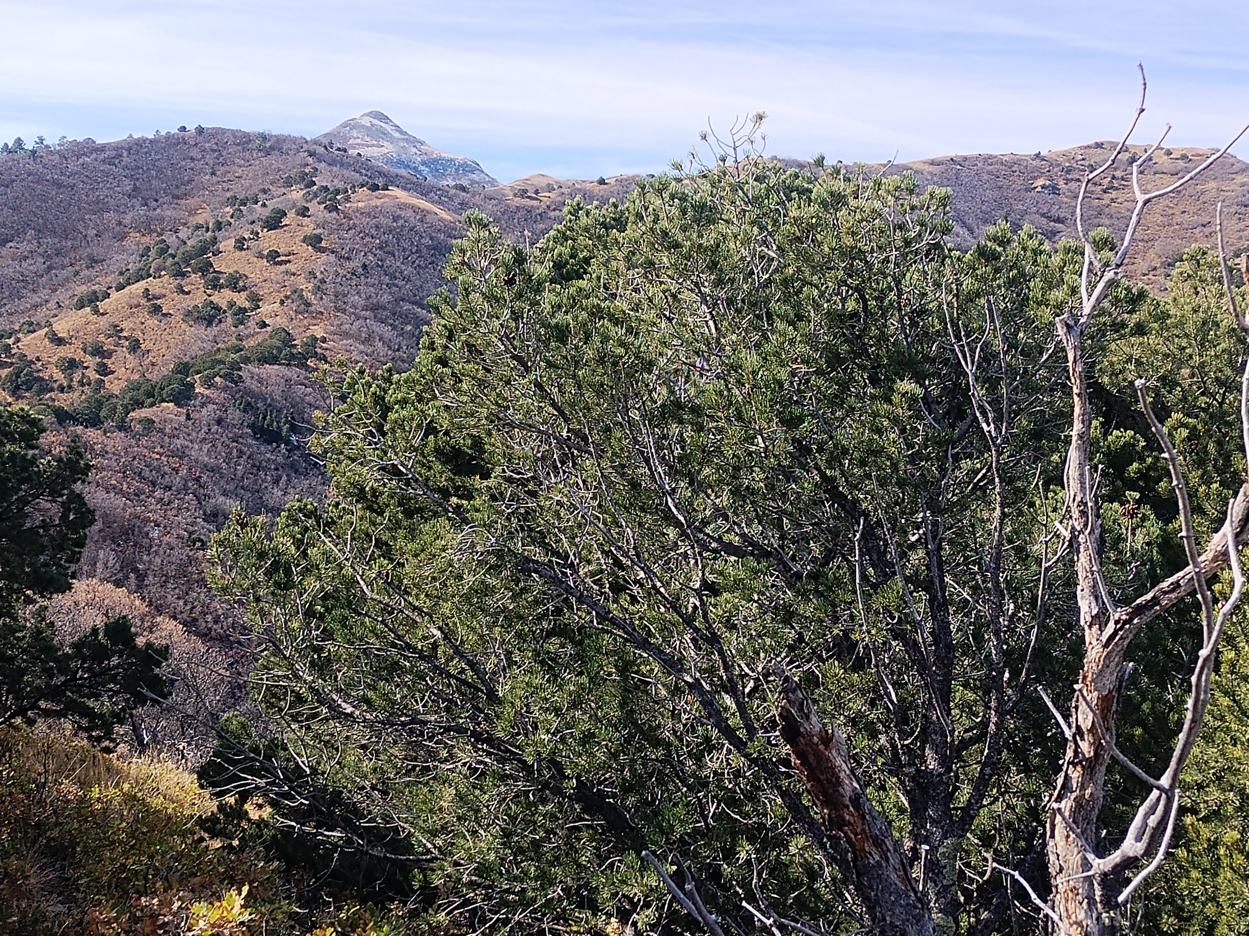
Nogal Peak was only visible at one spot on the trail, “peeking” around a ridge I was surprised that we were able to see the ski resort at Sierra Blanca
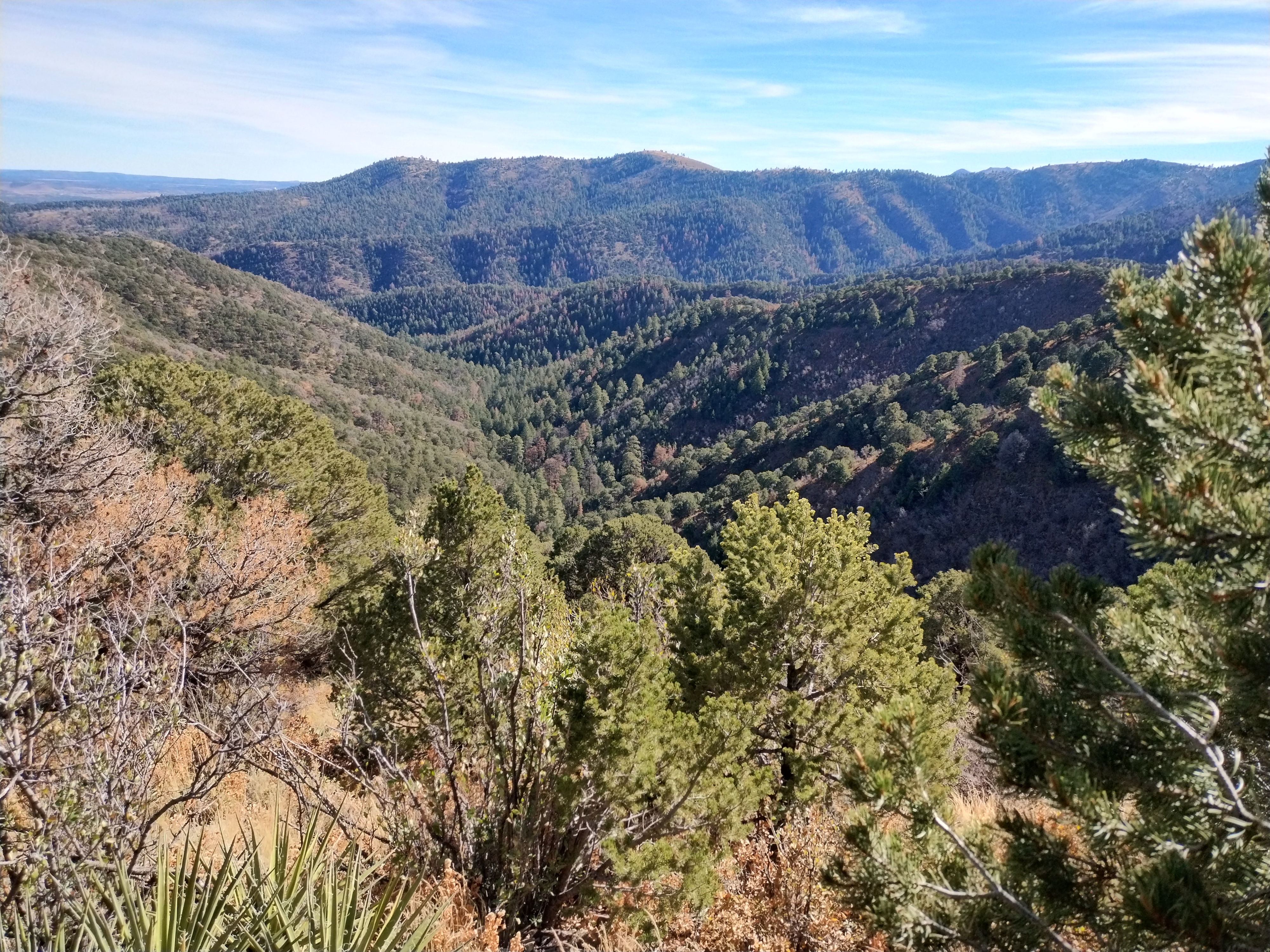
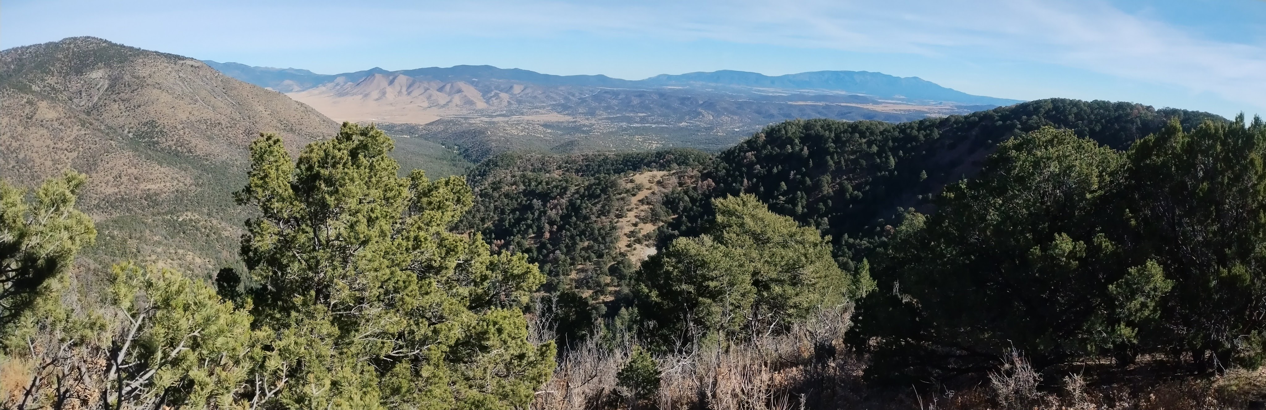
The best part of the views was seeing miles of wilderness in every direction. If I can’t spend Thanksgiving Day sitting around a table with family and friends then I don’t think there is any better way to be filled with thankfulness then to experience the wonder of God’s beautiful creation.
The experience of planning our Thanksgiving Day reminds me of a verse from Proverbs 16:9 “A man’s heart plans his way, but the LORD directs his steps.” We do what we can to figure out the best way through life but things often don’t go as planned. I’m glad that the Lord is there to guide us, because His way always seems to be the best.