If you want to be extraordinary you have to stop being ordinary.
–Bernice Ende
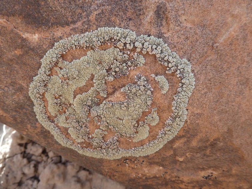
Although I will share some photos from yesterday’s hike, this post will be somewhat different from the usual hike descriptions I write about. Instead it’s going to be a description of a book I have been reading, Lady Long Rider: Alone Across America on Horseback by Bernice Ende.
A couple of weeks ago an announcement in the Albuquerque Journal caught my eye. Bernice Ende, whom I’d never heard of, was going to be at the main library to talk about her experiences riding long distances across the country on horseback and then signing copies of her new book. Something came up at the last minute and I was not able to attend the event. But I was interested in learning more about this extraordinary woman. After reading her website and the book description on Amazon, I knew that I wanted to get the book.
Yesterday as we drove out towards Grant to hike one of the trails in the El Malpais National Monument, I was reading Chapters 6 and 7 of the book. These chapters describe incidents from Bernice’s 2nd long ride April 2006 to September 2007, when she rode a 5,000 mile loop, from Trego, Montana, east to Minnesota, south to New Mexico, west to California, north through Oregon and Washington and then back to Trego.
Chapter 6 took place at a cafe in the small Kansas town of Copeland. The key point she made in this chapter was that you can meet extraordinary people in the most ordinary places and that any of us can be extraordinary if we just stop being ordinary. I thought about how these adventures that she is living are a perfect example of someone getting out of the ordinary. It inspired me to dream of the possibilities for extraordinary living around the corner of every new day, if we remind ourselves to look past what seems to be only an ordinary day.
Pie Town, New Mexico, was the setting for Chapter 7 and as we drove west from Albuquerque I was struck by the “coincidence” that this was the chapter I was reading. If we were to keep driving on the road south of Grants, past where we were headed for our hike, we would reach Highway 60, the highway that goes through Pie Town. I could picture exactly the part of New Mexico Bernice was describing in this chapter.
Although our New Mexico travels have included Highway 60 a number of times, the section of it that goes through Pie Town is still one we haven’t checked off our bucket list. After reading Bernice’s descriptions of her time there, it has moved up the list as a destination for an enjoyable day trip from Albuquerque. I’ll be sure to not go, though, in the winter because Bernice got stranded there for several days by a record breaking snowstorm.
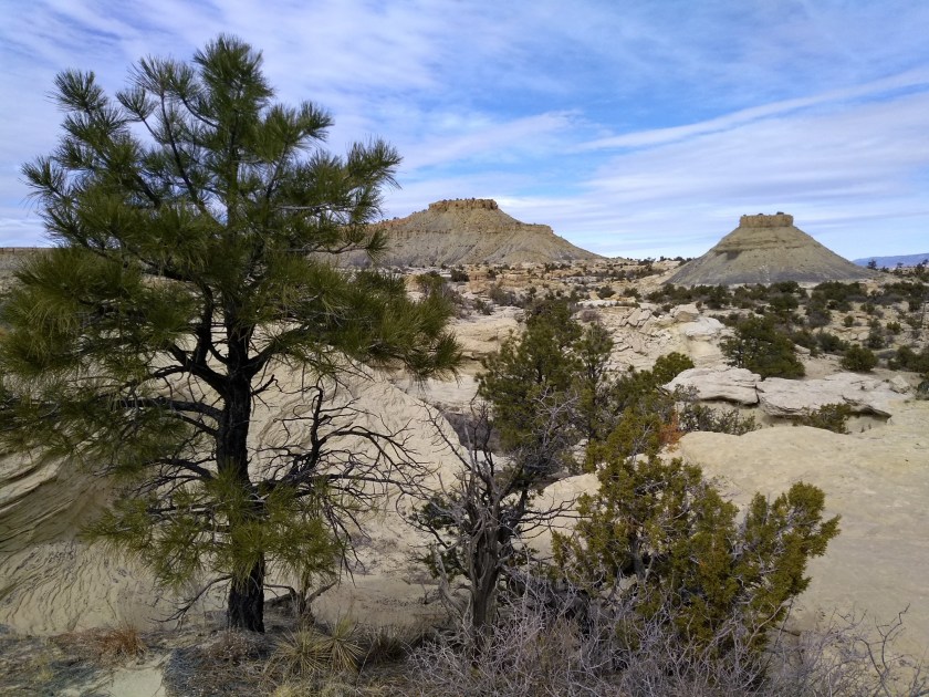
It’s only an hour and a half drive from Albuquerque to our hike in El Malpais, but the weather in that part of the state can be quite different. There was a lot more snow this winter than usual and we could still see evidence of it on the peaks surrounding the lava fields. But the weather forecast yesterday called for 70 degrees in Albuquerque and it was close to that where we were hiking.
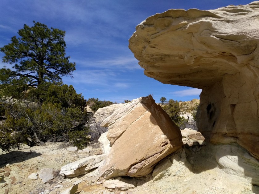
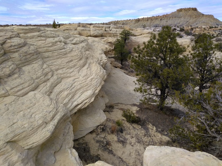
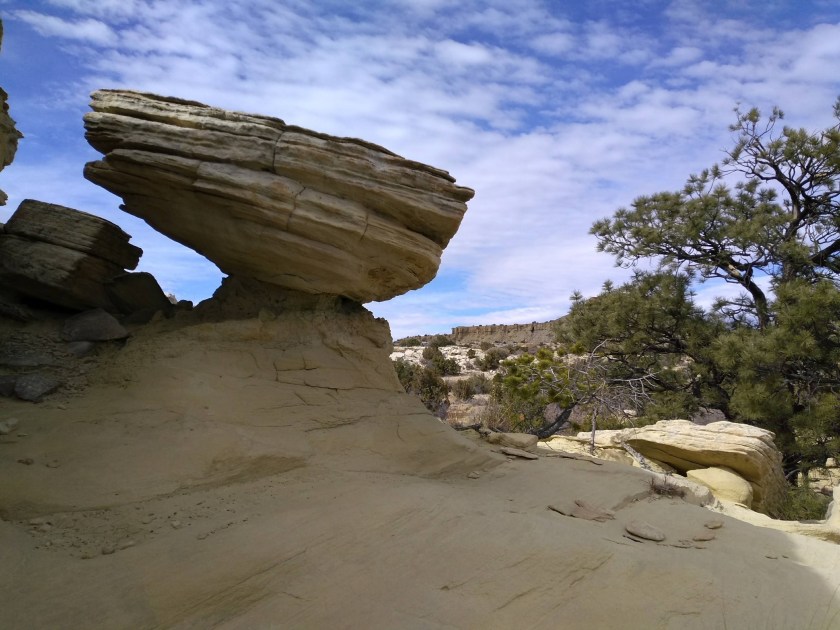
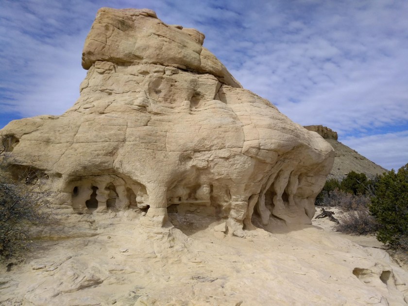
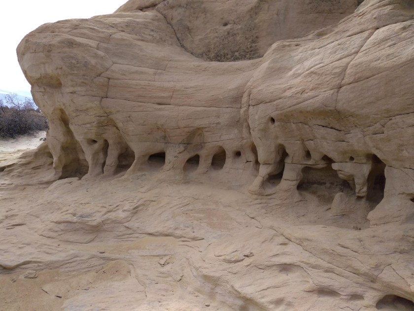
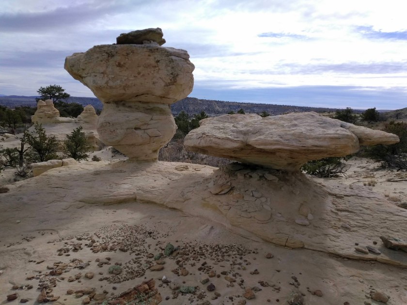
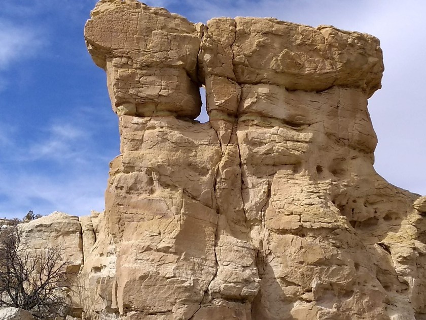
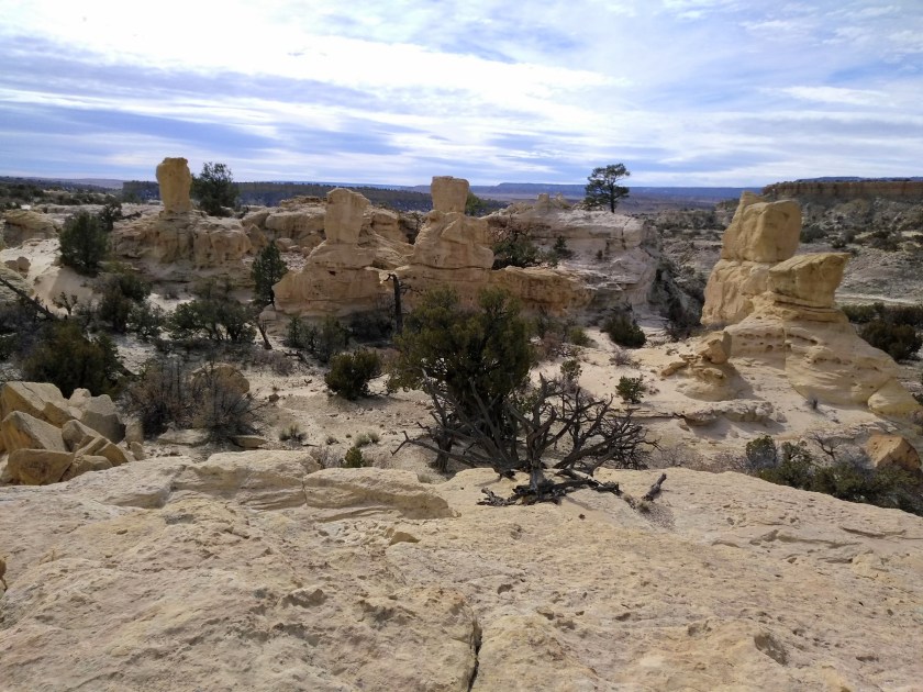
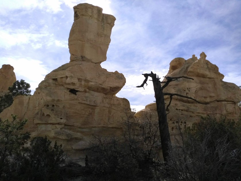
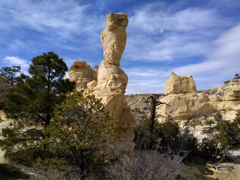
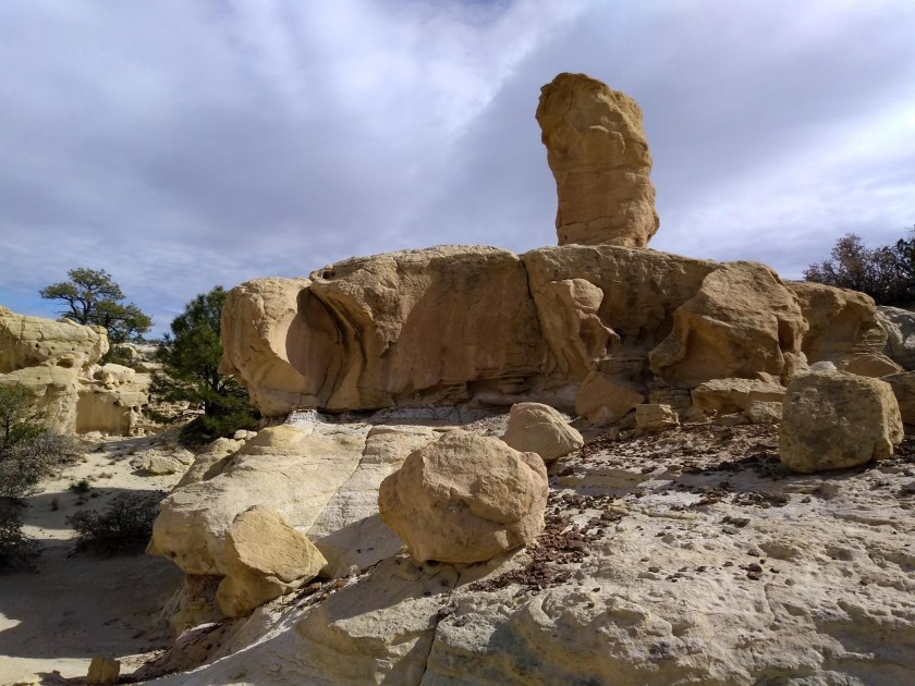
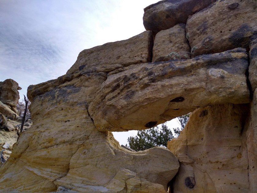
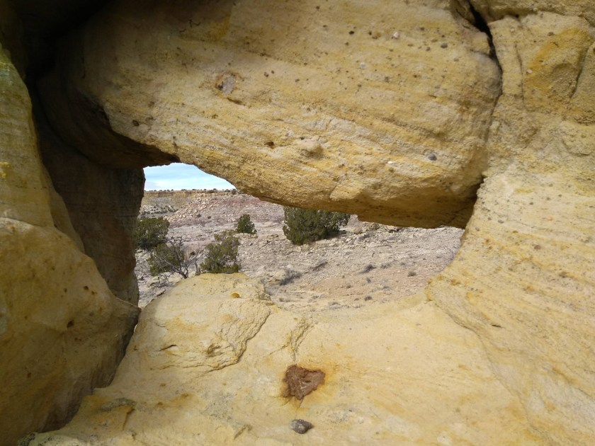
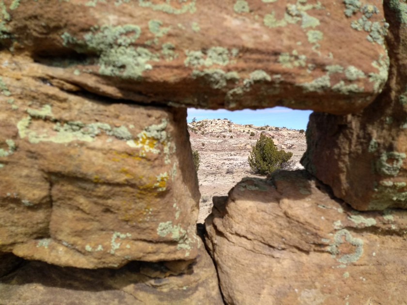
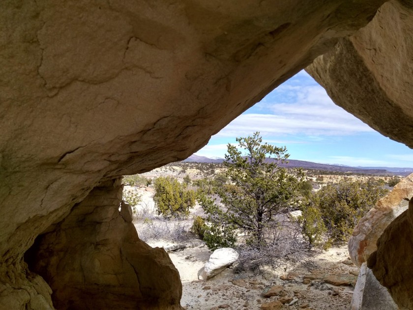
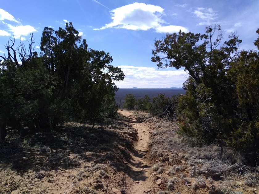
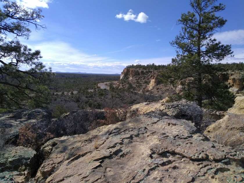
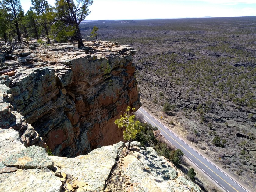
We did the Narrows Rim trail, which is an easy 8-mile out-and-back hike along the top of a sandstone cliff at the eastern edge of the lava fields. The area is called the Narrows because it’s a point where the lava flowed up to the base of the sandstone cliffs, leaving just a narrow passageway between the cliffs and the lava. This hike and a similar one at Sandstone Bluffs are favorites of mine. The bluffs are beautiful colors, eroded into fascinating formations, and from the top of the bluffs the views out over the immense lava fields are spectacular.


The weather for our hike was warm, but, unfortunately, as winter warms into spring in New Mexico we are faced with days of strong winds. Along with the 70 degree forecast for Albuquerque yesterday came the forecast today of strong winds. Those winds have arrived but it seems they were a day early where we were hiking out by Grants. After lunch when we turned around to hike back along the ridge, the winds had picked up and it seemed at times like it would blow us right over.
This morning I was reading Chapter 12 of Bernice’s book that describes the winter camp she made in 2010 in eastern Montana. The following paragraph seemed so appropriate for this windy day:
“The wild open Montana prairie invites a brutish, unforgiving wind, even encourages it–‘Come play, look at all this open space, do as you please,’ it says. And the wind smiles, perhaps sneers, before roaring on and on and on across the playground of eastern Montana. Of all the weather conditions I face, the most difficult, the most dangerous, is wind. Curse it and you’ll be left to suffer in a sweltering of bugs and heat. Welcome the wind and it will gladly freeze you or simply blow you off the face of the earth like an insignificant thought.” (page 124).
Bernice was describing winds of eastern Montana but I think it applies to New Mexico. Get the book. I’m sure you will find something that applies to your journey through life.